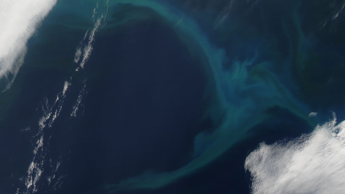
Seasonal rainfall and runoff of sediments from the Hawaiian Islands could be responsible for the previously undetected peak.
runoff
Posted inEditors' Highlights
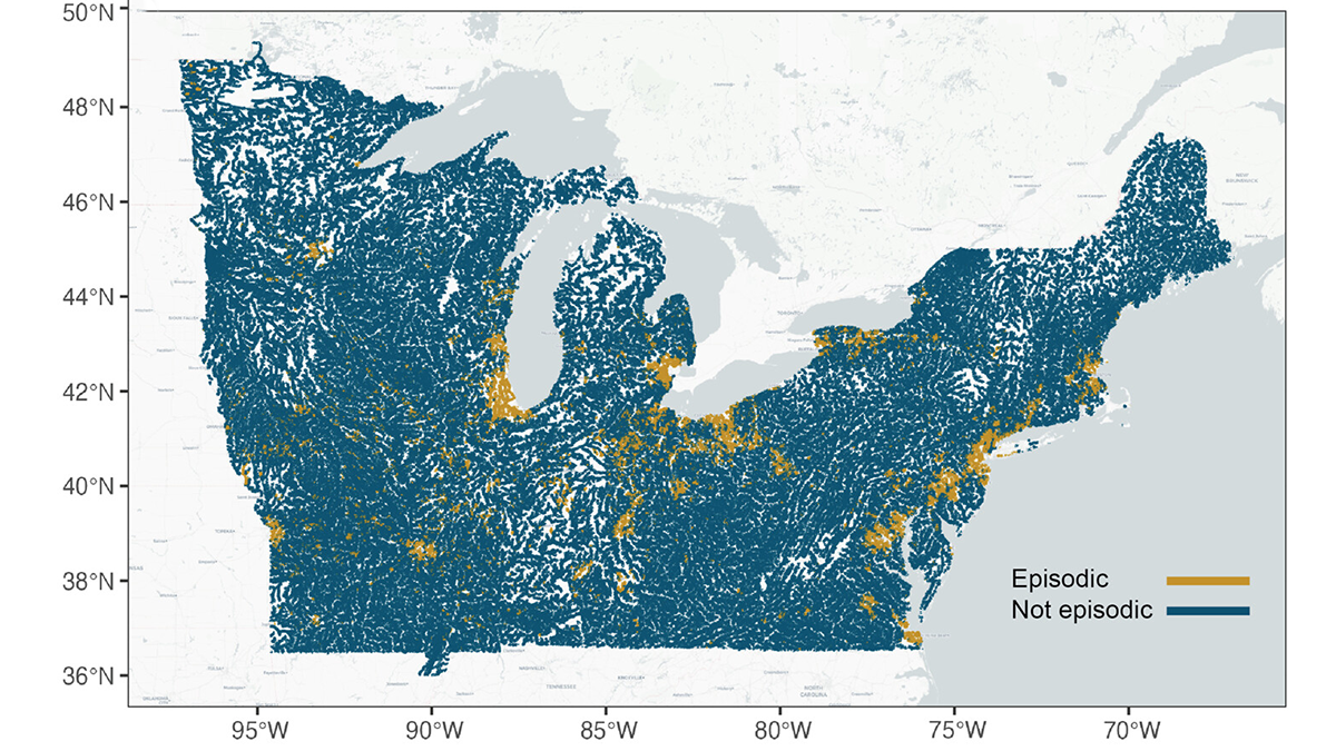
Episodic Tales of Salt
When episodic pulses of road salt hit after a winter storm, the impact can be like a lightning strike for the environment.
Posted inNews
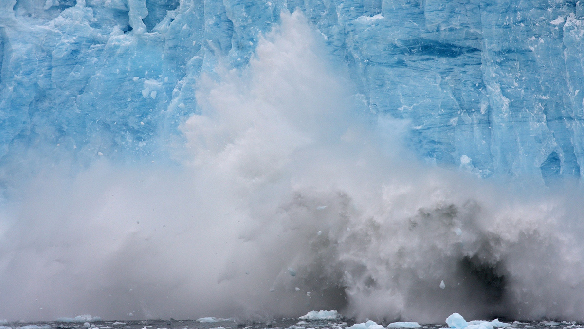
Glacier Runoff Becomes Less Nutritious as Glaciers Retreat
Sediment from retreating, land-terminating glaciers contains proportionally fewer micronutrients such as iron and manganese, reducing the glaciers’ value to microorganisms at the base of the food web.
Posted inFeatures
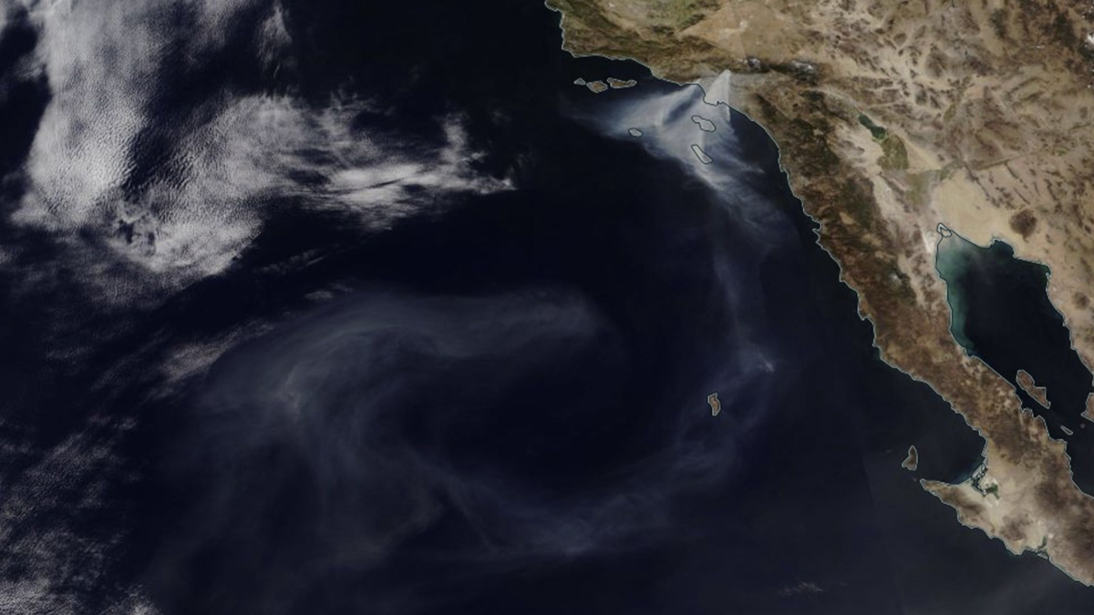
Scrambling to Study Smoke on the Water
Timely action shows the impact of urban fires on freshwater and marine ecosystems.
Posted inEditors' Highlights
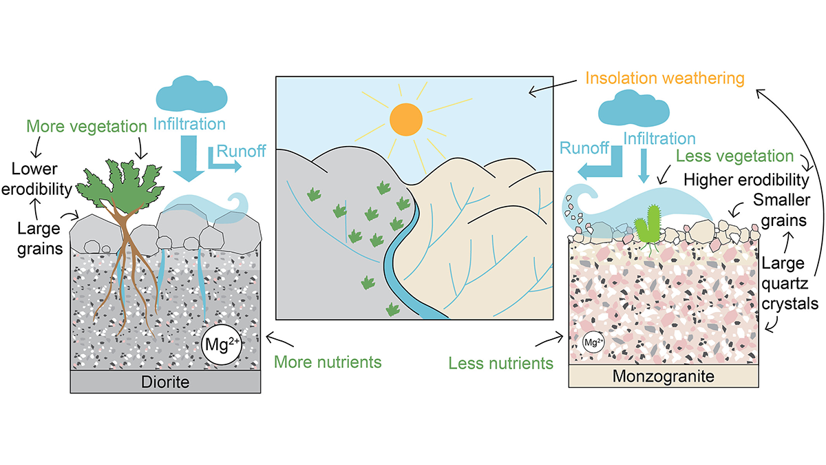
How Rock Type Shapes River Networks and Influences Landscape Evolution
A new study in Chile shows how small differences in rock type can drive large differences in erosion, vegetation, and river networks, illuminating the role of mineralogy in shaping landscapes.
Posted inNews
The Deleterious Dust of the Salton Sea
Coarse particulate matter deriving from California’s largest lake is linked to an increased risk of respiratory-related hospitalizations.

Posted inEditors' Highlights
How Does Subsurface Lithology Speak to Hillslope Morphology?
Subsurface flow hydrology connects soils and bedrock lithology to long-term catchment evolution in humid landscapes.

Posted inEditors' Highlights
Rainstorm Intensity Drives Desert Landscape Evolution
New mathematical models show that the persistence of near-vertical cliffs in arid landscapes is maintained by infrequent, but high-intensity rain storms.

Posted inENGAGE, News
Even Treated Sewage Harms Freshwater Ecosystems
In a controlled experiment, researchers diverted wastewater from an advanced treatment facility into a healthy stream and monitored the unfolding ecological effects.

Posted inENGAGE, News
Millions Likely Live in Areas Contaminated by Mining Runoff
Heavy metal contaminants from mining can live in ecosystems for centuries. A new global database shows where the problem is worst.