AGU Advances launches its Early Career Editorial Fellow program, welcoming three early career scientists to the editorial board.
David S. Schimel
Dave Schimel, Editor, AGU Advances
Posted inEditors' Highlights
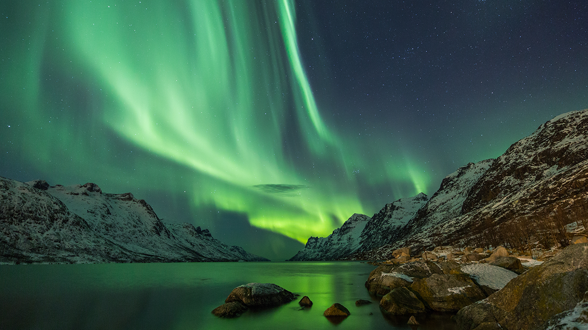
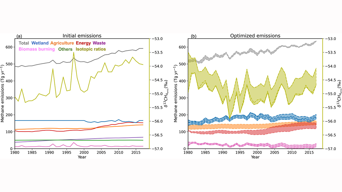
Cows, Coal, and Chemistry: The Role of Photochemistry in Methane Budget
Recent increases in atmospheric methane are a result of changing natural and manmade sources, climate, and other less-understood factors linked to its role in the atmosphere’s self-cleaning mechanisms.
Posted inEditors' Highlights
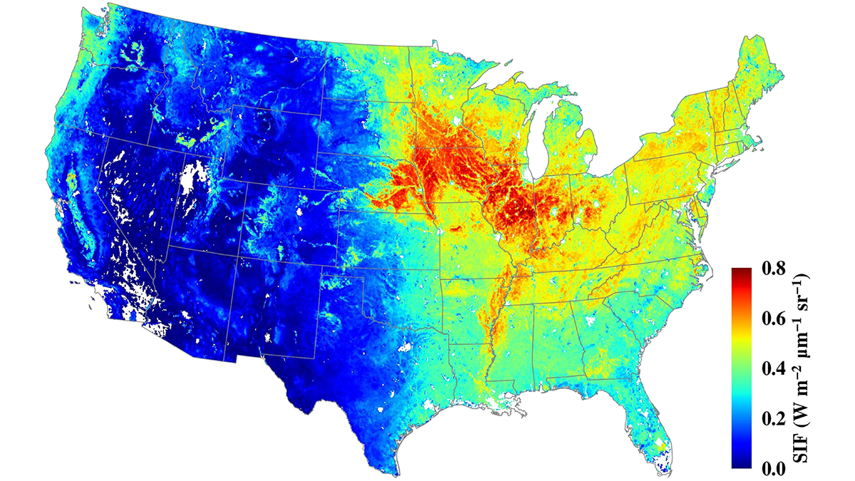
Serendipity in Space: NASA’s Eye in the Sky
The Orbiting Carbon Observatory-2 (OCO-2) mission, proposed for early termination, has turned out to be a boon to forest and agricultural management.

Posted inEditors' Highlights
Fixing Pollution from Space Needs Global Coordination
Remote sensing is a tool of choice for monitoring regions for air pollution, but the scale of the problem requires extending geostationary soundings globally.

Posted inEditors' Highlights
A Crystal Ball for the Carbon Cycle, But a Cloudy One
Carbon cycle models quantify relationships between emission scenarios and resulting atmospheric concentrations, but are the projections credible? New analyses find grounds for both hope and concern.

Posted inEditors' Highlights
Northern Ecosystems are Shaped by Snow
Changing climate in the Arctic leads to a shorter snow season but deeper snow in the depths of winter. Under the insulating snow, biological processes are accelerated leading to higher nutrient availability and carbon losses.
Posted inEditors' Highlights
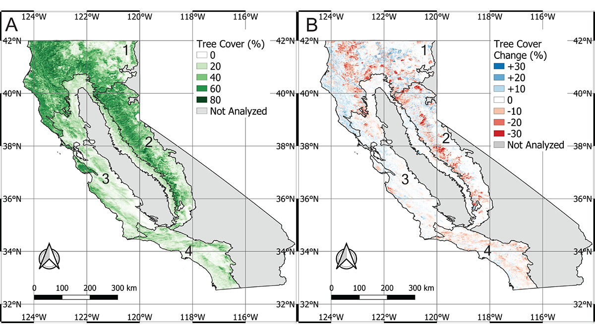
A Burning Issue
California has lost 7% of its forest cover to climate change over the past 25 years.
Posted inEditors' Highlights
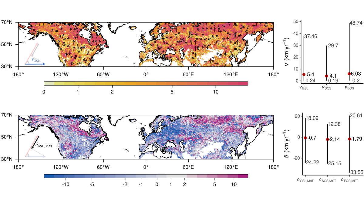
The Flowers that Bloom in the Spring (but Later)
Mismatch between the pace of climate change and crop phenology may signal a new challenge for climate change adaptation.

Posted inEditors' Highlights
Hot Lakes in a Cold Climate
Arctic warming may release less carbon dioxide from high latitude lakes but increase their climate impact by releasing more methane.