
New findings contrast with a prevailing hypothesis for low seismic velocity in subduction zones.
Jack Lee

Posted inFeatures
Navakanesh M Batmanathan: Customizing Hazard Outreach
Geologist contributes to community-focused outreach in Southeast Asia.

Posted inFeatures
Karen Layou: A Wider 2-Year Track
Supporting geoscience education across a spectrum of opportunities.

Posted inFeatures
Rick Jones: Finding the High School Spirit
Installing a love of learning in students and teachers alike.

Posted inFeatures
Joy Santiago: Charting Safety Through Mapmaking
An environmental planner proudly “helping the Filipino people.”

Posted inResearch Spotlights
First Report of Seismicity That Initiated in the Lower Mantle
A 4D back-projection method revealed that aftershocks of the 2015 earthquake beneath the Ogasawara (Bonin) Islands occurred as deep as about 750 kilometers.

Posted inResearch Spotlights
Simulating 195 Million Years of Global Climate in the Mesozoic
An ensemble of climate simulations identifies factors that drove long-term trends of a prehistoric greenhouse climate.
Posted inNews
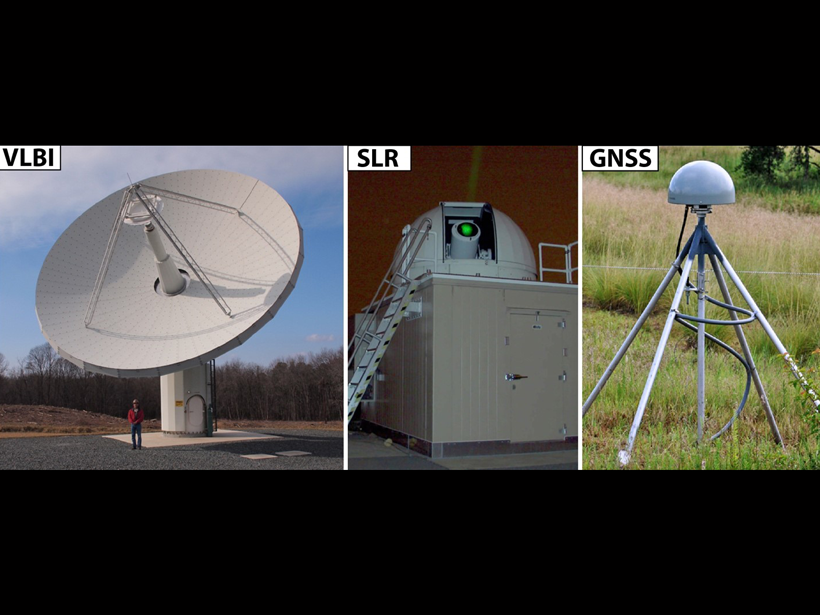
Evolving the Geodetic Infrastructure
Enhancements to the largely invisible framework will enable researchers to investigate pressing questions about our planet’s future.

Posted inResearch Spotlights
A New Method Produces Improved Surface Strain Rate Maps
The transdimensional Bayesian approach handles GPS data limitations better than existing methods and may assist future seismic hazard assessment studies.