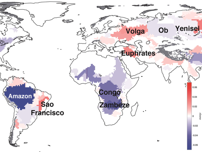
• About
  • Sections
  • Topics
    • Climate
    • Earth Science
    • Oceans
    • Space & Planets
    • Health & Ecosystems
    • Culture & Policy
    • Education & Careers
    • Opinions
  • Projects
    • ENGAGE
    • Editors’ Highlights
    • Editors’ Vox
    • Eos en Español
    • Eos 简体中文版
    • Print Archive
  • Blogs
    • Research & Developments
    • The Landslide Blog
  • Newsletter
  • Submit to Eos
  • AGU.org
  • Career Center
  • Join AGU
  • Give to AGU
  • About
  • Sections
  • Topics
    • Climate
    • Earth Science
    • Oceans
    • Space & Planets
    • Health & Ecosystems
    • Culture & Policy
    • Education & Careers
    • Opinions
  • Projects
    • ENGAGE
    • Editors’ Highlights
    • Editors’ Vox
    • Eos en Español
    • Eos 简体中文版
    • Print Archive
  • Blogs
    • Research & Developments
    • The Landslide Blog
  • Newsletter
  • Submit to Eos
Skip to content
  • AGU.org
  • Career Center
  • Join AGU
  • Give to AGU
Eos

Eos

Science News by AGU

Support Eos
Sign Up for Newsletter
  • About
  • Sections
  • Topics
    • Climate
    • Earth Science
    • Oceans
    • Space & Planets
    • Health & Ecosystems
    • Culture & Policy
    • Education & Careers
    • Opinions
  • Projects
    • ENGAGE
    • Editors’ Highlights
    • Editors’ Vox
    • Eos en Español
    • Eos 简体中文版
    • Print Archive
  • Blogs
    • Research & Developments
    • The Landslide Blog
  • Newsletter
  • Submit to Eos

Valeriy Ivanov

Editor, Geophysical Research Letters

Figure showing channel cross section geometry and erosion potential simulated with a comprehensive morphodynamic model at different stages of the channel evolution
Posted inEditors' Highlights

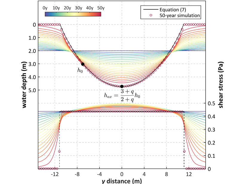
Stream Hydraulic Geometry 1.01

by Valeriy Ivanov 7 December 202015 February 2023

New research provides a theoretical explanation of channel cross section geometry dependence on flow rate that is commonly observed and described with power-laws.

Charts showing seasonal cycles of events caused by precipitation on snow
Posted inEditors' Highlights

Atmospheric Rivers Trigger Heavy Snowmelt in Western USA

by Valeriy Ivanov 13 December 201930 January 2024

A rare atmospheric phenomenon that transports large quantities of water vapor into the coastal watersheds of the western USA is responsible for up to 10–20% of intense snowmelt events in the region.

Map showing how much terrestrial water storage in some of the world’s major river basins contributes to sea level rise.
Posted inEditors' Highlights

A Closure on Sea Level Rise Budget

by Valeriy Ivanov 27 November 201928 October 2021

Terrestrial water loss may explain the lack of previous budget closure in global mean sea level rise.

An illustration of rainfall estimates from ground-based radar and spaceborne Tropical Rainfall Measuring Mission (TRMM) radar
Posted inEditors' Highlights

Machine Learning Improves Satellite Rainfall Estimates

by Valeriy Ivanov 31 October 201925 July 2022

A new deep learning approach bridges ground rain gauge and radar data with spaceborne radar observations of Tropical Rainfall Measuring Mission to improve precipitation estimation.

Maps showing flooding near Houston after Hurricane Harvey in 2017
Posted inEditors' Highlights

Future Remote Sensing Mission Holds Promise for Flood Monitoring

by Valeriy Ivanov 28 October 20191 December 2022

The 2021 Surface Water and Ocean Topography (SWOT) mission will measure water surface elevation, slopes, and inundations of rivers as narrow as 50 meters.

Graph showing performance of remote sensing-based model for leaf area
Posted inEditors' Highlights

Tropical Forests May Have More Canopy Than Previously Thought

by Valeriy Ivanov 30 August 201912 January 2023

A rare attempt to directly estimate leaf area in a tropical African broadleaved forest suggests that there may be more tree foliage than previously estimated.

Figure showing observed and modeled rates of land-surface warming relative to near-surface air during dry spells
Posted inEditors' Highlights

Diagnosing Soil Moisture Impacts on Model Energy Fluxes

by Valeriy Ivanov 13 June 201929 March 2023

Do climate models truthfully mimic how drying soil affects land-surface budget partition?

Posted inEditors' Highlights

A Step Closer to Quantifying Global Photosynthesis in Real Time

by Valeriy Ivanov 12 March 20197 July 2022

High spatial and temporal resolutions of a data set on a proxy for plant photosynthesis, as well as contiguous global coverage, have great utility for a variety of applications.

Posted inEditors' Highlights

Insensitivity of Total Sediment Flux to Hydraulic Details

by Valeriy Ivanov 6 September 201830 March 2023

The total sediment mass transported by flow under different sets of regimes is insensitive to the exact details of hydraulic forcing, but what matters is cumulative transport capacity.

Posts pagination

Newer posts 1 2
A view of a Washington, D.C., skyline from the Potomac River at night. The Lincoln Memorial (at left) and the Washington Monument (at right) are lit against a purple sky. Over the water of the Potomac appear the text “#AGU24 coverage from Eos.”

Features from AGU Publications

Research Spotlights

Mapping the Ocean Floor with Ancient Tides

6 May 20256 May 2025
Editors' Highlights

First Benchmarking System of Global Hydrological Models

7 May 20257 May 2025
Editors' Vox

Decoding Crop Evapotranspiration

6 May 20256 May 2025
Eos logo at left; AGU logo at right

About Eos
ENGAGE
Awards
Contact

Advertise
Submit
Career Center
Sitemap

© 2025 American Geophysical Union. All rights reserved Powered by Newspack