
Contrary to common assumptions, Arctic ponds mix in more than one direction. A new study finds that nighttime sideways flows, not vertical mixing, renew bottom waters.
Valeriy Ivanov
Editor, Geophysical Research Letters

Posted inEditors' Highlights
Peatland Plantations in Southeast Asia are Carbon Hotspots
A new study reports a rare set of data on greenhouse gas production and transport for a tropical peatland plantation showing exceptionally high concentrations of dissolved organic carbon.

Posted inEditors' Highlights
Logjams Promote Floodplain Complexity and Hydraulic Resistance
Using a new model, scientists compare logjam hydraulic impact across 37 reaches observed over 11 years in the Colorado Rockies.
Posted inEditors' Highlights
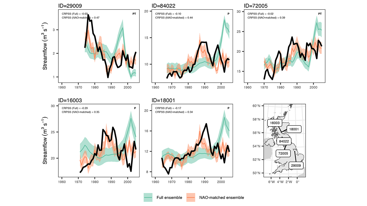
Predicting Flood Conditions in the Next Few Years
Multiyear flood predictions are possible for watersheds in which the magnitude and frequency of flooding can be related to an atmospheric pressure see-saw in the North Atlantic region.
Posted inEditors' Highlights
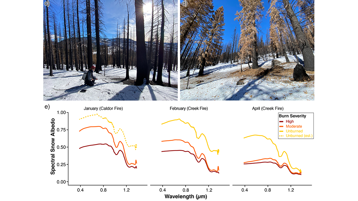
Summer Fire Means Winter Melt
Changing wildfire activity in California may impact seasonal hydrology by causing intense snowmelt during winter in areas where fires extend into higher elevation zones.
Posted inEditors' Highlights
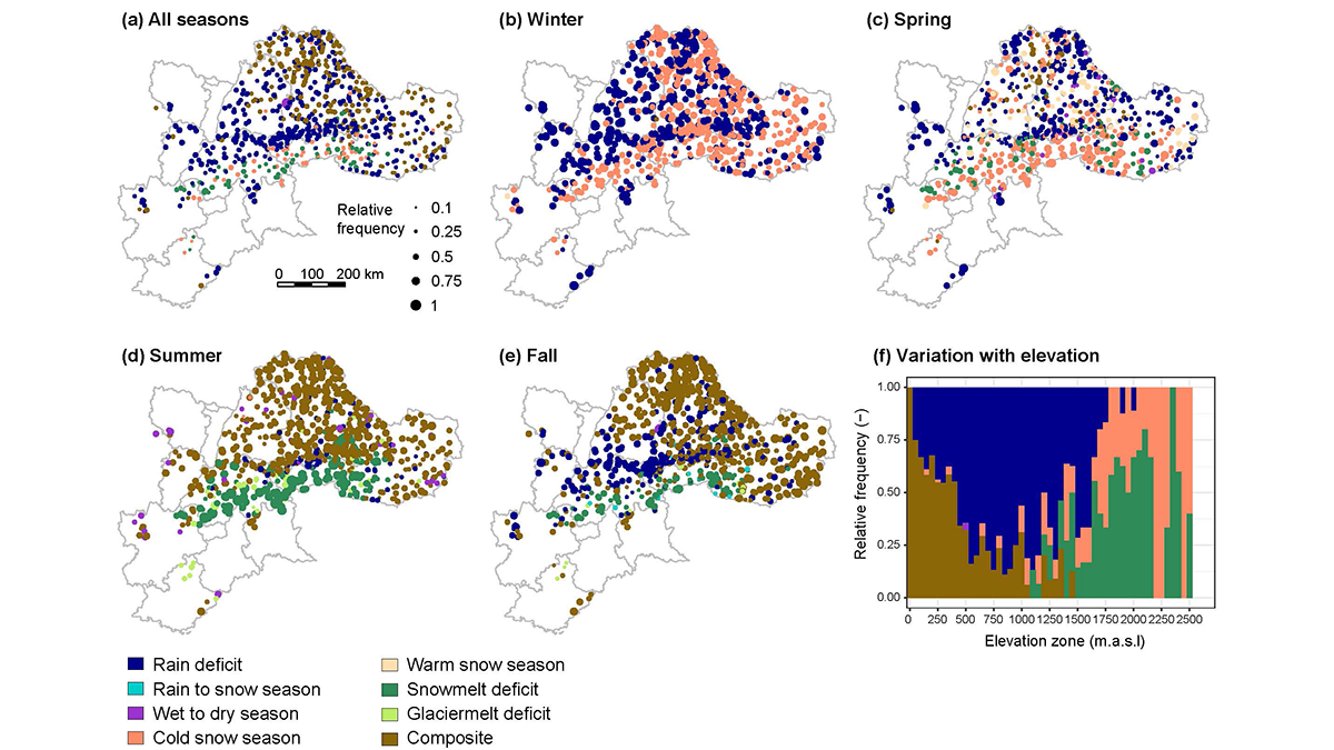
Streamflow Drought Intensification in the European Alps
A five-decade analysis of drought generation processes in the Alps shows their changing seasonality in high-elevation basins with increasingly frequent droughts caused by a lack of snowmelt water.
Posted inEditors' Highlights
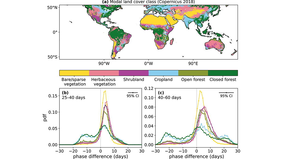
Vegetation Carries the Signature of Recent Precipitation
Vegetation response to precipitation is important for near-term weather predictability, and researchers show that such a response can occur within a few days and last up to two months.
Posted inEditors' Highlights
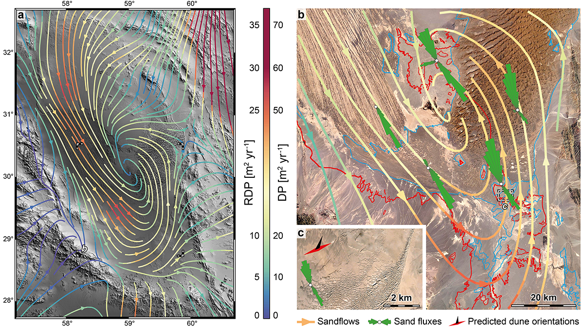
A Unique Glimpse at Sediment Erosion and Deposition by Wind
The Lut Desert in Iran is an exceptional natural laboratory to study how wind moves sediment across the landscape. A new study quantifies erosional and depositional sediment fluxes of the desert.
Posted inEditors' Highlights
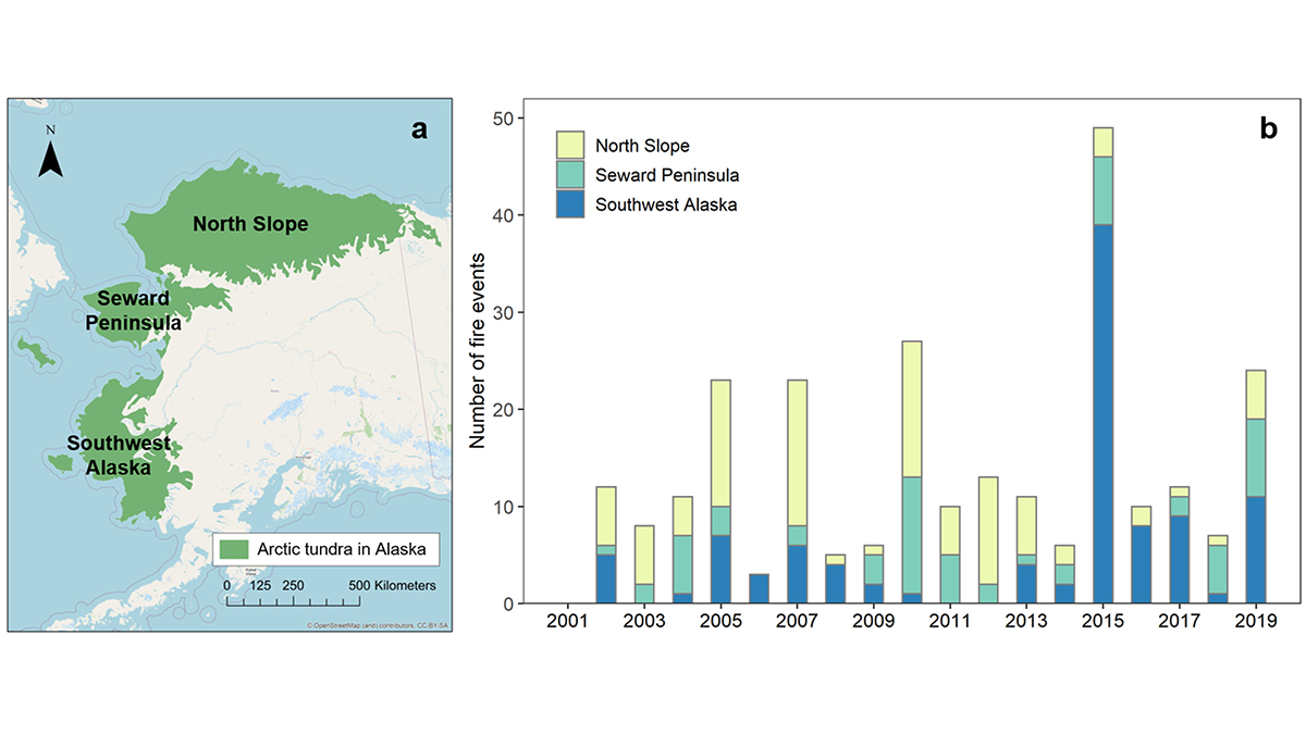
Lightning in Alaskan Tundra Ignites Most Fires
Cloud-to-ground lightning is found to be the most important controller of wildfire occurrence in the Artic tundra of Alaska from 2001 to 2019.
Posted inEditors' Highlights
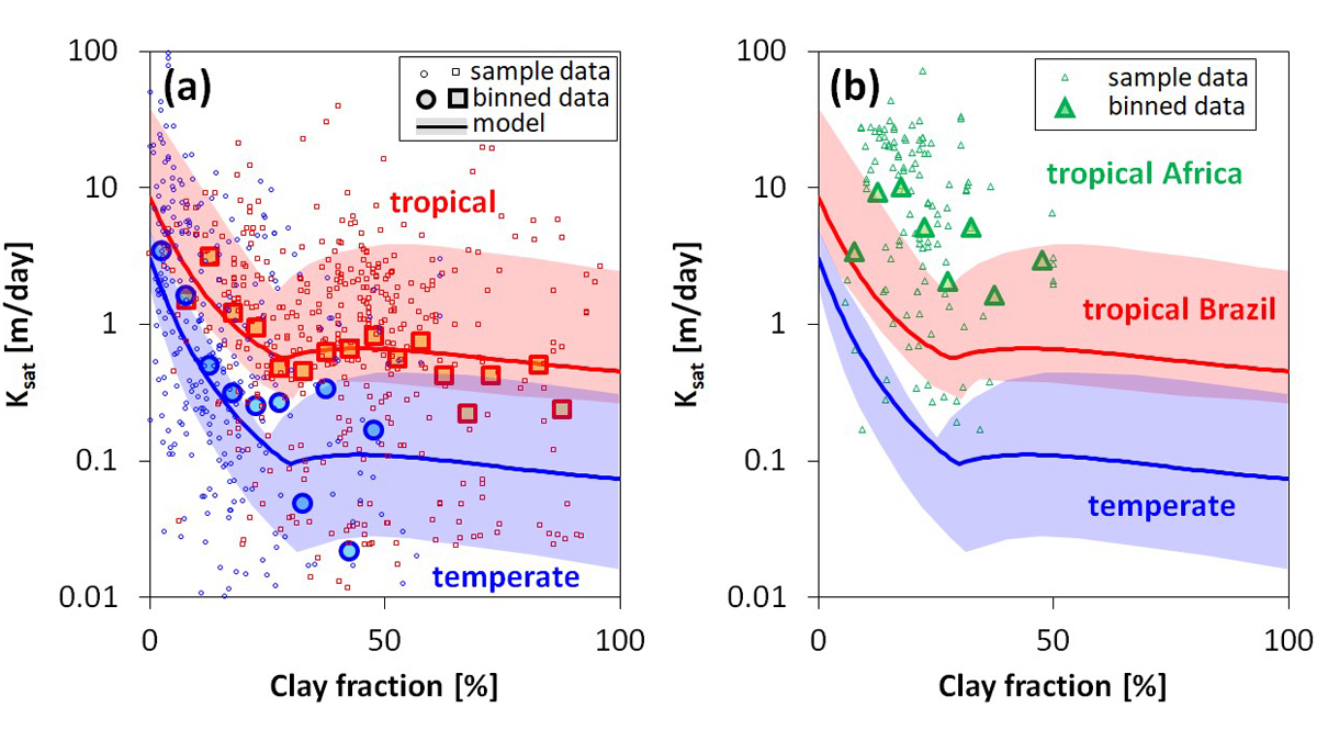
Not All Clays are Made Equal – and it Matters for Hydrology
Soil clay content is an important characteristic that affects many hydraulic and mechanical properties of soil; clay mineral type is important for their prediction.