Editors’ Highlights are summaries of recent papers by AGU’s journal editors.
Source: Earth and Space Science
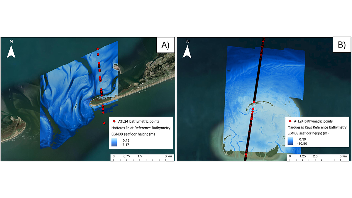
Measurements of bathymetry, the underwater depth of the ocean floor, are typically done for shallow coastal waters from boats with echosounders or from aircraft using green-wavelength lidar. However, these methods can be expensive to field, hard to update, and cannot access all locations.
NASA’s Ice, Cloud, and land Elevation Satellite-2 (ICESat-2) mission has introduced a new satellite-derived shallow water bathymetry product that will provide free, easy-to-access, and ready-to-use measurements for the world’s shallow coastal waters. This information is of value for navigational safety, in particular for measurements in very shallow water or close to shore where boats cannot safely operate. Scientists can also use the data to study coral reefs and near-shore aquatic habitats.
The shallow water bathymetry product is derived using data from the ICESat-2 green-wavelength Advanced Topographic Laser Altimeter System (ATLAS) lidar, which operates from an orbit about 500 kilometers above the Earth’s surface.
Parrish et al. [2025] present their results of the first processing of the ICESat-2 archive, providing bathymetric measurements from approximately 0.5 to 21.5 meters depth for 13.7 million kilometers of coastal waters. This initial data set has been validated against high accuracy airborne bathymetry data acquired over eight locations in the eastern United States and the Caribbean islands. The products will be regularly updated as ICESat-2 acquires new data, filling in areas not initially measured because of rough seas or cloud cover and updating earlier measurements over time.
Citation: Parrish, C. E., Magruder, L. A., Perry, J., Holwill, M., Swinski, J. P., & Kief, K. (2025). Analysis and accuracy assessment of a new global nearshore ICESat-2 bathymetric data product. Earth and Space Science, 12, e2025EA004391. https://doi.org/10.1029/2025EA004391
—Cathleen Jones, Editor, Earth and Space Science