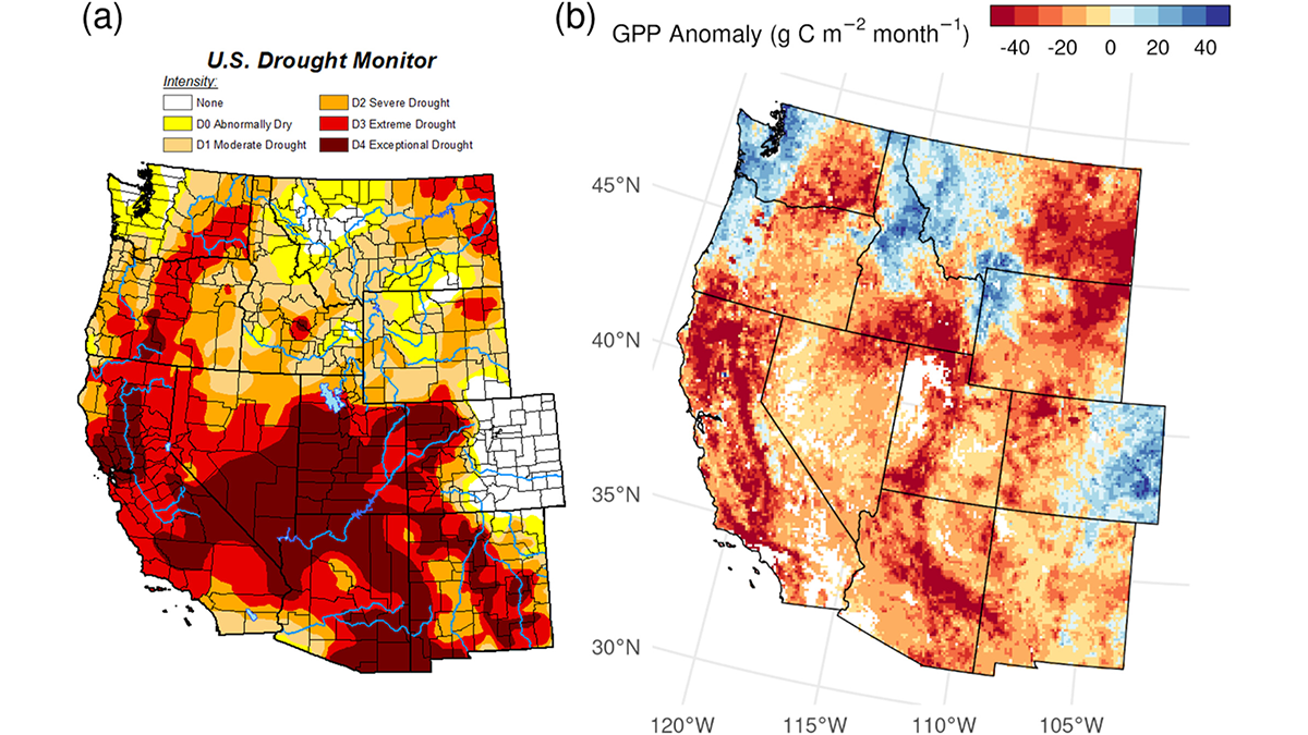
A parsimonious ecosystem model constrained by data from NASA’s Soil Moisture Active and Passive mission generates a global daily carbon flux product that is highly sensitive to drought and pluvial events.
satellites

Posted inResearch & Developments
NASA Rushes to Buoy a Swiftly Sinking Telescope
The Neil Gehrels’ Swift Observatory is plummeting toward Earth, and NASA is spending $30 million to try to stop it.

Posted inEditors' Vox
Small-Scale Indian Ocean Dynamics Underpin Marine Ecology and Climate
With unique monsoon, mesoscale and submesoscale processes, the Indian Ocean offers critical insights and new challenges to achieving a full understanding of marine environments and the Earth system.

Posted inNews
Weak Faults Play a Strong Role in the Tibetan Plateau’s Deformation
Ten years’ worth of data reveal that two theories about how the Tibetan Plateau deforms are both probably right.

Posted inNews
Vegetation Moves Upslope Across the Himalayas
The vegetation line in places like Nepal and Bhutan is shifting upward by meters per year, with implications for how water moves through the planet’s “Third Pole.”
Posted inNews
Urban Methane Emissions Are Rising, Despite Cities’ Pledges
Eyes in the sky could help cities get on track to decrease emissions of the potent greenhouse gas—and monitor whether their efforts are working.
Posted inEditors' Highlights
Taking the Pulse of Atmospheric Drag to Predict Satellite Trajectory
Scientists present a new method for estimating the density of the upper atmosphere to account for atmospheric drag when predicting satellite trajectory.
Posted inEditors' Highlights
How Space Plasma Can Bend the Laser of Gravitational Wave Detectors
A new study reveals how and to what extent laser beams are bent during propagation through space plasma in TianQin, a geocentric space-borne gravitational wave detector.

Posted inEditors' Highlights
More Braided Rivers from Increasing Flow Variability
Global analysis of satellite data and river flow records show that higher flow intermittency after climate change may lead to an increasing number of threads in braided rivers, thus impacting ecosystems.
Posted inEditors' Vox
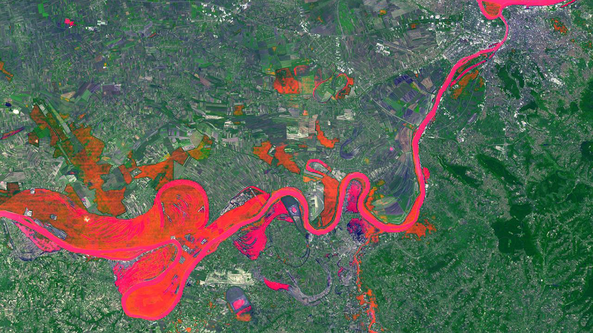
Can Any Single Satellite Keep Up with the World’s Floods?
How well does our current satellite fleet capture the world’s major floods? Scientists turn to the Dartmouth Flood Observatory record for a data-driven answer.