The world has made significant progress on methane mitigation since 2020, though meeting the goals of a major international pledge will require additional action, according to a United Nations Environment Programme (UNEP) report.
satellites
Posted inEditors' Highlights
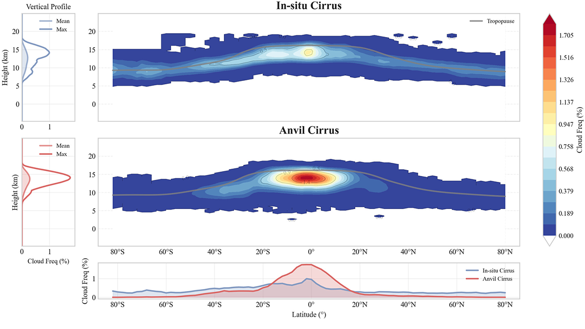
Understanding Relative Atmospheric Roles of Anvil and In-situ Cirrus Clouds
New framework for separating anvil and in-situ cirrus clouds provides a pathway for modeling cirrus and how regional shifts in convection could reshape global cirrus distributions and their radiative impact.
Posted inEditors' Highlights
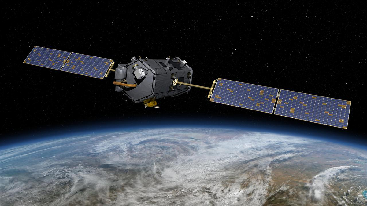
Taking Carbon Science Out of Orbit
NASA’s Orbiting Carbon Observatory-2 satellite reveals an impressively dynamic picture of the Earth’s carbon cycle, yet it may be prematurely decommissioned and destroyed due to budget cuts.
Posted inNews
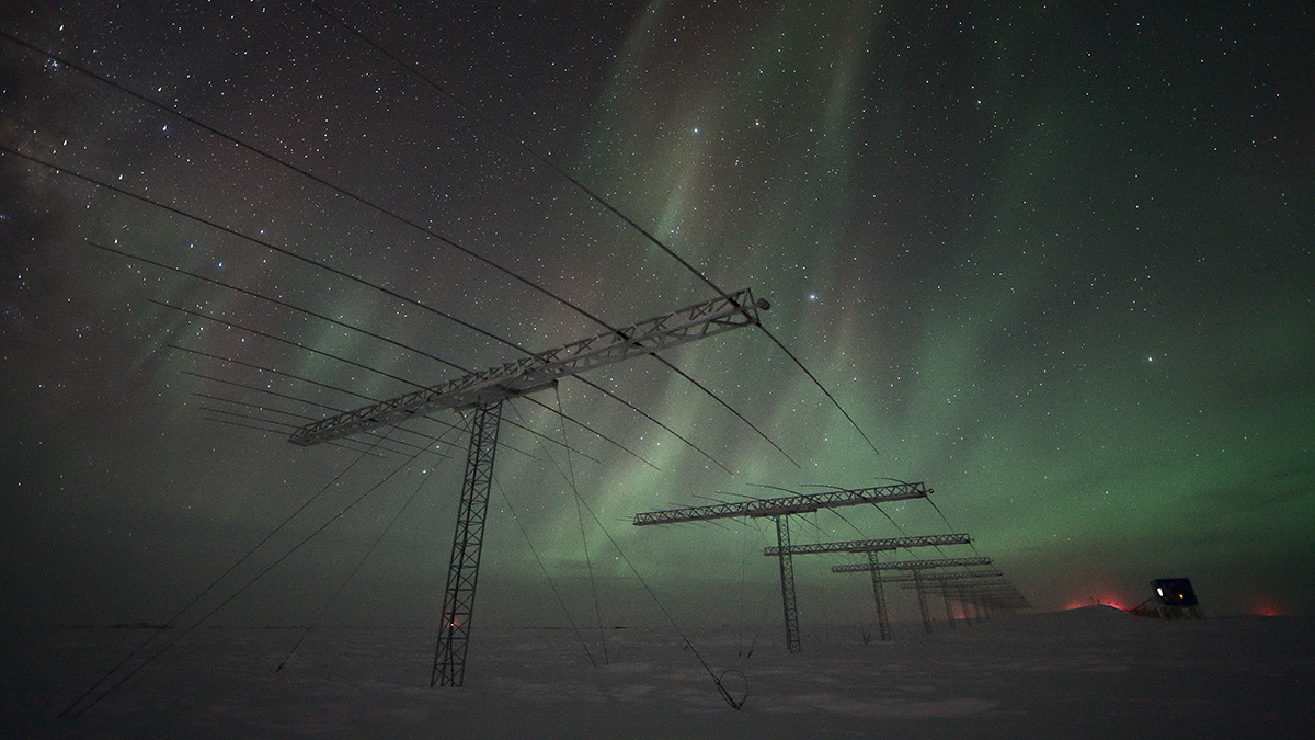
A Weak Spot in Earth’s Magnetic Field Is Going from Bad to Worse
This could be bad news for satellites and spacefarers.
Posted inEditors' Highlights
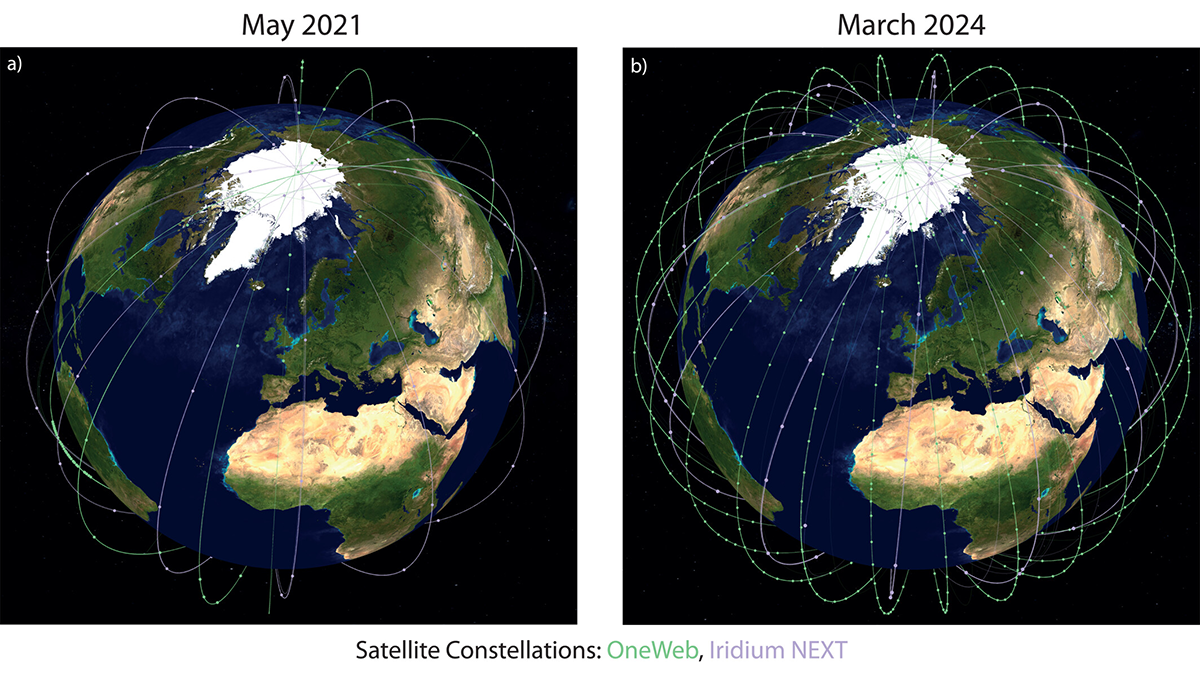
Space Weather Monitoring from Commercial Satellite Mega-Constellations
Enabling unprecedented monitoring of key electric current systems in low-Earth orbit using commercial satellite mega-constellations advances space weather monitoring.
Posted inEditors' Highlights
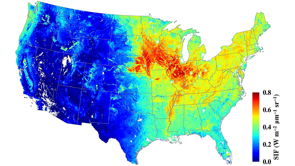
Serendipity in Space: NASA’s Eye in the Sky
The Orbiting Carbon Observatory-2 (OCO-2) mission, proposed for early termination, has turned out to be a boon to forest and agricultural management.
Posted inOpinions
A Better Way to Monitor Greenhouse Gases
A unified, global observing system could more effectively monitor progress in reducing emissions and accelerate climate action through improved data and decision support.
Posted inFeatures
The AI Revolution in Weather Forecasting Is Here
The past decade has seen explosive growth in forecasting research and applications using AI. Sophisticated new approaches show vast potential to support public safety, health, and economic prosperity.
Posted inFeatures
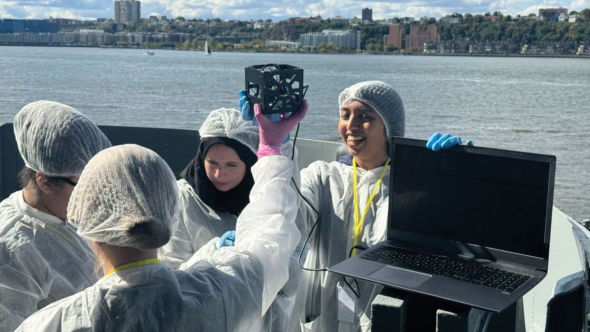
Small Satellites, Big Futures
Programs that teach students to design, build, and launch tiny satellites are helping to inspire the next generation of space scientists and engineers.
Posted inResearch & Developments
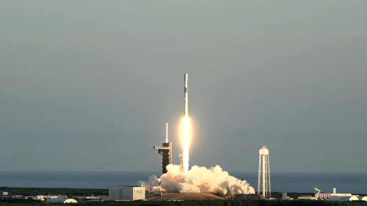
Trio of Space Weather Satellites Take Flight
These three satellites will that study the solar wind and its impacts.