JGR: Space Physics welcomes new and original developments in instrumentation including novel experimental methodologies that are relevant to space physics.
satellites
Posted inEditors' Highlights
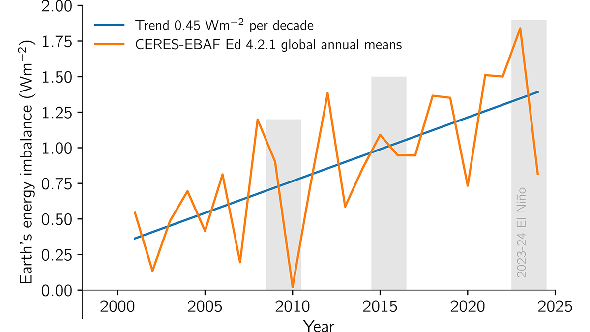
Earth’s Energy Imbalance is Growing Faster Than Expected
Satellite observation of the imbalance between incoming and outgoing radiation in the atmosphere, which causes global warming, shows growth beyond what climate models have predicted.
Posted inNews
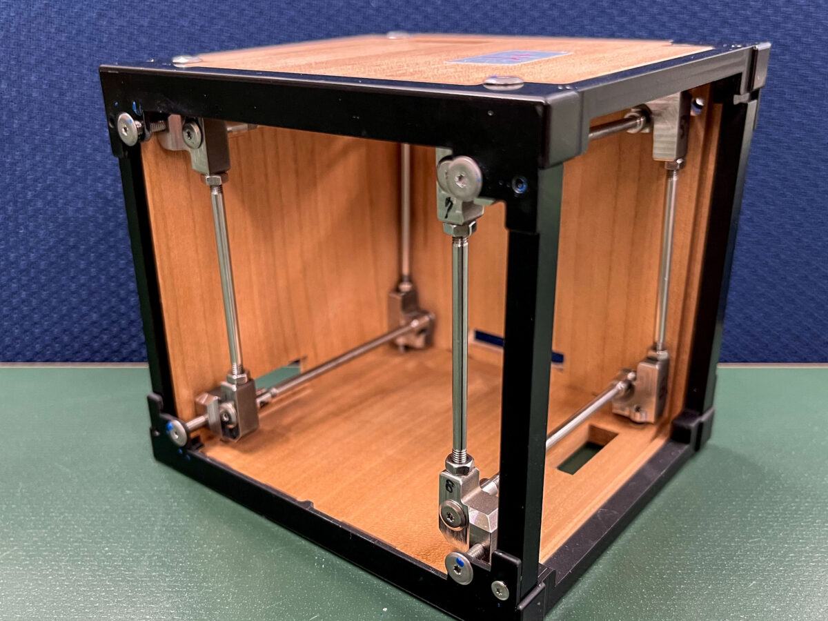
A New Satellite Material Comes Out of the Woodwork
With lessons learned from their first attempt, Kyoto University scientists hope a second CubeSat made of magnolia will spark an age of wooden spacecraft.
Posted inResearch & Developments
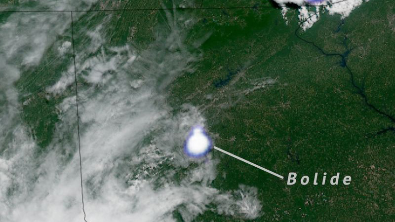
Fireball Passes Over Southeastern United States
It’s a bird! It’s a plane! It’s… a bolide!
Posted inEditors' Highlights
Coverage Factors Affect Urban CO2 Monitoring from Space
Orbital mechanics and environmental factors limiting the ability of Orbiting Carbon Observatory missions to collect data in space and time affect city-level monitoring, reporting, and verification goals.
Posted inEditors' Vox
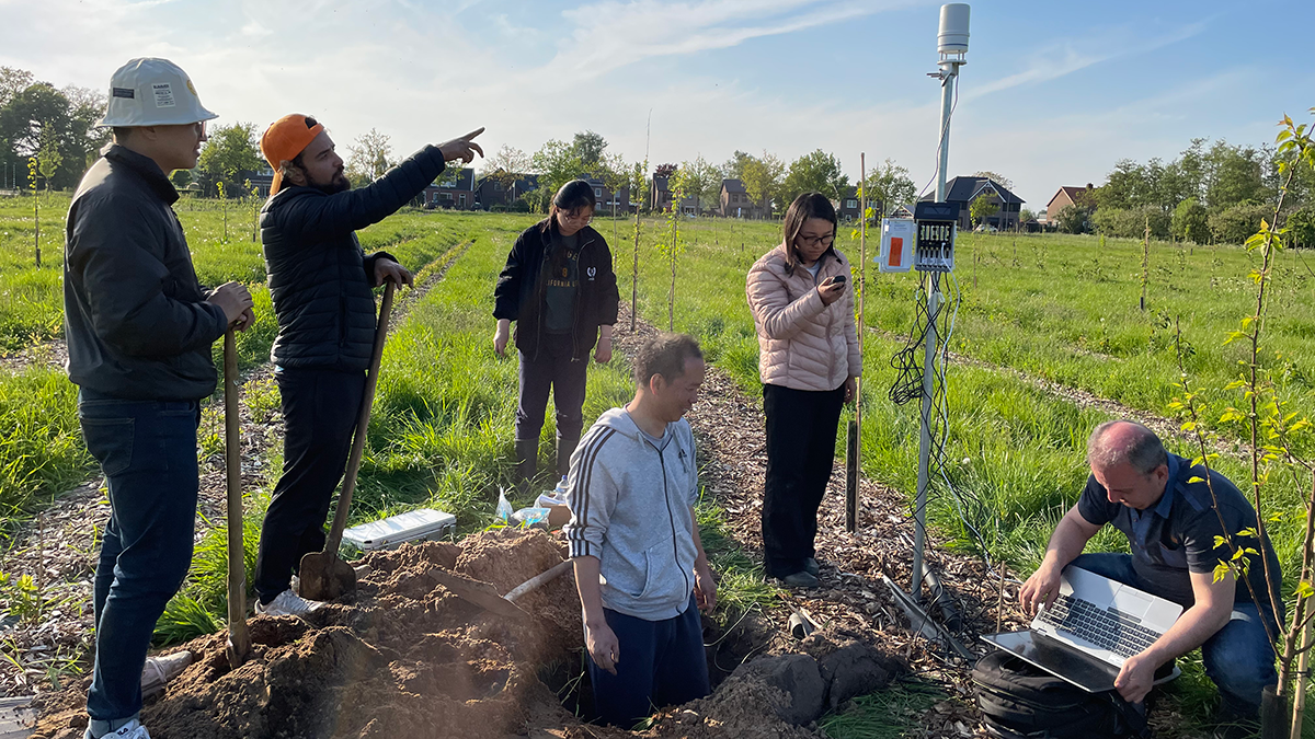
Keeping Soil Healthy: Why It Matters and How Science Can Help
Healthy soil is the foundation of our food, clean water, and a stable climate, and cutting-edge science helps us to protect it.
Posted inResearch Spotlights
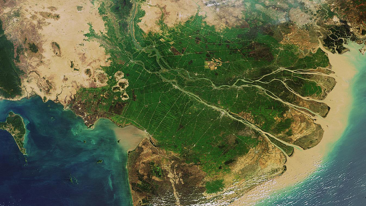
New Global River Map Is the First to Include River Bifurcations and Canals
GRIT provides a much more detailed look at how rivers merge and split, which could enhance hydrological modeling, flood forecasting, and water management efforts.
Posted inEditors' Highlights
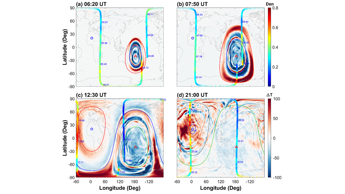
Tonga’s Volcanic Fury Ripples to the Netherworld
Secondary gravity waves emerge as the hidden architects of global-scale thermospheric upheaval following the Tonga eruption in 2022.
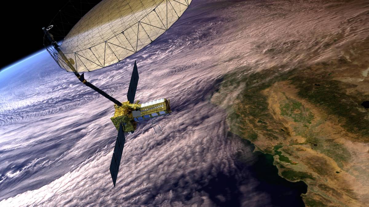
Posted inNews
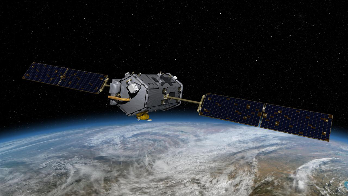
“Transformational” Satellite Will Monitor Earth’s Surface Changes
The mission, jointly operated by the United States and India, will measure minute changes to land, ice, and ecosystems around the globe.

Posted inResearch & Developments
NASA Science Faces an “Extinction-Level Event” with Trump Draft Budget Proposal
The initial draft of President Donald Trump’s budget request proposes devastating cuts to NASA’s science research, future space missions, and field centers.