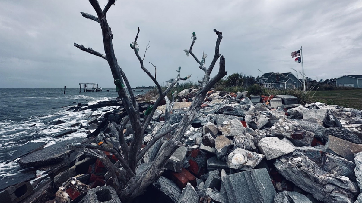
An interdisciplinary network of scientists and stakeholders is working to understand how saltwater intrusion and sea level rise are affecting rural communities and to help address the consequences.
Science Updates
Posted inScience Updates
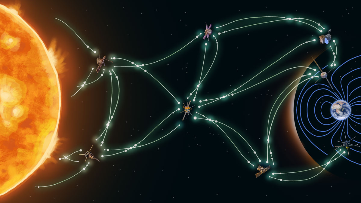
Vast Space, Sparse Data: An AI Answer to Twin Space Weather Challenges
Modern machine learning and AI methods can help heliophysics researchers and space weather forecasters overcome limitations from a dearth of observations and the infrequency of extreme events.
Posted inScience Updates
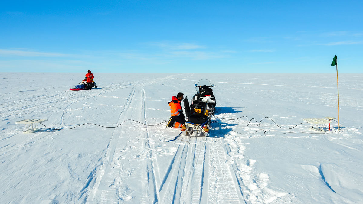
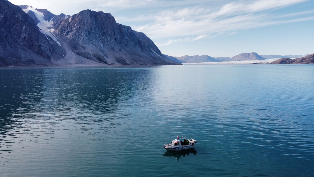
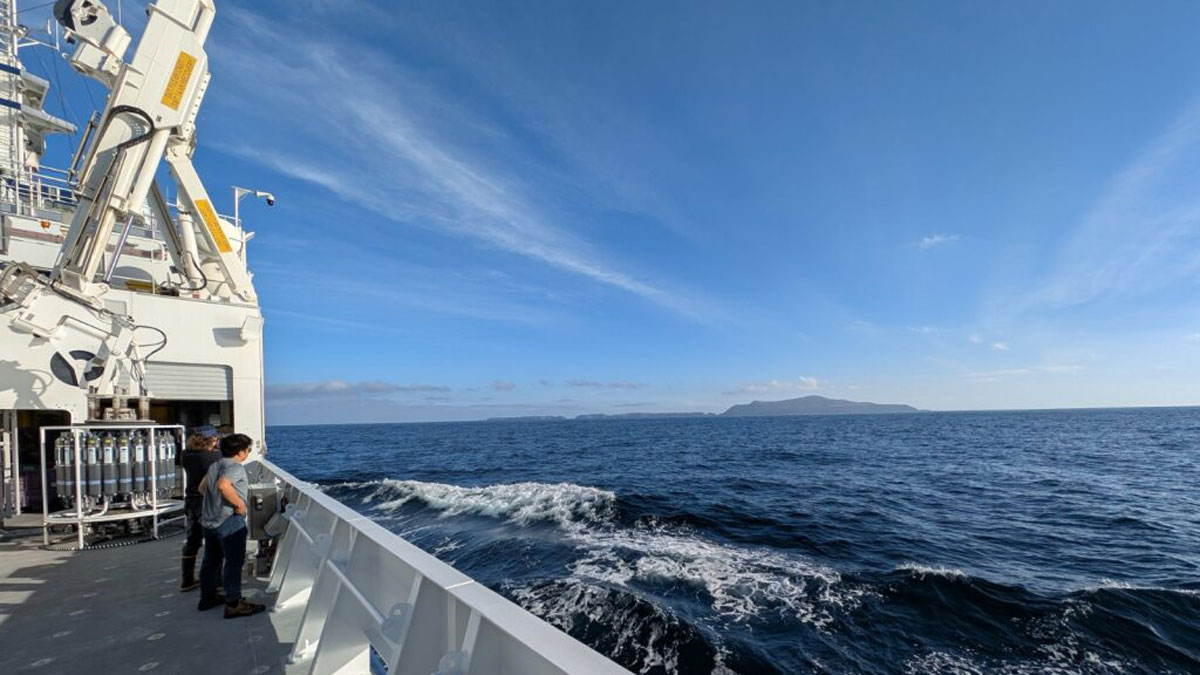
New Directions in Mapping Ice Sheet Fabrics and Flow
Polarimetric radar advances enable scientists to measure orientations of crystals, bubbles, and other properties that affect the flow of glaciers and ice sheets—and their contributions to sea level.
Posted inScience Updates
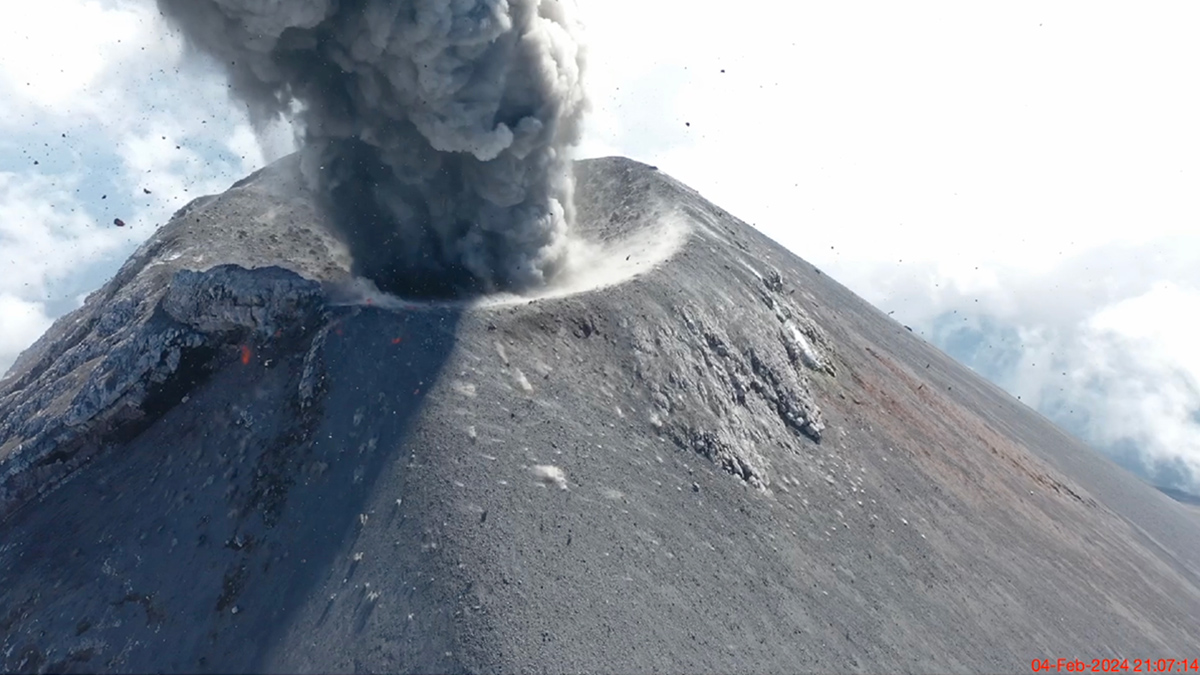
Sensing the Sounds from Earth’s Hazardous Environments
Low-cost infrasound sensors, deployed in large numbers, provide a practical means of data collection near volcanoes, earthquakes, wildfires, and other geophysical phenomena.
Posted inScience Updates
Melting Glaciers Make the Coastal Ocean More Sensitive
Fresh water from retreating ice does more than raise sea levels. It affects how the ocean responds to acidification and other environmental changes.
Posted inScience Updates
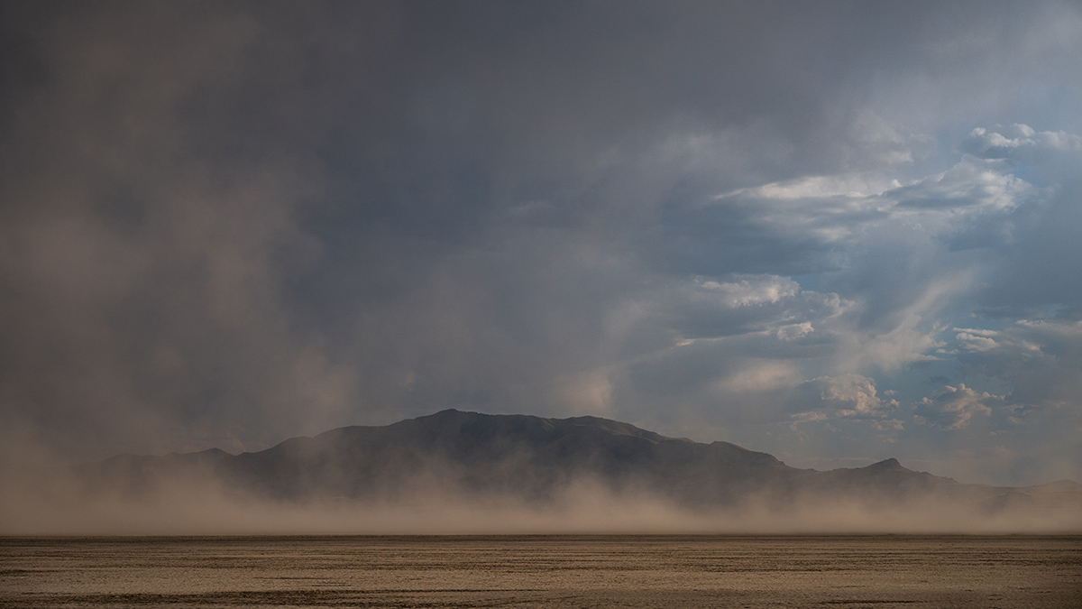
Lessons from Linking Great Salt Lake Desiccation and Depression
By melding different expertise and merging disparate datasets, researchers revealed how lake bed dust may be affecting mental health outcomes across Utah.
Posted inScience Updates
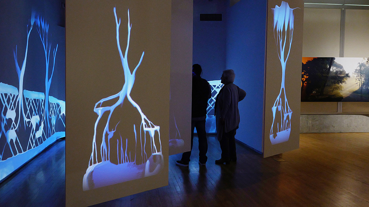
An Art-Science Partnership Offering New Views of Dynamic Landscapes
The immersive and interactive WILDLAND exhibition allowed the public—and the exhibition’s creators—to explore connections among water, trees, fire, and other natural and human-made materials expressed across a spectrum of artistic approaches.
Posted inScience Updates
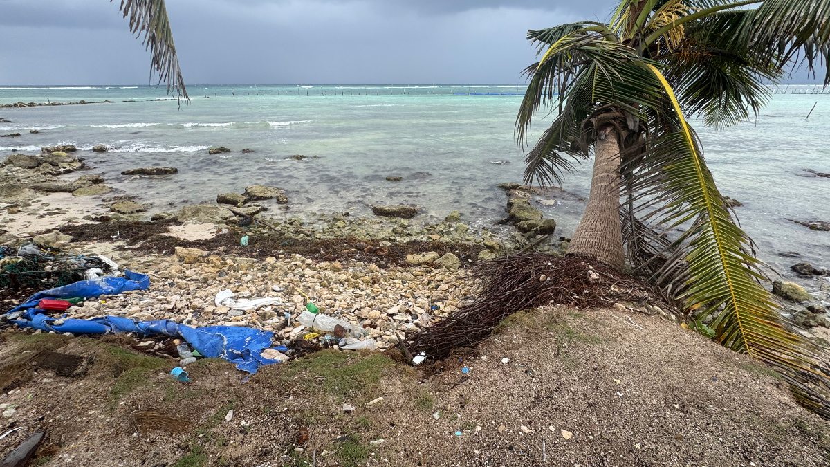
Tracking Microplastics Above and Below the Waves
Measuring plastic particles carried on Cozumel’s sea breezes and ocean currents reveals how simple physics shapes the particles’ pathways and the impacts they may have on coastal regions.
Posted inScience Updates
A New Twist on Robotic Float Data Reveals Critical Ocean Chemistry
A novel application of a statistical method to existing data from the global network of BGC-Argo floats unveiled chemical measurements critical to tracking nitrogen cycling in oxygen minimum zones.
Posted inScience Updates
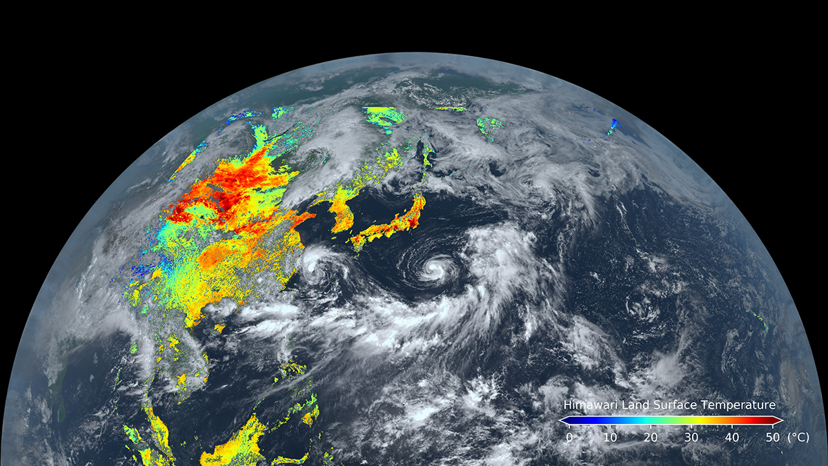
Geostationary Satellite Applications Expand into Land Monitoring
Known for their weather-observing prowess, these satellites can also track land surface processes and disturbances over broad areas in near-real time.