
Swirling currents called mesoscale eddies occupy about 22% of the ice-free Southern Ocean. Using data from drifting floats and satellites, scientists report the impact these eddies have on biogeochemical cycles.
satellites

Posted inFeatures
De los datos a las decisiones: cambiando las prioridades en las observaciones de la Tierra
La NASA está actualizando la forma en la que diseña e implementa las misiones de las Ciencias de la Tierra, para garantizar que sus datos y ciencia lleguen a los usuarios y a los responsables de la toma de decisiones de forma más rápida y eficaz.

Posted inNews
Darker, Less Cloudy Earth Contributed to Record Heat
Decreases to our planet’s albedo caused by fewer low-lying clouds helped push temperatures to historic highs in 2023, according to new research.

Posted inEditors' Highlights
Wave-Modulated Electron Loss Affects GPS Location Determination
Earth’s magnetosphere controls ionospheric total electron content modulation via plasma wave-induced electron loss impacting GPS spatial location determination.
Posted inEditors' Highlights
Imaging Magma from Afar
Reservoirs of magma and fluids in the crust create gravity anomalies detectable by altimetry, which can help find submarine volcanoes and provide key insights into their depth, shape and volume.

Posted inNews
Climate Change Is Driving Dangerous Bacteria Farther North
Satellite data could help address rising rates of vibriosis infections, often the result of eating undercooked seafood, along the East Coast of the United States.

Posted inNews
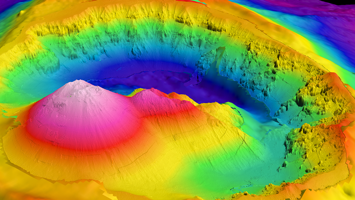
Satellite Measurements Make Major Seafloor Map Improvements
Though ship-based sounding has mapped some areas of the ocean floor in higher resolution, researchers have used SWOT data to create a detailed new map of the seafloor, including thousands of previously undetected small seamounts.

Posted inNews
The Survival of Arctic Sea Ice May Depend on Its Travel Routes
Researchers find that the motions of ice parcels determine which ones survive the annual summer melt.
Posted inResearch Spotlights
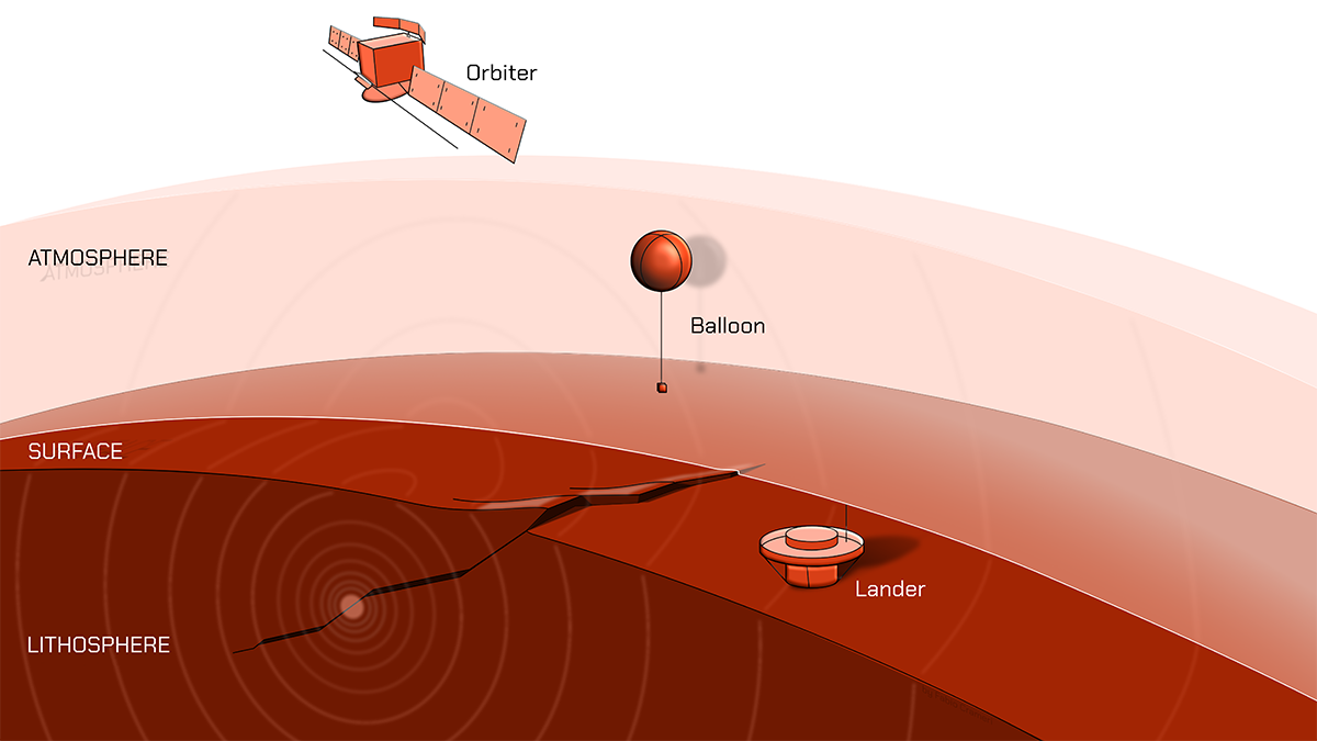
Three Ways to Track Venusquakes, from Balloons to Satellites
The planet’s harsh conditions make studying seismicity challenging, but it is likely possible.
Posted inEditors' Highlights
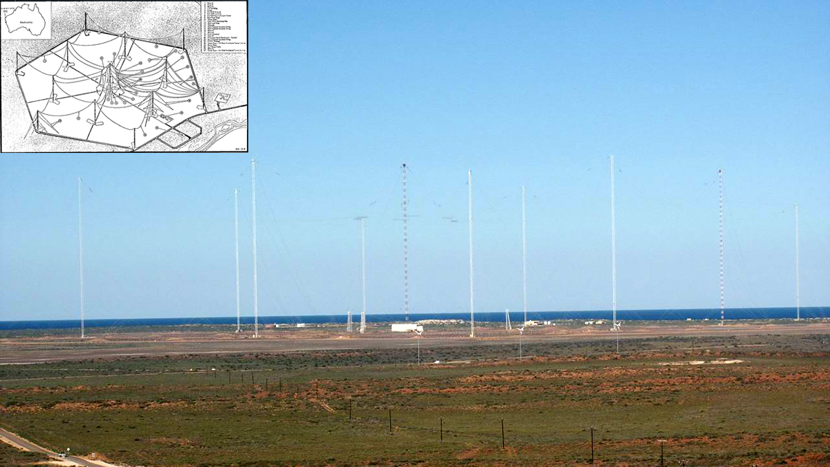
Ground-based Transmitters Cause Radiation Belt Electron Loss
A U.S. Navy transmitter in Australia produces wisps of electron loss as observed by the Colorado Inner Radiation Belt Experiment (CIRBE) CubeSat in Low Earth Orbit.