• About
  • Sections
  • Topics
    • Climate
    • Earth Science
    • Oceans
    • Space & Planets
    • Health & Ecosystems
    • Culture & Policy
    • Education & Careers
    • Opinions
  • Projects
    • ENGAGE
    • Editors’ Highlights
    • Editors’ Vox
    • Eos en Español
    • Eos 简体中文版
    • Print Archive
  • Science Policy Tracker
  • Blogs
    • Research & Developments
    • The Landslide Blog
  • Newsletter
  • Submit to Eos
  • AGU.org
  • Career Center
  • Join AGU
  • Give to AGU
  • About
  • Sections
  • Topics
    • Climate
    • Earth Science
    • Oceans
    • Space & Planets
    • Health & Ecosystems
    • Culture & Policy
    • Education & Careers
    • Opinions
  • Projects
    • ENGAGE
    • Editors’ Highlights
    • Editors’ Vox
    • Eos en Español
    • Eos 简体中文版
    • Print Archive
  • Science Policy Tracker
  • Blogs
    • Research & Developments
    • The Landslide Blog
  • Newsletter
  • Submit to Eos
Skip to content
  • AGU.org
  • Career Center
  • Join AGU
  • Give to AGU
Eos

Eos

Science News by AGU

Support Eos
Sign Up for Newsletter
  • About
  • Sections
  • Topics
    • Climate
    • Earth Science
    • Oceans
    • Space & Planets
    • Health & Ecosystems
    • Culture & Policy
    • Education & Careers
    • Opinions
  • Projects
    • ENGAGE
    • Editors’ Highlights
    • Editors’ Vox
    • Eos en Español
    • Eos 简体中文版
    • Print Archive
  • Science Policy Tracker
  • Blogs
    • Research & Developments
    • The Landslide Blog
  • Newsletter
  • Submit to Eos

satellites

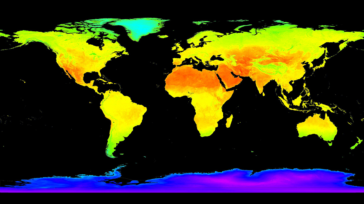
World map with radiative forcing data.
Posted inEditors' Highlights

Sensing the Color of Soil for Climate Modeling

Eric Davidson, president-elect of AGU by Eric Davidson 20 July 202328 August 2023

The color of soil reflecting the Sun’s rays affects the Earth’s climate and water cycle. Using satellite data that senses many wavelengths improves soil reflectivity estimates, especially in deserts.

Collage
Posted inFeatures

WMO Weathered the Cold War, but Can It Survive Capitalism?

by Bill Morris 26 June 202326 June 2023

After 150 years of international cooperation, meteorology’s “vast machine” is adapting to private weather forecasting.

Global map with colors indicating different types of aerosols.
Posted inEditors' Vox

Reducing Aerosol Climate-Forcing Uncertainty: A Three-Way Street

by Ralph A. Kahn 13 June 202312 June 2023

To reduce persistent aerosol-climate-forcing uncertainty, new in situ aerosol and cloud measurement programs are needed, plus much better integration of satellite and suborbital measurements with models.

Photo showing technologies for monitoring volcanic gas emissions.
Posted inEditors' Highlights

Send in the Drones: Safely Monitoring Volcanic Gas Emissions

by Paul Asimow 8 June 20238 June 2023

New drone technology was combined with satellite and ground-based data to improve volcanic gas flux monitoring at the remote Bagana Volcano in Papua New Guinea.

Photo of dust blowing on an Arizona hillside.
Posted inEditors' Vox

Danger in the Dust! The Hazards of Windblown Dust

by Thomas E. Gill, Daniel Tong, William Sprigg and R. Scott Van Pelt 1 June 202314 July 2023

Airborne dust not only causes disease, it also menaces transportation on land, sea, and air; disrupts renewable energy systems; transports pathogens and toxic substances; and poses many other hazards.

Hollywood road sign hangs above cars along Highway 101. In the distance is the smog-filled skyline of Los Angeles.
Posted inResearch Spotlights

Fine-Tuning Air Pollution Models

Sarah Derouin, Science Writer by Sarah Derouin 19 May 202322 June 2023

InMAP estimates air pollution within cities, but its predictions are flawed for specific chemicals. Now, scientists are addressing that shortcoming.

Vertical streaks of digital ones and zeroes rise from digitized representation of Earth against a deep blue background.
Posted inOpinions

We Need a Better Way to Share Earth Observations

by Zhong Liu, Yixin Wen, Vasco Mantas and David Meyer 12 May 202325 July 2023

A more accessible, open data-sharing infrastructure will engage a broader community of contributors, helping to develop satellite data products that benefit Earth science research and applications.

Graphs from the paper.
Posted inEditors' Highlights

Satellite View of African Easterly Waves and Hurricane Formation

by Suzana Camargo 9 May 20235 May 2023

Researchers present a new analysis of surface winds and enthalpy fluxes from satellite retrievals for African easterly waves that intensify into Atlantic hurricanes.

Posted inEditors' Vox

Using Cave Formations to Investigate Ancient Wildfires

by Micheline Campbell, Liza McDonough, Pauline C. Treble and Andy Baker 2 May 20231 May 2023

From sediment cores to speleothems, environmental archives are helping us to understand the history of wildfires.

Satellite view of a swirling green bloom of phytoplankton set in the dark blue ocean.
Posted inScience Updates

Carbon In, Carbon Out: Balancing the Ocean’s Books

by Ryan Vandermeulen 27 April 202325 January 2024

Scientists have developed a consensus guide of standard protocols for how best to measure oceanic primary productivity, a key component in Earth’s carbon cycle.

Posts pagination

Newer posts 1 … 7 8 9 10 11 … 26 Older posts
A view of a Washington, D.C., skyline from the Potomac River at night. The Lincoln Memorial (at left) and the Washington Monument (at right) are lit against a purple sky. Over the water of the Potomac appear the text “#AGU24 coverage from Eos.”

Features from AGU Publications

Research Spotlights

Machine Learning Simulates 1,000 Years of Climate

27 August 202527 August 2025
Editors' Highlights

As Simple as Possible: The Importance of Idealized Climate Models

28 August 202526 August 2025
Editors' Vox

Waterworks on Tree Stems: The Wonders of Stemflow

21 August 202520 August 2025
Eos logo at left; AGU logo at right

About Eos
ENGAGE
Awards
Contact

Advertise
Submit
Career Center
Sitemap

© 2025 American Geophysical Union. All rights reserved Powered by Newspack