New supercomputer models can provide valuable information about the ocean’s layers and movements, particularly slow moving features such as eddies and currents.
satellites

Posted inNews
Iceland’s Recent Eruptions Driven by Tectonic Stress
Magma flow in the magmatic dike near Grindavík was among the fastest recorded. The processes driving that flow could be at play at volcanoes in Hawaii, off the African coast, and anywhere crustal plates split apart.

Posted inScience Updates
Monitoring Polar Ice Change in the Twilight Zone
Landsat’s new extended data collection program is mapping Arctic and Antarctic regions year-round, even in polar twilight.
Posted inEditors' Highlights
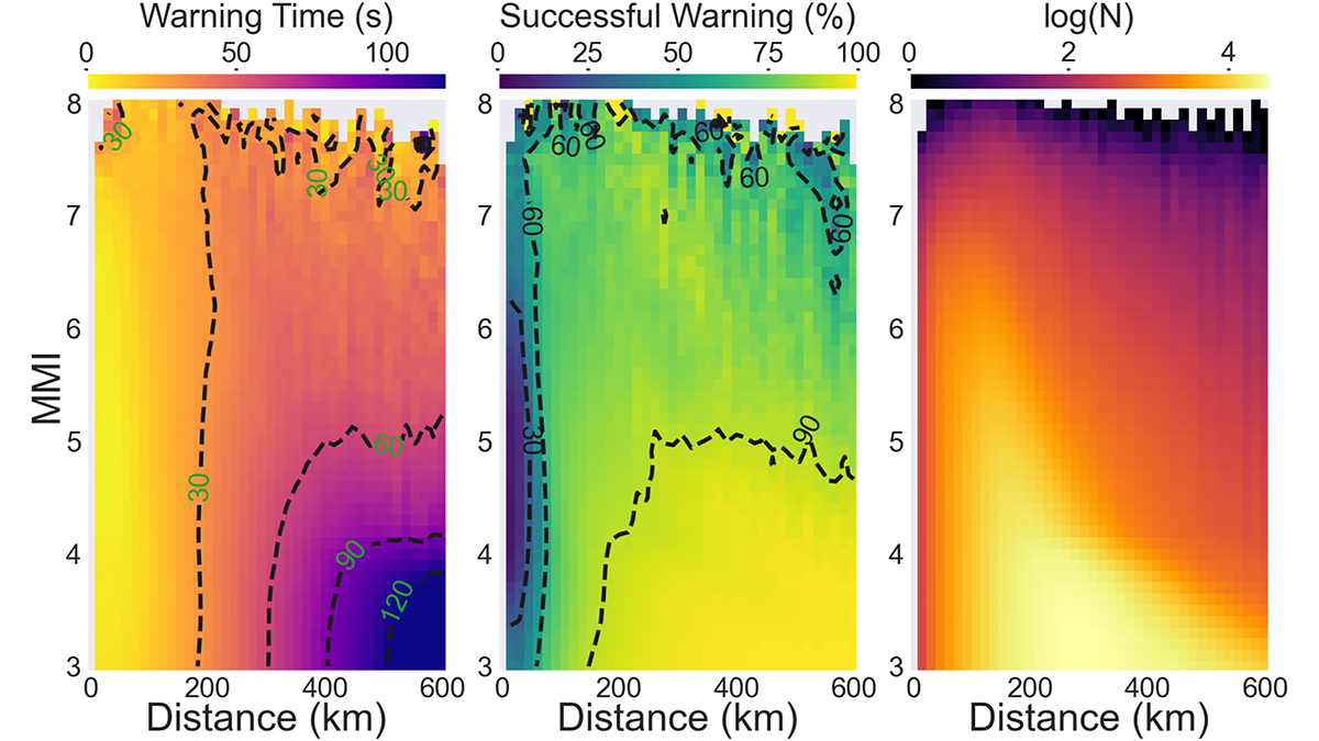
Deep Learning Facilitates Earthquake Early Warning
A deep learning model trained with real-time satellite data significantly reduces the time to predict the ground motion of big earthquakes.

Posted inEditors' Highlights
Pre-Season Wet Soil Produces Fire-Prone Conditions
The SMAP satellite shows that wetter-than-normal soil five months prior to wildfires in the western United States increases fuel availability and fire activity when desiccation occurs.
Posted inScience Updates
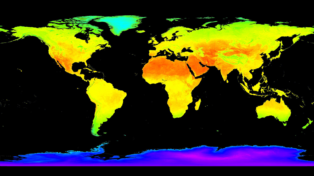
Trustworthy Satellite Earth Observations for Science and Society
Enhancing confidence in satellite observations of terrestrial properties like land surface temperature and soil moisture requires advances in validation and data quality assessment practices.

Posted inNews
New Satellite Will Help NASA Keep PACE with Earth Systems
Color and light measurements will help scientists better assess how our oceans and atmosphere interact.
Posted inEditors' Highlights
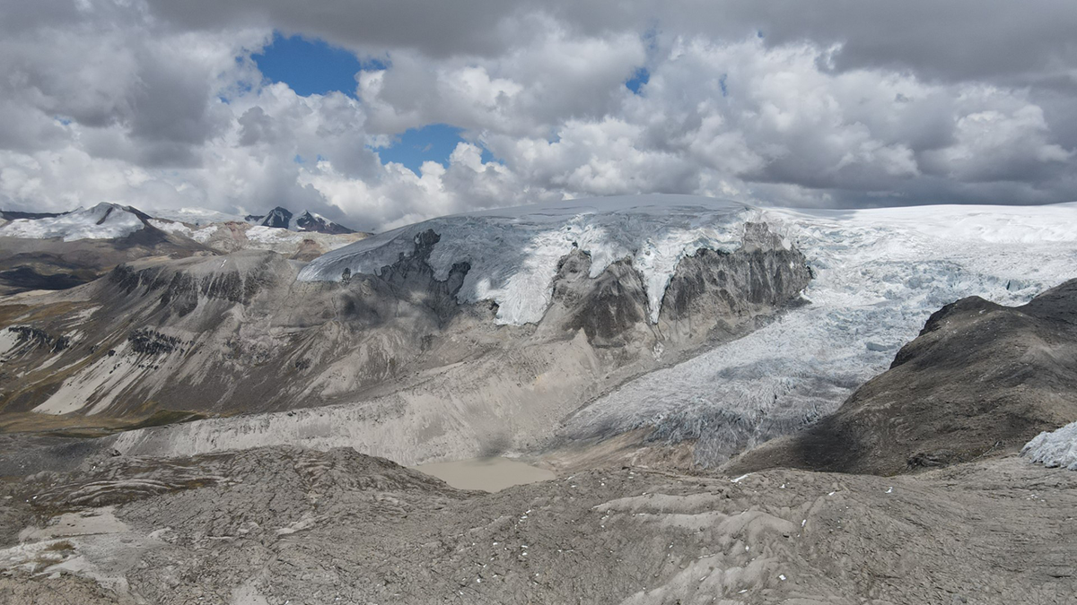
Plants Reveal the History of Earth’s Largest Tropical Ice Cap
Rooted plants buried by advancing outlet glaciers illustrate rapid changes in the extent of Quelccaya Ice Cap in Peru during the Holocene.

Posted inScience Updates
Ecosystem Observations from Every Angle
Proximal remote sensing provides a bridge between ecosystem flux data at Earth’s surface and optical data from satellite sensors, improving our grasp of feedbacks between terrestrial ecosystems and climate.
Posted inNews
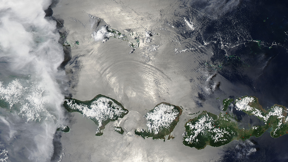
Shallower Clouds Hang More Often over Lost Forests
Two decades of satellite data show that deforestation in Southeast Asia has led to widespread low-lying clouds that might affect regional climate.