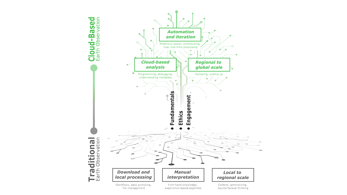
Cloud-based Earth Observation offers unique opportunities for education, but leveraging this requires new teaching methods that emphasize technical fundamentals, ethics, and stakeholder engagement.
satellites
Posted inEditors' Highlights
Sensing the Color of Soil for Climate Modeling
The color of soil reflecting the Sun’s rays affects the Earth’s climate and water cycle. Using satellite data that senses many wavelengths improves soil reflectivity estimates, especially in deserts.
Posted inFeatures
WMO Weathered the Cold War, but Can It Survive Capitalism?
After 150 years of international cooperation, meteorology’s “vast machine” is adapting to private weather forecasting.
Posted inEditors' Vox
Reducing Aerosol Climate-Forcing Uncertainty: A Three-Way Street
To reduce persistent aerosol-climate-forcing uncertainty, new in situ aerosol and cloud measurement programs are needed, plus much better integration of satellite and suborbital measurements with models.
Posted inEditors' Highlights
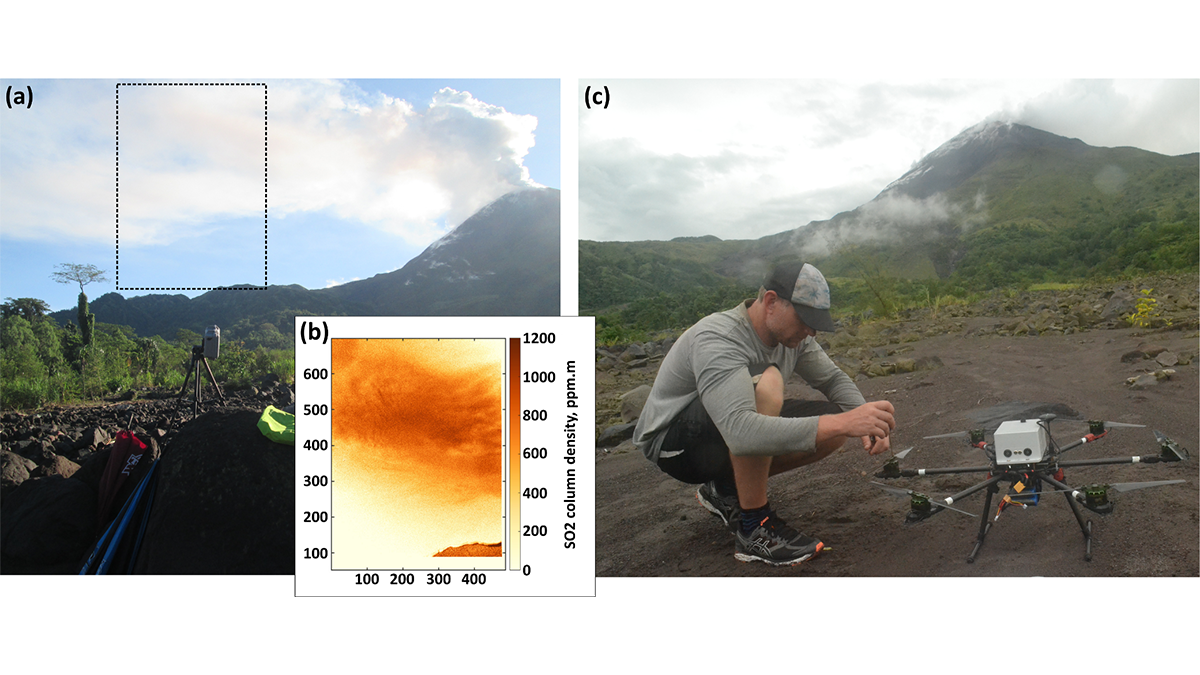
Send in the Drones: Safely Monitoring Volcanic Gas Emissions
New drone technology was combined with satellite and ground-based data to improve volcanic gas flux monitoring at the remote Bagana Volcano in Papua New Guinea.
Posted inEditors' Vox
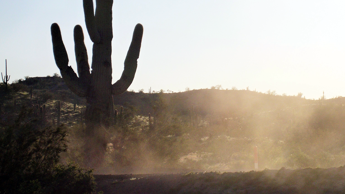
Danger in the Dust! The Hazards of Windblown Dust
Airborne dust not only causes disease, it also menaces transportation on land, sea, and air; disrupts renewable energy systems; transports pathogens and toxic substances; and poses many other hazards.

Posted inResearch Spotlights
Fine-Tuning Air Pollution Models
InMAP estimates air pollution within cities, but its predictions are flawed for specific chemicals. Now, scientists are addressing that shortcoming.

Posted inOpinions
We Need a Better Way to Share Earth Observations
A more accessible, open data-sharing infrastructure will engage a broader community of contributors, helping to develop satellite data products that benefit Earth science research and applications.
Posted inEditors' Highlights
Satellite View of African Easterly Waves and Hurricane Formation
Researchers present a new analysis of surface winds and enthalpy fluxes from satellite retrievals for African easterly waves that intensify into Atlantic hurricanes.

Posted inEditors' Vox
Using Cave Formations to Investigate Ancient Wildfires
From sediment cores to speleothems, environmental archives are helping us to understand the history of wildfires.