• About
  • Sections
  • Topics
    • Climate
    • Earth Science
    • Oceans
    • Space & Planets
    • Health & Ecosystems
    • Culture & Policy
    • Education & Careers
    • Opinions
  • Projects
    • ENGAGE
    • Editors’ Highlights
    • Editors’ Vox
    • Eos en Español
    • Eos 简体中文版
    • Print Archive
  • Science Policy Tracker
  • Blogs
    • Research & Developments
    • The Landslide Blog
  • Newsletter
  • Submit to Eos
  • AGU.org
  • Career Center
  • Join AGU
  • Give to AGU
  • About
  • Sections
  • Topics
    • Climate
    • Earth Science
    • Oceans
    • Space & Planets
    • Health & Ecosystems
    • Culture & Policy
    • Education & Careers
    • Opinions
  • Projects
    • ENGAGE
    • Editors’ Highlights
    • Editors’ Vox
    • Eos en Español
    • Eos 简体中文版
    • Print Archive
  • Science Policy Tracker
  • Blogs
    • Research & Developments
    • The Landslide Blog
  • Newsletter
  • Submit to Eos
Skip to content
  • AGU.org
  • Career Center
  • Join AGU
  • Give to AGU
Eos

Eos

Science News by AGU

Support Eos
Sign Up for Newsletter
  • About
  • Sections
  • Topics
    • Climate
    • Earth Science
    • Oceans
    • Space & Planets
    • Health & Ecosystems
    • Culture & Policy
    • Education & Careers
    • Opinions
  • Projects
    • ENGAGE
    • Editors’ Highlights
    • Editors’ Vox
    • Eos en Español
    • Eos 简体中文版
    • Print Archive
  • Science Policy Tracker
  • Blogs
    • Research & Developments
    • The Landslide Blog
  • Newsletter
  • Submit to Eos

bathymetry

Satellite images with lidar data.
Posted inEditors' Highlights

NASA Mission Creates a New Global Coastal Bathymetry Product

by Cathleen Jones 14 August 202514 August 2025

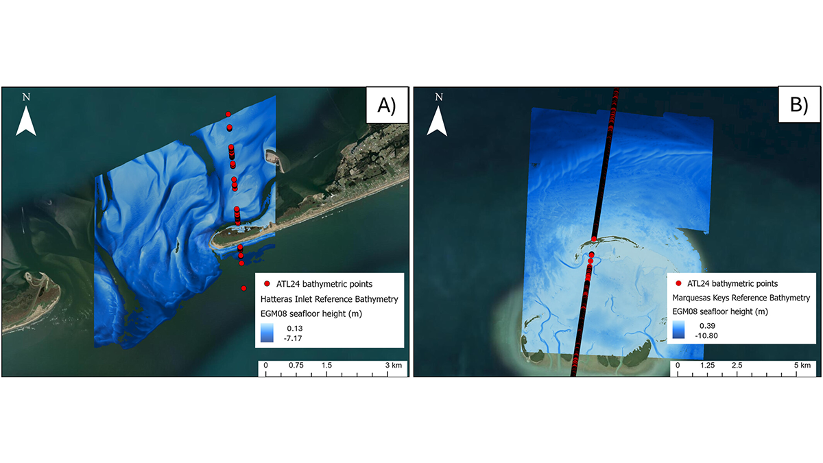
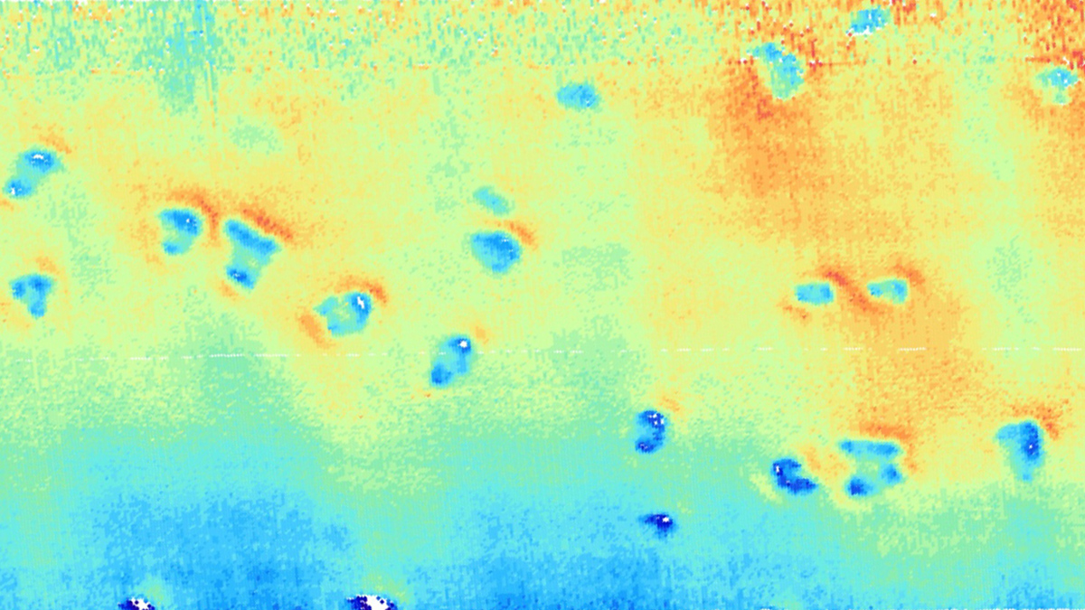
NASA’s Ice, Cloud, and land Elevation Satellite 2 (ICESat-2) mission recently released a new shallow water bathymetry product, which has already delivered data for 13.7 million kilometers of coastal waters.

A metal tool consisting of many cylinders is being suspended over the side of a ship above gray ocean waters. An iceberg is in the background.
Posted inResearch Spotlights

How Greenland’s Glacial Troughs Influence Ocean Circulation

Aaron Sidder, freelance science writer by Aaron Sidder 29 May 202529 May 2025

Glacial troughs in Antarctica promote mixing of warm and cold water, affecting global climate. A new study explores whether the same is true in troughs along Greenland’s coastline.

Silhouettes of people in lavender and periwinkle stand, some overlapping, on a aubergine-colored background. Overlying the image at the bottom is the text “R&D Research and Developments.”
Posted inResearch & Developments

NOAA Datasets Will Soon Disappear

Kimberly M. S. Cartier, News Writing and Production Intern for Eos.org by Kimberly M. S. Cartier 17 April 20258 May 2025

NOAA has quietly reported that they will soon decommission 14 datasets, products, and catalogs related to earthquakes and marine, coastal, and estuary science.

An image of Earth’s globe flattened out, with a detailed map of the ocean floor
Posted inNews

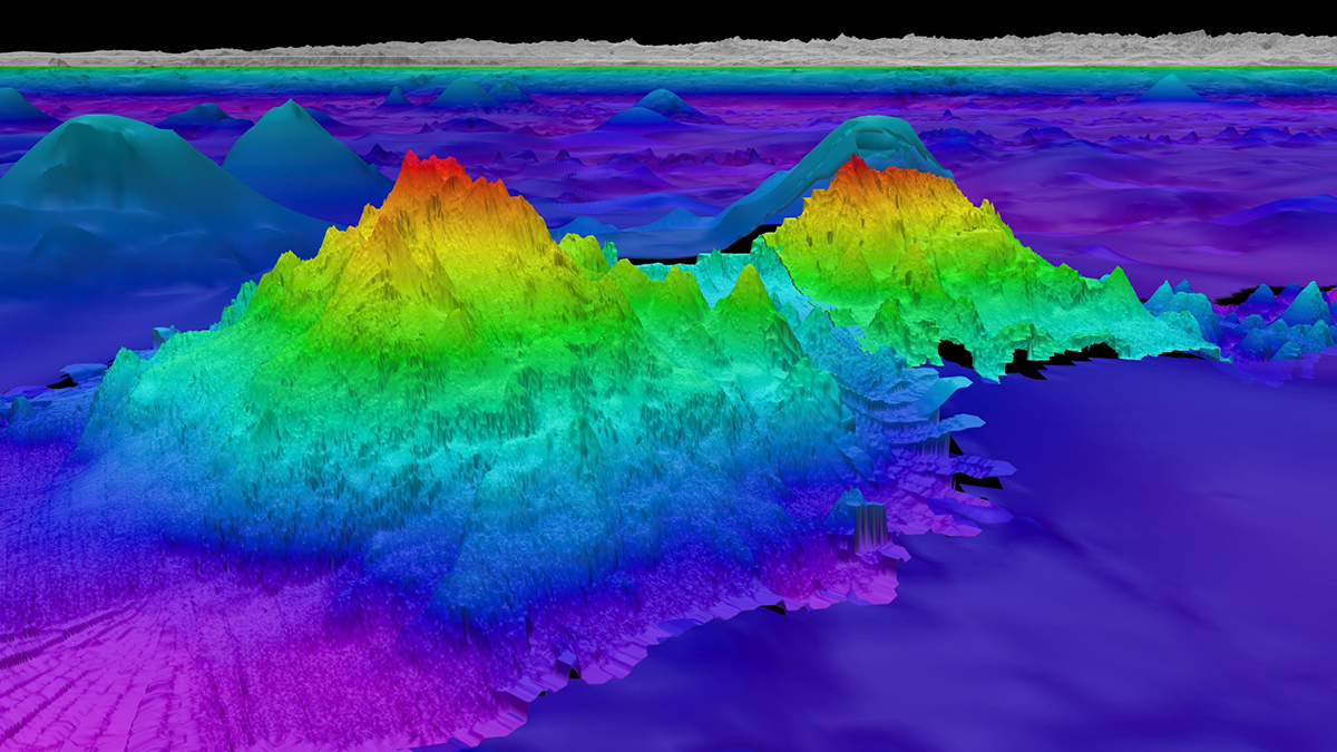
Satellite Measurements Make Major Seafloor Map Improvements

by Emily Dieckman 12 December 202410 January 2025

Though ship-based sounding has mapped some areas of the ocean floor in higher resolution, researchers have used SWOT data to create a detailed new map of the seafloor, including thousands of previously undetected small seamounts.

Three people wearing orange safety jackets stand on the deck of a ship in the Arctic.
Posted inNews

Swedish Icebreaker Is the First to Dig Into Greenland’s Remote Victoria Fjord

by Grace van Deelen 13 September 202413 September 2024

Data collected aboard Oden will shed light on the dynamics of the Greenland Ice Sheet.

Seamount discovered by Schmidt Ocean Institute’s R/V Falkor (too)
Posted inNews

New Seafloor Map Only 25% Done, with 6 Years to Go

Tim Hornyak, Science Writer by Tim Hornyak 2 April 20242 April 2024

Beneath the waves, the vast majority of the ocean is unknown. Seabed 2030 is using cutting-edge technologies to fill in the bathymetric blanks and fully map the seafloor.

Colorful multibeam bathymetry shows pits likely created by porpoises on the seafloor. Some pits have merged together to create bigger conjoined pits.
Posted inNews

Mysterious Seafloor Pits May Be Made on Porpoise

by Andrew Chapman 15 February 20246 June 2024

Some shallow seafloor depressions off the coast of Germany that look like those associated with methane might instead be the work of porpoises.

海底的彩色测深图像,其中海拔最高的点为红色,海拔最低的点为深蓝色。
Posted inResearch Spotlights

大洋中脊两侧的海底形态与岩浆供给有关

by Rebecca Owen 12 January 202412 January 2024

新的研究表明,大洋中脊形态变化的来源可能比科学家们想象的要深。

A view of a Washington, D.C., skyline from the Potomac River at night. The Lincoln Memorial (at left) and the Washington Monument (at right) are lit against a purple sky. Over the water of the Potomac appear the text “#AGU24 coverage from Eos.”

Features from AGU Publications

Research Spotlights

Machine Learning Simulates 1,000 Years of Climate

27 August 202527 August 2025
Editors' Highlights

Spacecraft Surveys Shed New Light on Auroral Kilometric Radiation

3 September 20253 September 2025
Editors' Vox

Experienced Researcher Book Publishing: Sharing Deep Expertise

3 September 202526 August 2025
Eos logo at left; AGU logo at right

About Eos
ENGAGE
Awards
Contact

Advertise
Submit
Career Center
Sitemap

© 2025 American Geophysical Union. All rights reserved Powered by Newspack