Dear Eos:
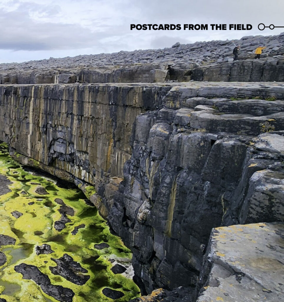
Welcome to the approximately 20-meter-high limestone cliffs on Inishmaan Island, Ireland. Here, researchers Hannah Spero and Michael Starek are seen walking along the top of the undercut cliff on Inishmaan. Spero, wearing a yellow jacket, leads the way to her field site, while Starek carries a handheld real-time kinematic (RTK) GPS unit used to map the surrounding landscape. Behind them are ridges of large limestone coastal boulders that extend up to approximately 30 meters above mean sea level.
These coastal boulder deposits are more than dramatic coastal features; they are natural records of extreme wave events. Spero’s doctoral research combines hydrodynamic modeling with detailed field mapping through drone surveys, high-precision GPS measurements, and field instrumentation measurements (of the rock coast platform and the boulders). These techniques allow researchers to investigate how storms move coastal boulders on Inishmaan and reshape rocky shorelines.
The boulders mapped over multiple storms and years help reveal the forces required to transport them, offering new insights into the magnitude of extreme waves affecting exposed coasts and improving our understanding of coastal hazards.
—Hannah Spero and Andrew Kennedy, Department of Civil and Environmental Engineering and Earth Sciences, University of Notre Dame, Notre Dame, Ind.; Jake Berryhill, Conrad Blucher Institute for Surveying and Science, Texas A&M University–Corpus Christi; and Michael Starek, College of Engineering and Computer Science and Conrad Blucher Institute for Surveying and Science, Texas A&M University–Corpus Christi