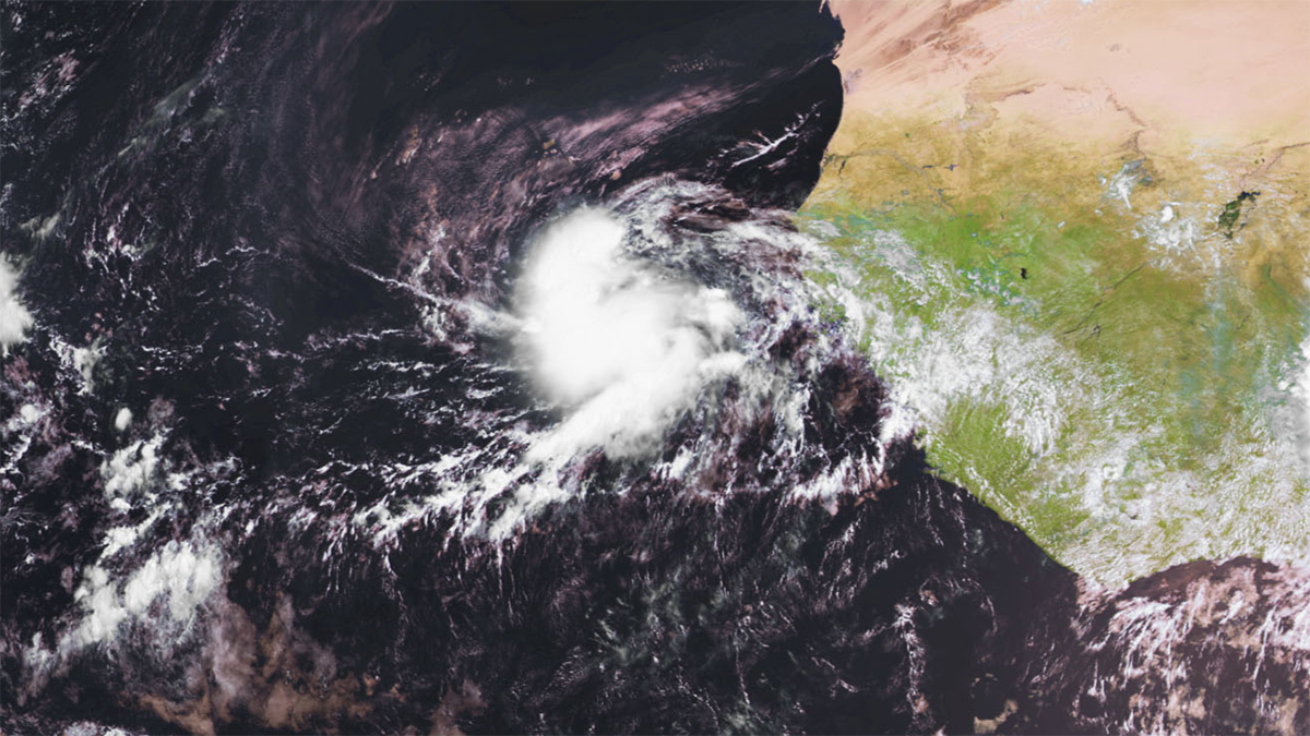
Intensified hurricane precursors may linger longer over the continent, worsening extreme flooding hazards.
Africa
Posted inNews
When a Prayer Is Also a Climate Signal
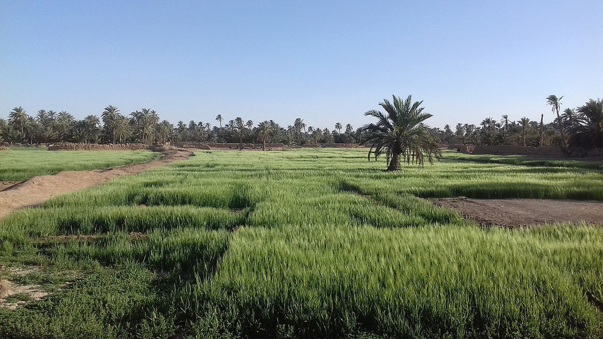
New research in North Africa is validating calls for communal rain prayers as a means of tracking droughts in the region.
Posted inThe Landslide Blog
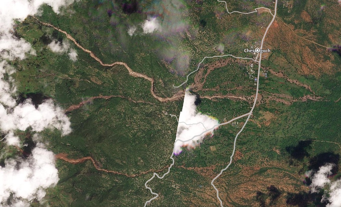
The 31 October 2025 fatal landslides in Chesongoch, Kenya
It is reported that 51 people have been killed by a series of debris flows in Kenya, triggered by heavy rainfall. On 31 October 2025, heavy rainfall triggered a series of large landslides in the vicinity of Chesongoch in Elgeyo Marakwet County, Kenya. To date, 26 people are known to have been killed and it […]
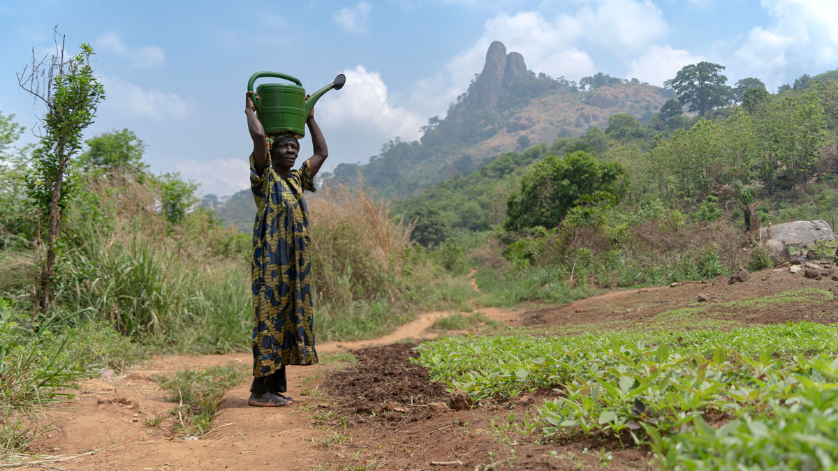
Posted inFeatures
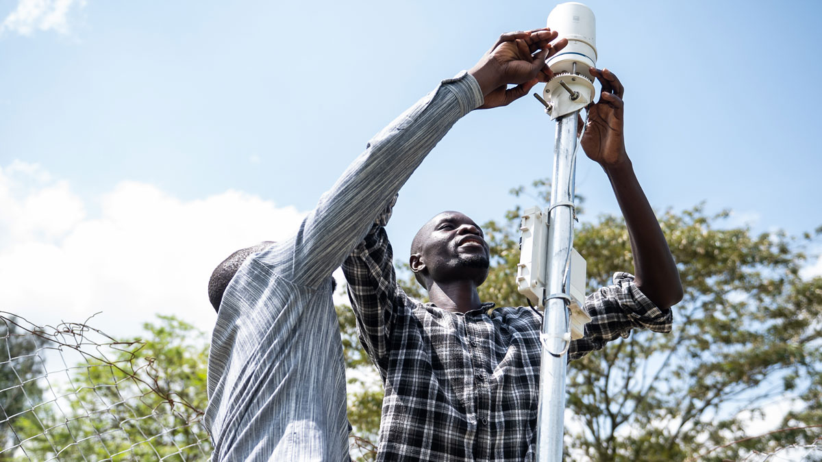
Building Better Weather Networks
A lack of weather data often leaves African communities vulnerable. Convergent efforts to improve observational networks throughout the continent are slowly filling the gaps.
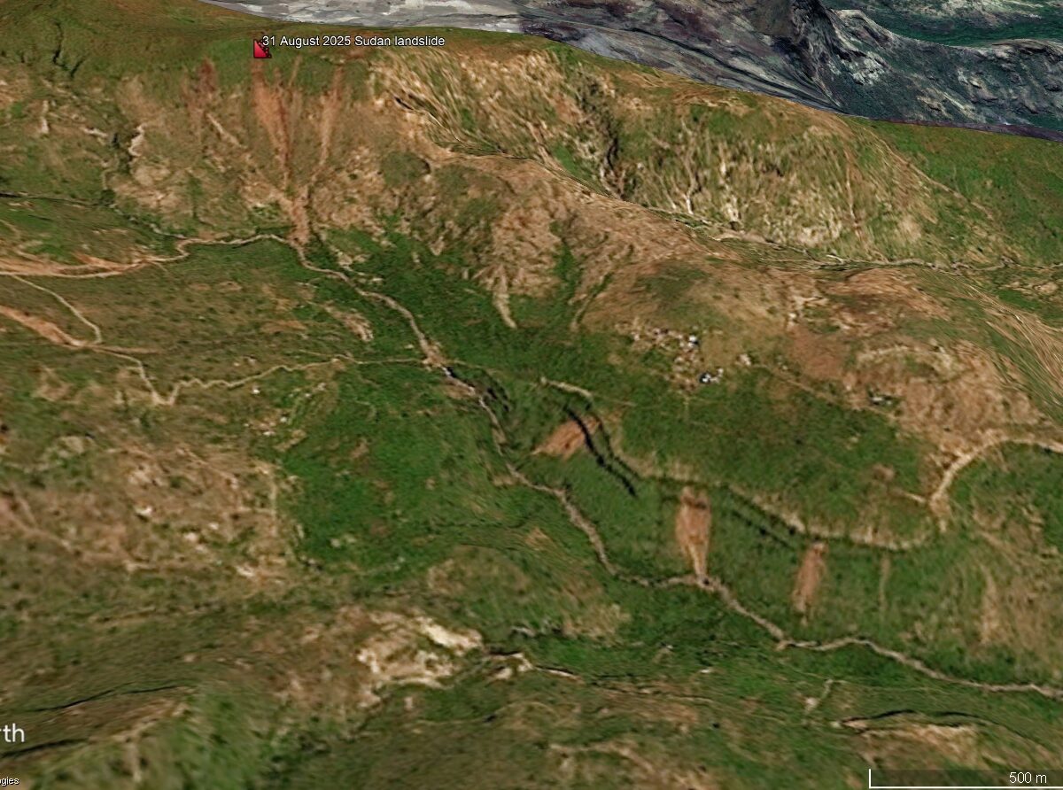
Posted inThe Landslide Blog
The strange case of the 31 August 2025 landslides in Sudan
Local reports suggested that over 1,500 people died in this event, and a high death toll was reported by some international agencies. However, examination of satellite imagery casts significant doubt on this interpretation. It has been widely reported that on 31 August 2025, a devastating landslide occurred at Tarasin (there are various spellings of this […]
Posted inResearch Spotlights
When Rain Falls in Africa, Grassland Carbon Uptake Rises
Satellite data suggest an explanation for the continent’s high year-to-year variability in carbon uptake.
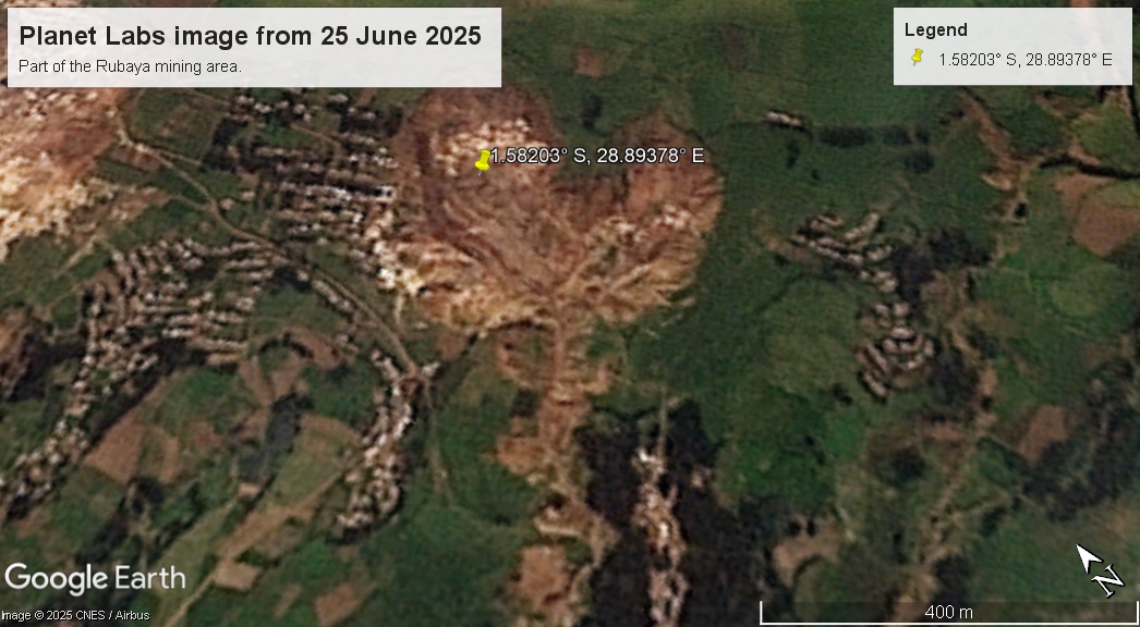
Posted inThe Landslide Blog
The 19 June 2025 landslide at the Rubaya mining site in the Democratic Republic of Congo
A major slope failure killed many people, possibly over 300, in an area of unlicenced mining of the mineral Coltan. On 19 June 2025, a very significant landslide occurred at the Rubaya mining site in Masisi territory, North Kivu, which is located in the eastern part of the Democratic Republic of the Congo (DRC). The […]

Posted inNews
For Climate and Livelihoods, Africa Bets Big on Solar Mini-Grids
Nigeria is pioneering the development of small, off-grid solar panel installations to bring reliable electricity to remote communities—setting a model for other African countries.
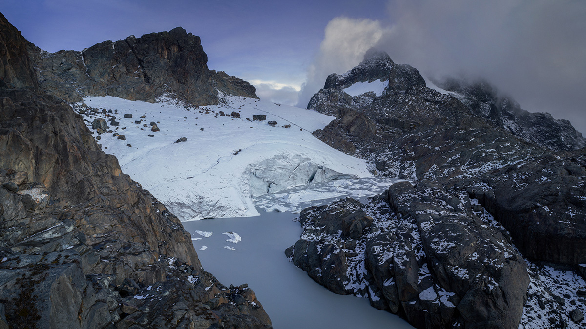
Posted inNews
A New 3D Map Shows Precipitous Decline of Ugandan Glaciers
A team of dozens spent weeks in the Rwenzori Mountains capturing drone photography, GPS coordinates, and ground-penetrating radar data to document glacial retreat.
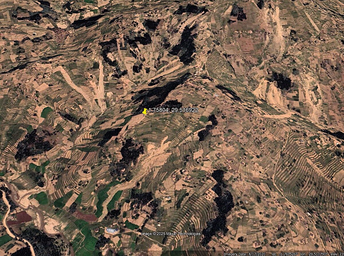
Posted inThe Landslide Blog
The role of agricultural terraces in enabling or preventing landslides
The Landslide Blog is written by Dave Petley, who is widely recognized as a world leader in the study and management of landslides. In many steeply-sloping areas of the world, agricultural terraces are used to enable farming. Terraces change the shape of the slope, but also alter the distribution of the soil and they greatly […]