
A new study of the Seattle Fault Zone is revealing records of smaller, hidden earthquakes that could inform future hazard research.
faults
Posted inEditors' Highlights
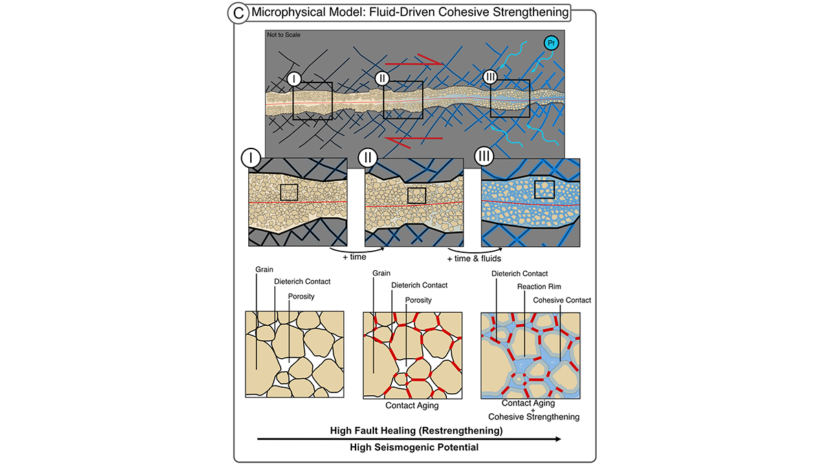
Fluid-Driven Reactions Restore Fault Strength Between Earthquakes
In fault gouge, fluids drive chemical healing by cementing grains, a mechanism for seismic slip in rocks frictionally expected to creep. This cohesion matters for fault stability.
Posted inEditors' Highlights
Multi-Scale Fault Roughness Encapsulated in a Friction Law
A new rate- and roughness-dependent friction law incorporates multi-scale fault processes to reproduce earthquake fracture energy scaling.
Posted inEditors' Highlights
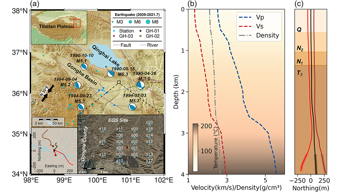
Pre-Existing Structure and Stress Shape Geothermal-Induced Seismicity
At China’s first Enhanced Geothermal System site, dense seismic observations, integrated with borehole data and stress modeling, reveal weak faults and scale-dependent control of stress and structure on induced seismicity.

Posted inNews
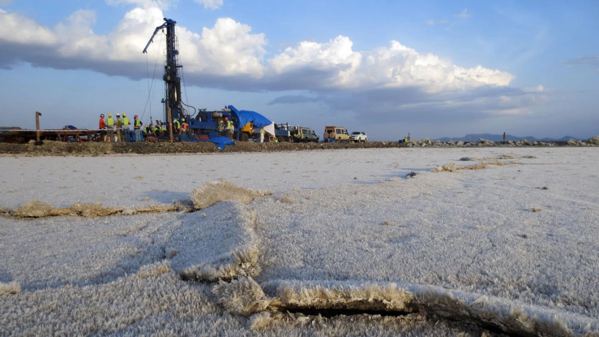
A Swarm of Earthquakes in South Africa’s Karoo Basin Poses Questions for Oil and Gas Development
A recent study cautions that the Karoo, a potential target for shale gas exploration, might not be as seismologically calm as it appears.

Posted inNews
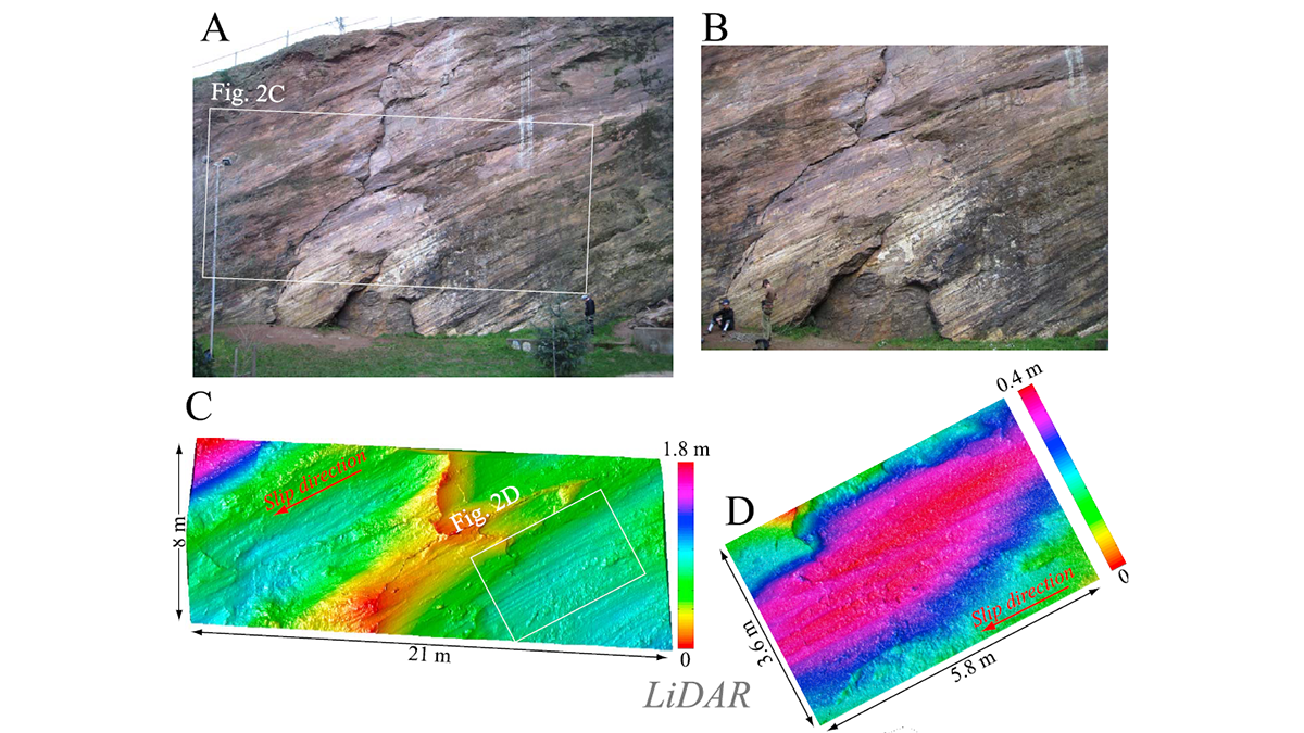
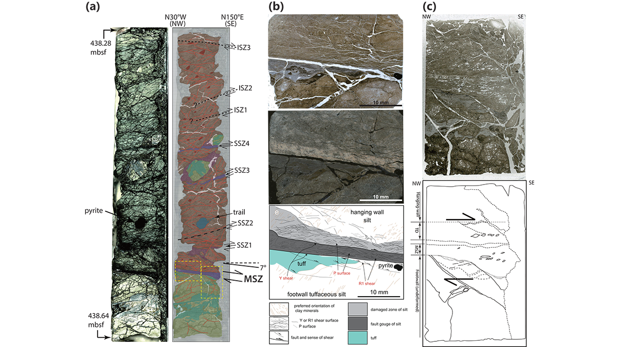
On the Seattle Fault, the Biggest Quakes Aren’t the Most Likely
Smaller quakes from secondary faults—which are not included in national seismic hazard modeling—occur more frequently than previously thought.
Posted inFeatures
Drilling Down to Open Up New Understanding of Earth’s Continents
Scientists have drilled into Earth’s crust for decades to understand natural hazards, past climates, energy resources, and more. They’ve only scratched the surface of what we can learn.
Posted inEditors' Highlights
Long-Term and Recent Activity of the Brenner Fault Finally Reconciled
A novel application of an established dating method, namely electron spin resonance, provides constraints on the timing and relative movements of the Brenner Fault walls during the Quaternary.
Posted inEditors' Highlights
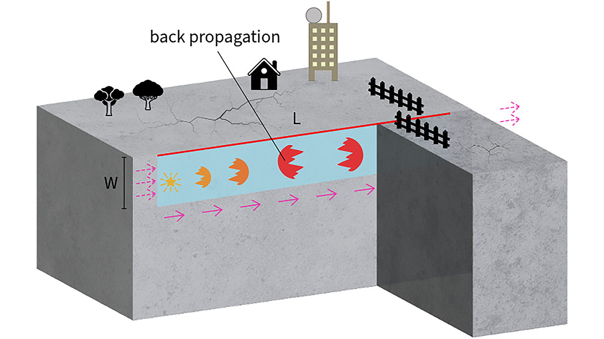
Boomerang Earthquakes Don’t Need Complex Faults
New simulations show earthquakes can reverse direction within seconds on simple, uniform faults, suggesting back-propagating subevents are more common than previously thought.
Posted inEditors' Highlights
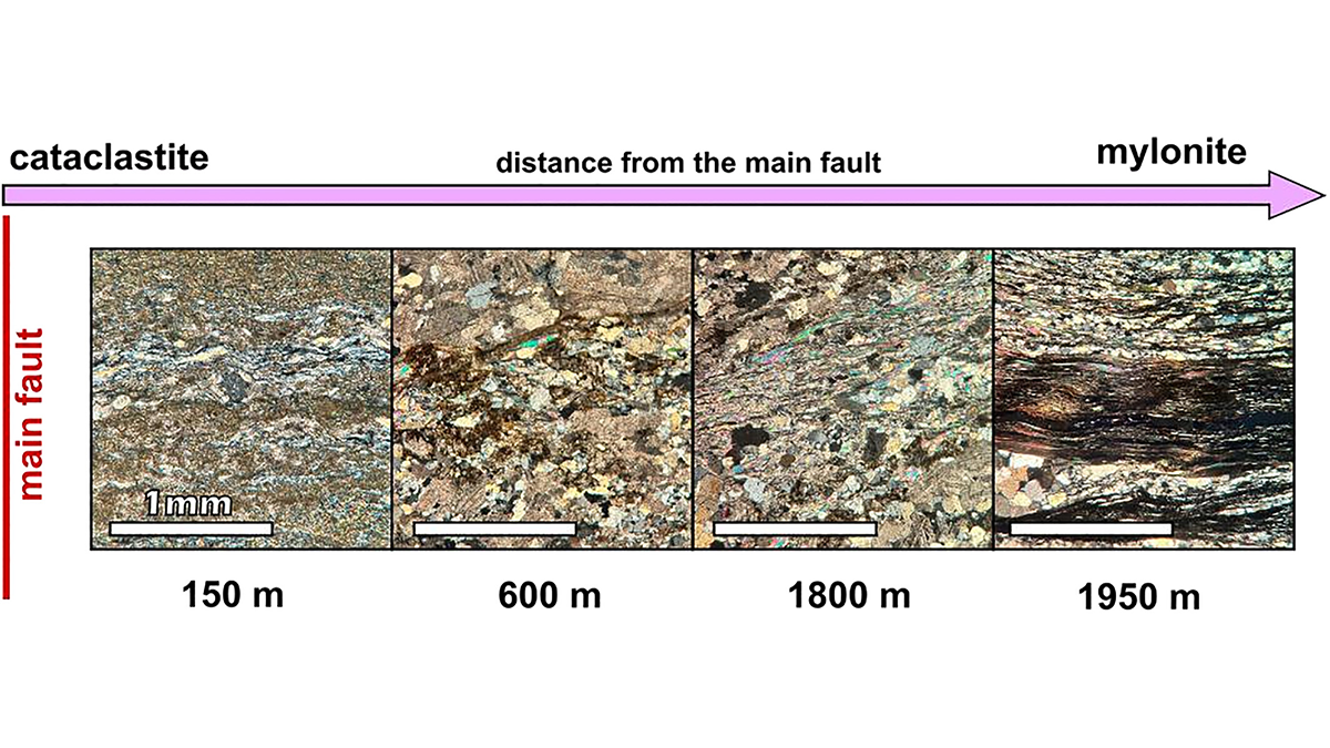
Frictional Properties of the Nankai Accretionary Prism
A database of frictional properties from IODP drilling materials explores the range of slip spectrum and the generation of slow to fast earthquakes in the Nankai subduction zone in light of mineralogy.