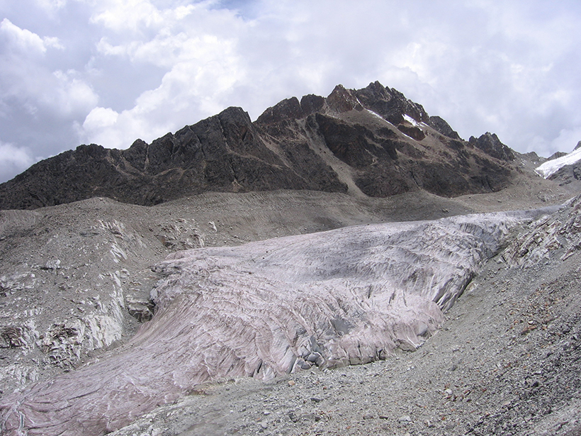
Investigaciones recientes revelan que las emisiones de carbono negro producidas por los incendios en el Amazonas causan que los glaciares en los Andes absorban más radiación solar y se derritan más.
Hazards & Disasters
Posted inResearch Spotlights
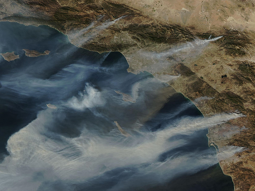
Santa Ana Winds and Wildfires Influence Air Pollution
Inhaling particulate matter is hard on human health. New research shows that Southern California’s Santa Ana winds can clear or exacerbate fine-particulate pollution depending on wildfire conditions.
Posted inNews
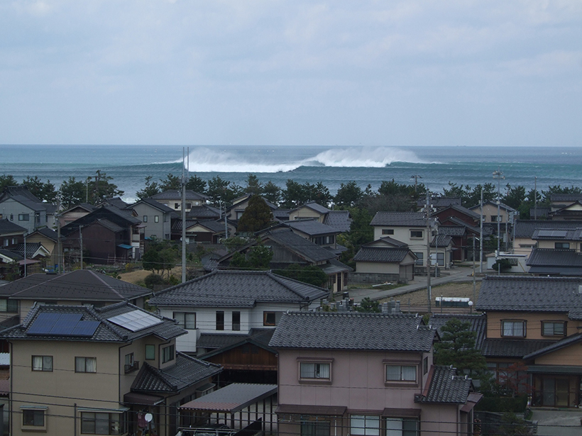
Submarine Canyons Breed Megawaves in Japan
The canyons act like a prism, focusing waves into mammoths of destruction.

Posted inNews
Tiny Fireballs May One Day Reveal Unseen Asteroids
The tiny fireball that flew over Japan in 2017 came from an asteroid that could threaten Earth in 10 million years or so. Scientists are trying to use these little meteors to hunt larger objects.

Posted inAGU News
Edmond Dewan, Citizen Science, and the Mystery of Ball Lightning
In the early 1960s, a physicist enlisted the help of the public to study a rare atmospheric phenomenon.
Posted inNews
Fluid Pressure Changes Grease Cascadia’s Slow Aseismic Earthquakes
Twenty-five years’ worth of data allows scientists to suss out subtle signals deep in subduction zones.
Posted inNews
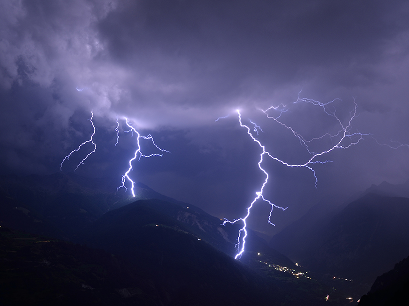
New Study Hints at Bespoke Future of Lightning Forecasting
Researchers used machine learning to develop a model that can predict lightning strikes to within 30 minutes of their occurrence and within 30 kilometers of a weather station by using just four simple atmospheric measurements.
Posted inNews
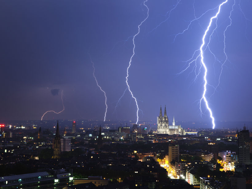
Northern Europe Set for Increases in Lightning
As the climate warms across Europe, a rise in severe thunderstorms could bring a dramatic increase in related hazards, including lightning and hailstones.

Posted inResearch Spotlights
Wildfire Smoke Boosts Photosynthetic Efficiency
Wildfires can destroy large tracts of vegetation. But their smoke plumes may help crops and other plants use sunlight more efficiently.

Posted inNews
Cortes de Energía, PG&E y el Futuro Vacilante de la Ciencia
Mientras los legisladores debaten sobre los apagones como una medida paliativa para resolver el problema de los incendios forestales en Estados Unidos, la ciencia pende de un hilo.