• About
  • Special Reports
  • Topics
    • Climate
    • Earth Science
    • Oceans
    • Space & Planets
    • Health & Ecosystems
    • Culture & Policy
    • Education & Careers
    • Opinions
  • Projects
    • Postcards From the Field
    • ENGAGE
    • Editors’ Highlights
    • Editors’ Vox
    • Eos en Español
    • Eos 简体中文版
    • Print Archive: 2015–2025
  • Policy Tracker
  • Blogs
    • Research & Developments
    • The Landslide Blog
  • Newsletter
  • Submit to Eos
  • AGU.org
  • Career Center
  • Join AGU
  • Give to AGU
  • About
  • Special Reports
  • Topics
    • Climate
    • Earth Science
    • Oceans
    • Space & Planets
    • Health & Ecosystems
    • Culture & Policy
    • Education & Careers
    • Opinions
  • Projects
    • Postcards From the Field
    • ENGAGE
    • Editors’ Highlights
    • Editors’ Vox
    • Eos en Español
    • Eos 简体中文版
    • Print Archive: 2015–2025
  • Policy Tracker
  • Blogs
    • Research & Developments
    • The Landslide Blog
  • Newsletter
  • Submit to Eos
Skip to content
  • AGU.org
  • Career Center
  • Join AGU
  • Give to AGU
Eos

Eos

Science News by AGU

Support Eos
Sign Up for Newsletter
  • About
  • Special Reports
  • Topics
    • Climate
    • Earth Science
    • Oceans
    • Space & Planets
    • Health & Ecosystems
    • Culture & Policy
    • Education & Careers
    • Opinions
  • Projects
    • Postcards From the Field
    • ENGAGE
    • Editors’ Highlights
    • Editors’ Vox
    • Eos en Español
    • Eos 简体中文版
    • Print Archive: 2015–2025
  • Policy Tracker
  • Blogs
    • Research & Developments
    • The Landslide Blog
  • Newsletter
  • Submit to Eos

Louisiana

Diagram showing how the authors used GPS, anchors, and fiber-optic strain meters to measure coastal subsidence.
Posted inEditors' Highlights

Tracking Subsidence on Deltas With Fiber-Optics

by John Shaw 20 September 202219 September 2023

Fiberoptic strain meters capable of measuring micron-scale subsidence reveal a Holocene sediment package on the Mississippi Delta that is mostly stable.

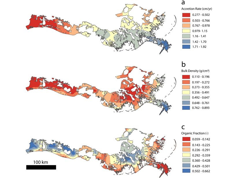
3 maps showing accumulation of sediment and organic material in coastal Louisiana
Posted inEditors' Highlights

Coastal Sediment Deficit Appears Smaller Than Previously Thought

by Ton Hoitink 4 September 202024 February 2022

With a deficit of sediment needed to compensate for relative sea level rise, a new study demonstrates that organic material cannot be ignored in evaluating mass and volume accumulation rates.

Green, grassy wetlands along Louisiana’s coast
Posted inNews

Diverting the Mississippi River May Not Save Louisiana’s Coast

Kate Wheeling, freelance science writer by Kate Wheeling 18 September 201910 February 2022

New research finds that man-made river diversions have previously led to land losses.

Researchers examine ties between increased wealth and decreased water pollution in Louisiana.
Posted inResearch Spotlights

When Income Goes Up, Does Pollution Go Down?

Alexandra Branscombe by A. Branscombe 16 February 20171 February 2022

Scientists look at a possible connection between increased wealth and decreased water pollution in Louisiana.
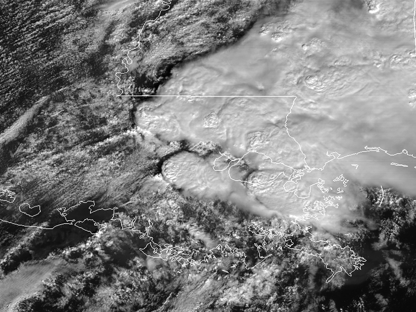
Storm image
Posted inNews

NOAA Video Shows Satellite Views of Louisiana Tornadoes

JoAnna Wendel, freelance science writer and illustrator by JoAnna Wendel 13 February 201730 August 2022

Real-time updates of storms will help forecasters track and predict where the most damage could occur.

Posts pagination

Newer posts 1 2
Over a dark blue-green square appear the words Special Report: The State of the Science 1 Year On.

Features from AGU Publications

Research Spotlights

Students Enable Widespread Water Monitoring in India

20 July 202620 July 2026
Editors' Highlights

Redesigning Farmland Through Community Collaboration in California

22 July 202621 July 2026
Editors' Vox

Why Healthy Soils Matter More Than Ever

22 July 202622 July 2026
Eos logo at left; AGU logo at right

About Eos
ENGAGE
Awards
Contact

Advertise
Submit
Career Center
Sitemap

© 2026 American Geophysical Union. All rights reserved Powered by Newspack