• About
  • Sections
  • Topics
    • Climate
    • Earth Science
    • Oceans
    • Space & Planets
    • Health & Ecosystems
    • Culture & Policy
    • Education & Careers
    • Opinions
  • Projects
    • ENGAGE
    • Editors’ Highlights
    • Editors’ Vox
    • Eos en Español
    • Eos 简体中文版
    • Print Archive
  • Science Policy Tracker
  • Blogs
    • Research & Developments
    • The Landslide Blog
  • Newsletter
  • Submit to Eos
  • AGU.org
  • Career Center
  • Join AGU
  • Give to AGU
  • About
  • Sections
  • Topics
    • Climate
    • Earth Science
    • Oceans
    • Space & Planets
    • Health & Ecosystems
    • Culture & Policy
    • Education & Careers
    • Opinions
  • Projects
    • ENGAGE
    • Editors’ Highlights
    • Editors’ Vox
    • Eos en Español
    • Eos 简体中文版
    • Print Archive
  • Science Policy Tracker
  • Blogs
    • Research & Developments
    • The Landslide Blog
  • Newsletter
  • Submit to Eos
Skip to content
  • AGU.org
  • Career Center
  • Join AGU
  • Give to AGU
Eos

Eos

Science News by AGU

Support Eos
Sign Up for Newsletter
  • About
  • Sections
  • Topics
    • Climate
    • Earth Science
    • Oceans
    • Space & Planets
    • Health & Ecosystems
    • Culture & Policy
    • Education & Careers
    • Opinions
  • Projects
    • ENGAGE
    • Editors’ Highlights
    • Editors’ Vox
    • Eos en Español
    • Eos 简体中文版
    • Print Archive
  • Science Policy Tracker
  • Blogs
    • Research & Developments
    • The Landslide Blog
  • Newsletter
  • Submit to Eos

Mariana Islands

People in orange work suits crouch next to small clear cylinders with brown material inside.
Posted inNews

In the Deepest Ocean Reaches, a Potent Pollutant Comes to Rest

by Sean Cummings 9 December 20222 March 2023

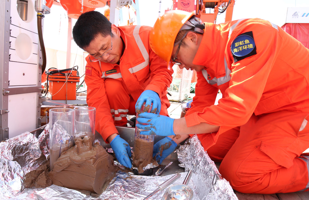
Surprising amounts of mercury settling into deep-sea trenches may provide a fuller picture of the metal’s path through the environment, but pulling it to the surface is no easy feat.

A global map of subduction zones. The Mariana Trench is near the center with a zoomed-in image of bathymetry.
Posted inResearch Spotlights

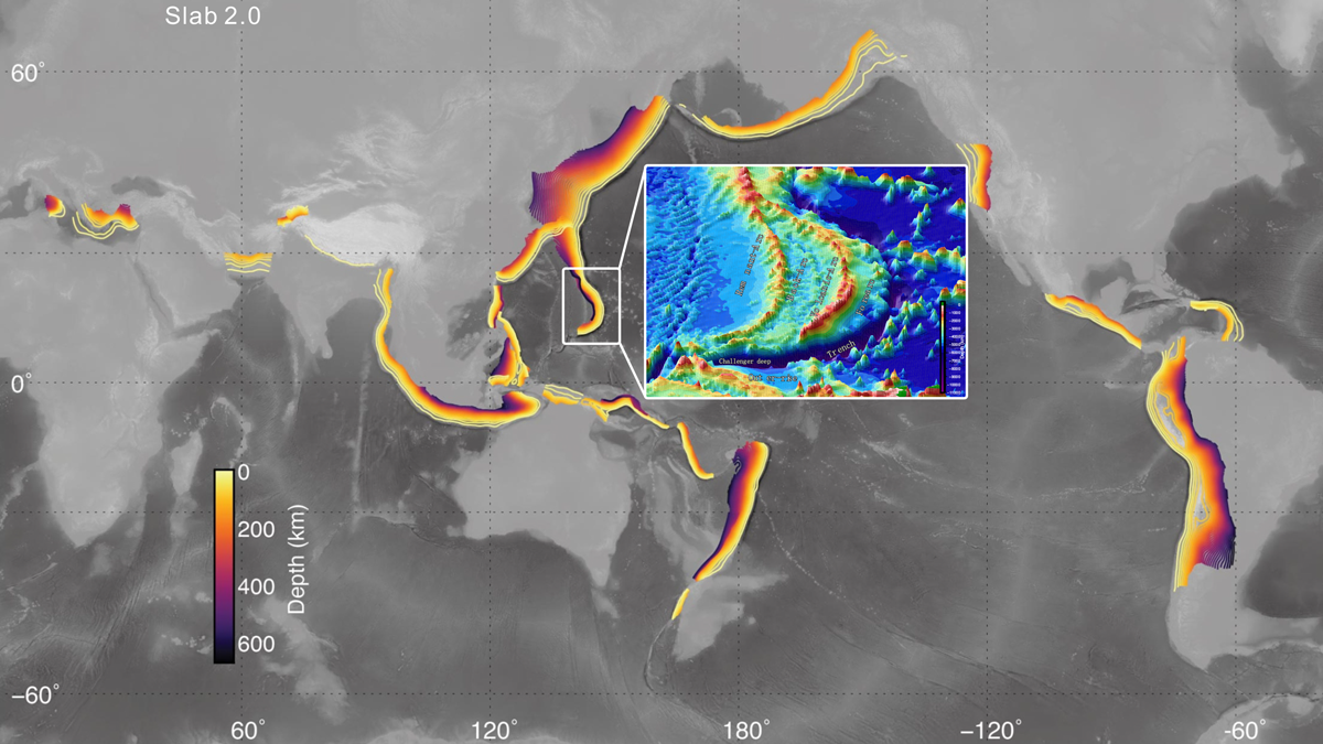
Deep Earthquakes Suggest Well-Hydrated Mariana Subduction Zone

by Morgan Rehnberg 10 August 20222 March 2023

Earthquakes as deep as 50 kilometers below the seafloor were detected by 12 ocean bottom seismometers placed around the Challenger Deep.

Andrew Pietruczka ayuda a guiar al piloto de un vehículo operado remotamente que explora sitios submarinos que podrían contener restos de aeronaves de la Segunda Guerra Mundial. Andrew y el piloto miran hacía un arreglo de monitores con información e imágenes enviadas por el vehículo.
Posted inNews

Vehículos robóticos exploran campos de batalla de la Segunda Guerra Mundial en el océano

by James Dacey 5 July 202222 July 2022

El Proyecto Recover usa vehículos autónomos submarinos para identificar, acceder, y captar imágenes de sitios difíciles de alcanzar con restos de la Segunda Guerra Mundial, cerca de las Islas Marianas del Norte.

Andrew Pietruszka helps guide the pilot of a remotely operated vehicle exploring underwater sites that may contain aircraft wreckage from WWII.
Posted inNews

Robotic Vehicles Explore World War II Era Ocean Battlefields

by James Dacey 7 April 20225 July 2022

Project Recover used autonomous underwater vehicles to identify, access, and image hard-to-reach World War II wreckage sites near the Northern Mariana Islands.

Three people listen while a guy in a lei talks animatedly on the deck of a ship
Posted inNews

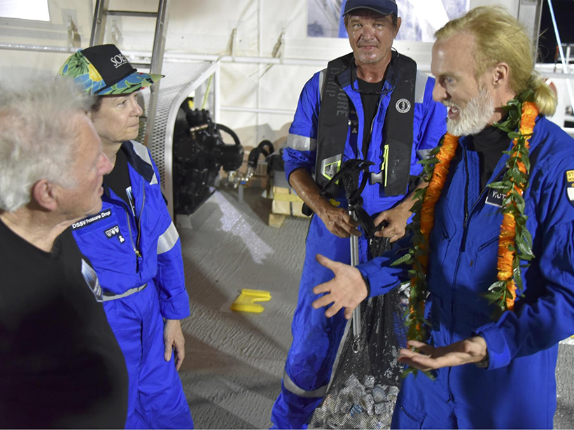
Limiting Factor Was a Science Opportunity for a Deep-Sea Geologist

Ilima Loomis, Science Writer by Ilima Loomis 3 July 20192 March 2023

For Mariana Trench expert Patricia Fryer, an extreme explorer’s record-setting dive was a chance to retrieve some of the deepest samples ever collected.

Researchers study what happens to ocean eddies when they encounter the Izu-Ogasawara Ridge in the Pacific Ocean.
Posted inResearch Spotlights

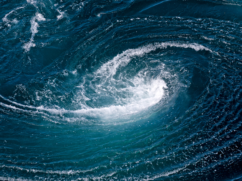
What Happens When Ocean Eddies Hit a Wall?

by E. Underwood 24 April 20172 March 2023

A new study tracks two ocean eddies passing over the Pacific Ocean's Izu-Ogasawara Ridge.

A view of a bridge, with the New Orleans skyline visible in the distance between the bridge and the water. A purple tint, a teal curved line representing a river, and the text “#AGU25 coverage from Eos” overlie the photo.

Features from AGU Publications

Research Spotlights

Understanding Flux, from the Wettest Ecosystems to the Driest

24 November 202524 November 2025
Editors' Highlights

Heatwaves Increase Home Births in India

2 December 20252 December 2025
Editors' Vox

Echoes From the Past: How Land Reclamation Slowly Modifies Coastal Environments

19 November 202519 November 2025
Eos logo at left; AGU logo at right

About Eos
ENGAGE
Awards
Contact

Advertise
Submit
Career Center
Sitemap

© 2025 American Geophysical Union. All rights reserved Powered by Newspack