• About
  • Sections
  • Topics
    • Climate
    • Earth Science
    • Oceans
    • Space & Planets
    • Health & Ecosystems
    • Culture & Policy
    • Education & Careers
    • Opinions
  • Projects
    • ENGAGE
    • Editors’ Highlights
    • Editors’ Vox
    • Eos en Español
    • Eos 简体中文版
    • Print Archive
  • Blogs
    • Research & Developments
    • The Landslide Blog
  • Newsletter
  • Submit to Eos
  • AGU.org
  • Career Center
  • Join AGU
  • Give to AGU
  • About
  • Sections
  • Topics
    • Climate
    • Earth Science
    • Oceans
    • Space & Planets
    • Health & Ecosystems
    • Culture & Policy
    • Education & Careers
    • Opinions
  • Projects
    • ENGAGE
    • Editors’ Highlights
    • Editors’ Vox
    • Eos en Español
    • Eos 简体中文版
    • Print Archive
  • Blogs
    • Research & Developments
    • The Landslide Blog
  • Newsletter
  • Submit to Eos
Skip to content
  • AGU.org
  • Career Center
  • Join AGU
  • Give to AGU
Eos

Eos

Science News by AGU

Support Eos
Sign Up for Newsletter
  • About
  • Sections
  • Topics
    • Climate
    • Earth Science
    • Oceans
    • Space & Planets
    • Health & Ecosystems
    • Culture & Policy
    • Education & Careers
    • Opinions
  • Projects
    • ENGAGE
    • Editors’ Highlights
    • Editors’ Vox
    • Eos en Español
    • Eos 简体中文版
    • Print Archive
  • Blogs
    • Research & Developments
    • The Landslide Blog
  • Newsletter
  • Submit to Eos

James Dacey

Claude Monet’s painting Houses of Parliament, Sunlight in the Fog (1904).
Posted inNews

¿Estaban los maestros impresionistas retratando una realidad contaminada?

by James Dacey 3 February 202322 March 2023

Análisis de imágenes sugiere que el estilo de los artistas evolucionó en sincronía con el incremento de la contaminación en el aire durante la Revolución Industrial.

Claude Monet’s painting Houses of Parliament, Sunlight in the Fog (1904).
Posted inNews

Were Impressionist Masters Painting a Polluted Reality?

by James Dacey 12 December 202222 March 2023

Image analysis suggests that artists’ styles evolved in sync with increasing air pollution during the Industrial Revolution.

Ciudadanos mayores en una zona rural toman parte de un mapeo. El mapa está al centro de la foto, y cinco ciudadanos miran cómo uno de ellos dibuja el mapa.
Posted inNews

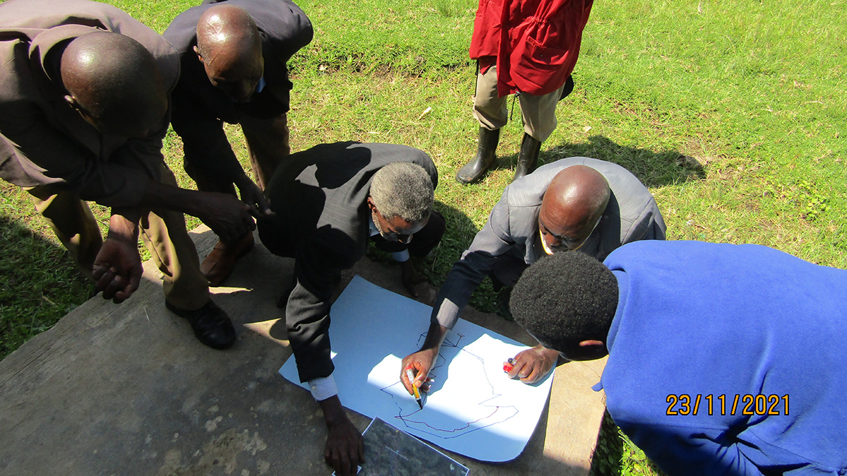
Proyecto de ciencia comunitaria ayuda a rastrear los riesgos geológicos en Uganda

by James Dacey 14 September 202222 March 2023

Un proyecto comunitario en las tierras altas de Kigezi está ayudando a identificar puntos calientes de deslizamientos de tierra e inundaciones y cómo los peligros están evolucionando.

Map of the European Union and the United Kingdom, with a line drawn through the English Channel
Posted inNews

U.K.-Based Geoscientists Trapped in European Funding Impasse

by James Dacey 1 September 202221 March 2023

Political disputes threaten the United Kingdom’s status in Horizon Europe, the world’s largest transnational funding program.

Senior citizens in a rural setting take part in a mapping workshop in Uganda’s Kigezi Highlands.
Posted inNews

Community Science Project Helps Track Geohazard Risks in Uganda

by James Dacey 22 July 202227 March 2023

A community project in the Kigezi Highlands is helping to identify landslide and flooding hot spots and how the hazards are evolving.

Andrew Pietruczka ayuda a guiar al piloto de un vehículo operado remotamente que explora sitios submarinos que podrían contener restos de aeronaves de la Segunda Guerra Mundial. Andrew y el piloto miran hacía un arreglo de monitores con información e imágenes enviadas por el vehículo.
Posted inNews

Vehículos robóticos exploran campos de batalla de la Segunda Guerra Mundial en el océano

by James Dacey 5 July 202222 July 2022

El Proyecto Recover usa vehículos autónomos submarinos para identificar, acceder, y captar imágenes de sitios difíciles de alcanzar con restos de la Segunda Guerra Mundial, cerca de las Islas Marianas del Norte.

Andrew Pietruszka helps guide the pilot of a remotely operated vehicle exploring underwater sites that may contain aircraft wreckage from WWII.
Posted inNews

Robotic Vehicles Explore World War II Era Ocean Battlefields

by James Dacey 7 April 20225 July 2022

Project Recover used autonomous underwater vehicles to identify, access, and image hard-to-reach World War II wreckage sites near the Northern Mariana Islands.

Satellite image of sea ice in the southwestern Labrador Sea.
Posted inNews

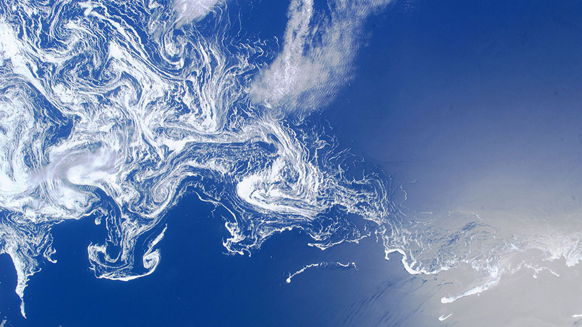
Oxygen Levels Measured in a Lung of the Deep Ocean

by James Dacey 23 February 202223 February 2022

The Labrador Sea “inhales” oxygen and supplies it to deep-sea life across the world. But its breath could be threatened by climate change.

A migrant farmworker is interviewed by social scientist Anna Erwin at the Majes-Siguas irrigation project in Peru.
Posted inNews

Peruvian Farmers Threatened by Water Stress

by James Dacey 14 December 202114 December 2021

Two analyses present the Arequipa region as a microcosm of water supply issues facing small-scale agriculture communities.

A reenactor works on a Viking farm at a living history museum in Sweden.
Posted inNews

Food Security Lessons from the Vikings

by James Dacey 29 June 202115 March 2023

Scandinavian societies of the first millennium adapted their farming practices to volcano-driven climate changes.

Posts pagination

1 2 Older posts
A view of a Washington, D.C., skyline from the Potomac River at night. The Lincoln Memorial (at left) and the Washington Monument (at right) are lit against a purple sky. Over the water of the Potomac appear the text “#AGU24 coverage from Eos.”

Features from AGU Publications

Research Spotlights

Deforestation Is Reducing Rainfall in the Amazon

19 May 202519 May 2025
Editors' Highlights

Bringing Storms into Focus

19 May 202515 May 2025
Editors' Vox

Decoding Crop Evapotranspiration

6 May 20256 May 2025
Eos logo at left; AGU logo at right

About Eos
ENGAGE
Awards
Contact

Advertise
Submit
Career Center
Sitemap

© 2025 American Geophysical Union. All rights reserved Powered by Newspack