
Satellite images are revealing the scale of the destruction in Sri Lanka caused by landslides triggered by Cyclone Ditwah at the end of November 2025.

At the end of November 2025, a “weak” tropical cyclone, subsequently named Cyclone Ditwah, formed just offshore from Sri Lanka. Over the following day the storm tracked around the south and east coasts of Sri Lanka before moving northwards to dissipate on 3 December off the east coast of India. This was not a strong tropical cyclone, but it brought catastrophic rainfall to Sri Lanka, triggering extremely extensive landslides and floods.
The stats on the impact of Cyclone Ditwah on Sri Lanka are horrifying. The UNDP is reporting that 1,200 landslides were triggered and that about 20% of the island was affected by flooding. As of the time of writing, there are 639 known fatalities, with a further 203 people reported to be missing. The highest loss of life occurred in Kandy District, in the hilly centre of of the country. Many of the fatalities occurred in channelised debris flows.
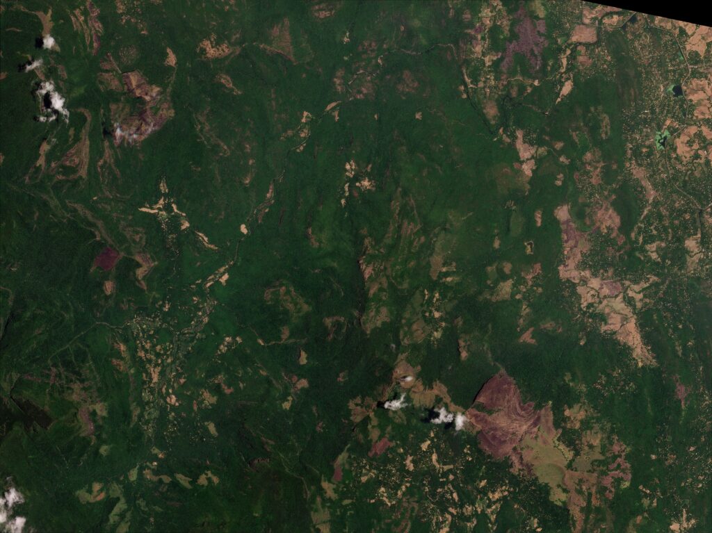
The impact of the storm is complex – to study the landslides properly would require a PhD study or similar – but a quick inspection of the Planet Labs imagery of the centre of Sri Lanka illustrates the scale of the devastation. This image, collected on 7 September 2025, shows an area in the vicinity of [7.43518, 80.87898]:-
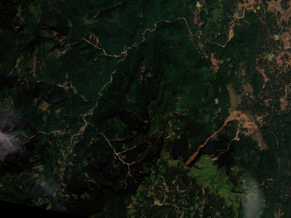
This image, collected on 30 November 2025, shows the same area after the passage of Cyclone Ditwah:-
And here is a slider to compare the two images:


And here is the post event image pasted onto the Google Earth DEM:-
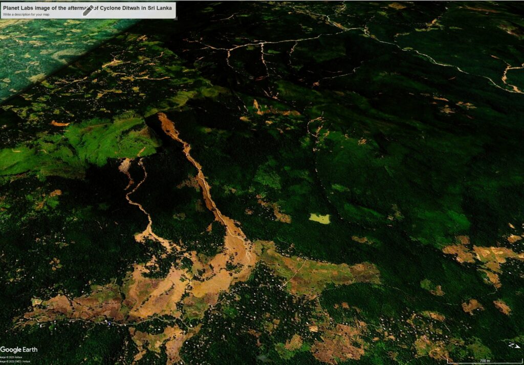
In the foreground is a large landslide that has started at the ridgeline. It has entrained heavily along the track, and has impacted a large area of fields at the toe of the slope. Note the channelised debris flow close by. In the background are multiple shallow landslides, many of which have reached the drainage line to generate channelised debris flows. These have been devastating downstream.
The impact of these landslides will be long lasting. I have made the point before, but it is worth reiterating, that tropical cyclones are often associated with strong winds and storm surge, but a huge proportion of the damage is actually caused by rainfall. Cyclone Ditwah was, in meteorological terms, “weak”. The images above show that this is a completely inappropriate way to characterise such storms.
Acknowledgement
Images from Planet Labs 2025 – see: https://www.planet.com/. Thanks as always for their agreement that I can use their images on this blog.