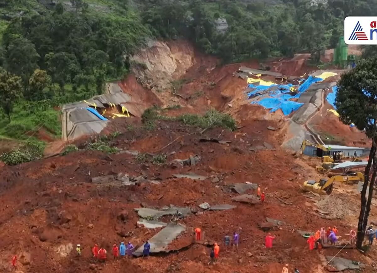
A major landslide triggered by monsoon rainfall killed eight people this week. The failure occurred at the site of works for a new road tunnel – there is speculation that poor handling of excavated materials may have been the cause. Imagery suggests that the event might have been slightly more complex, though. On 7 July […]
Hazards & Disasters
Posted inThe Landslide Blog
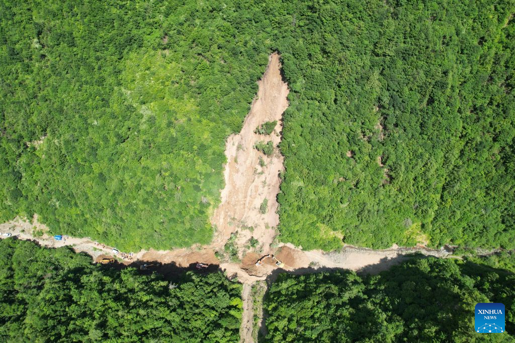
The 7 July 2026 landslide at Renzang Village in Longnan City, Gansu Province, China
A major landslide in China yesterday killed 21 forestry workers. Satellite imagery suggests that the slope showed signs of disturbance before the failure. On 7 July 2026, a major landslide struck Renzang Village, which is located in the administrative area of Nanhe Township in Longnan City, Gansu Province, China. Xinhua reports that 33 people were […]

Posted inThe Landslide Blog
Fatal landslides at the Rohingya refugee camps in Bangladesh
Early in the morning of 6 July 2026, three fatal landslides killed eight people in the refugee camps housing the displaced Rohingya people in Bangladesh. There have long been fears of the potential for fatal landslides in the refugee camps Cox’s Bazar in Bangladesh that house the Rohingya people who were ethnically cleansed from Myanmar. […]
Posted inThe Landslide Blog
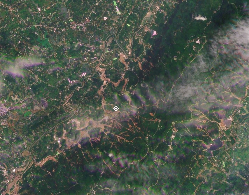
The 24 May 2026 landslide disaster in Yongchuan, Chongqing, China
Planet Labs imagery reveals a cluster of shallow landslides and channelised debris flows triggered by extreme rainfall. Official figures indicate that 20 people were killed. Early in the morning of 24 May 2026, extremely heavy rainfall triggered a significant landslide disaster in Yongchuan District in Chongqing, China. As is so often the case in mainland […]
Posted inResearch & Developments
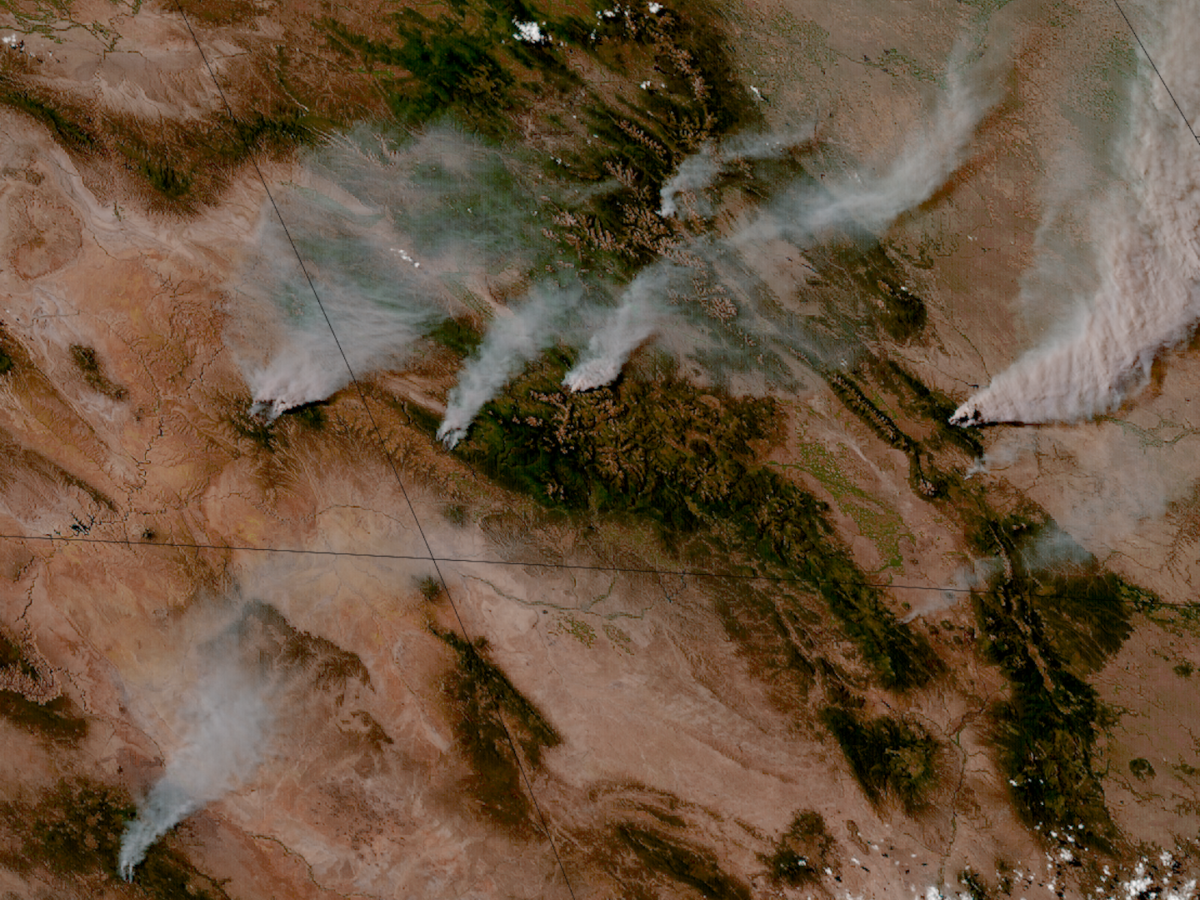
Amid USFS Upheaval, Utah and Colorado Are Burning
The fires come in the wake of historically low amounts of snow in the American West, as well as organizational changes at the U.S. Forest Service.
Posted inThe Landslide Blog
Book review: Engineering Geomorphology – A Practitioners Guide by Gareth Hearn
A review of a fascinating volume that examines the principles and practice of the often neglected but incredibly powerful field of engineering geomorphology. Engineering geomorphology provides a vital input into the site investigation, the selection of alignments for infrastructure projects, land use zonation and geohazard risk assessment. In essence, it involves the use of trained […]
Posted inThe Landslide Blog
A valley-blocking landslide in Lower Siang district, Arunachal Pradesh, India
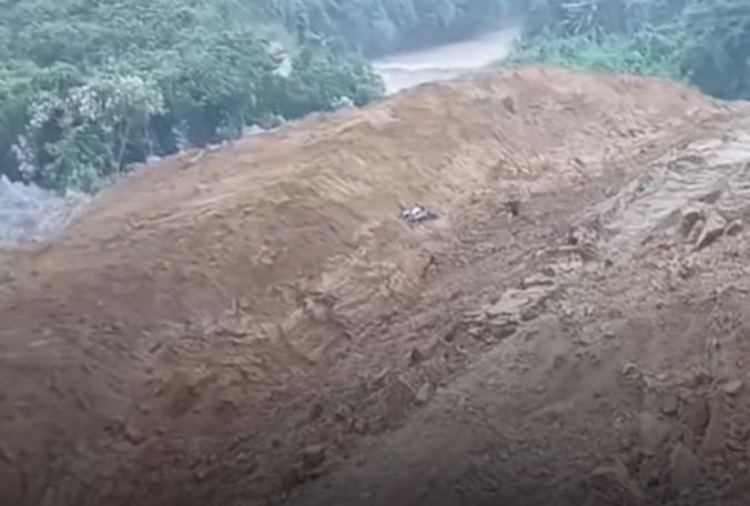
A large landslide in India, triggered by monsoon rainfall, was captured on a remarkable video. On Monday 29 June 2026, a valley-blocking landsldie occurred on the Siji River in Lower Siang district, Arunachal Pradesh, India. I have yet to track down the precise location of this event, but it is in the region of [27.7146, […]
Posted inThe Landslide Blog
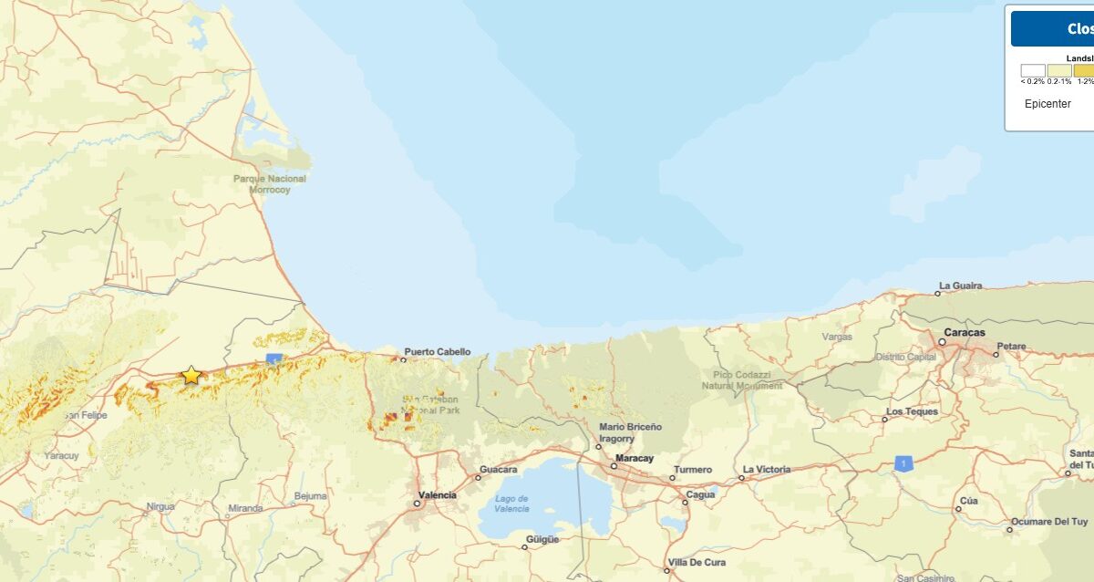
Landslides and liquefaction from the 24 June 2026 “double tap” earthquakes in Venezuela
The Landslide Blog is written by Dave Petley, who is widely recognized as a world leader in the study and management of landslides. The news this morning of the “double tap” M=7.2 and M=7.5 earthquakes in Venezuela late on 24 June 2026 is grim. These are large earthquakes in their own right occurring at a […]
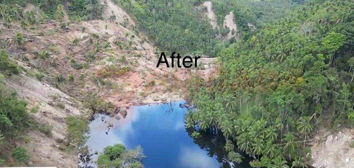
Posted inThe Landslide Blog
The valley blocking landslide between barangays San Isidro and Nuing in Mindanao
A significant “quake lake” has developed in a remote area of the Philippines, threatening four communities located downstream. In the aftermath of the 8 June 2026 M=7.8 earthquake in the Philippines, a major challenge has developed in the Jose Abad Santos region of Mindanao. Here, a landslide has blocked the valley between barangays (villages) San […]