
The system, under development in Acireale, Italy, could be used to monitor earthquakes in real time and help rescue workers focus efforts where they’re needed most.
Hazards & Disasters

Posted inNews
Florida Mayors Spotlight Climate Change as U.S. Election Issue
In the run-up to presidential primaries today in Florida, a bipartisan group of mayors there raised the issue by convincing moderators to pose questions about it in national debates and in other ways.
Posted inResearch Spotlights
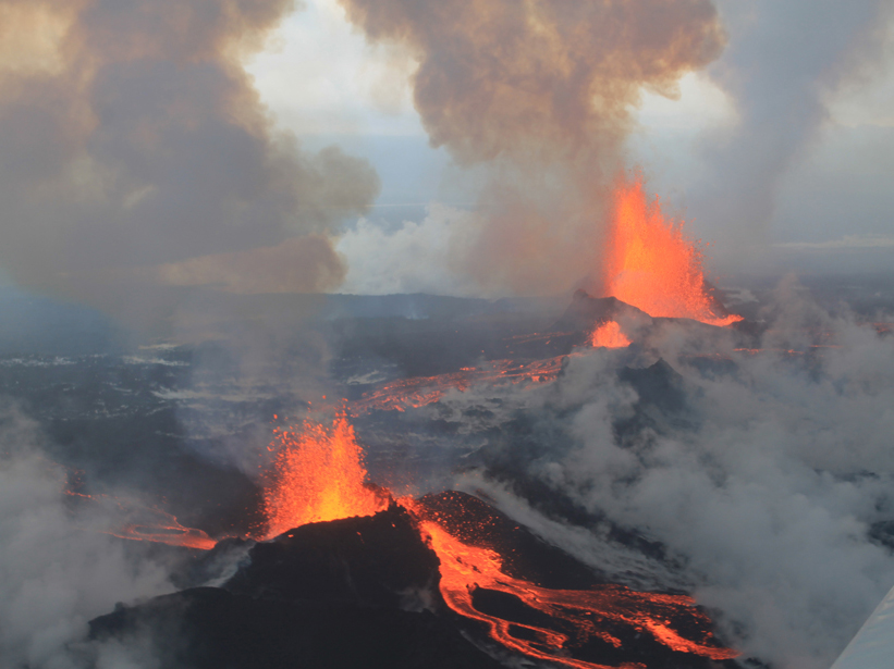
Icelandic Eruption Caused Record-Breaking Sulfur Dioxide Release
Satellite and ground-based data reveal sulfur dioxide flux, trace element release, and preeruption magma movement.
Posted inScience Updates
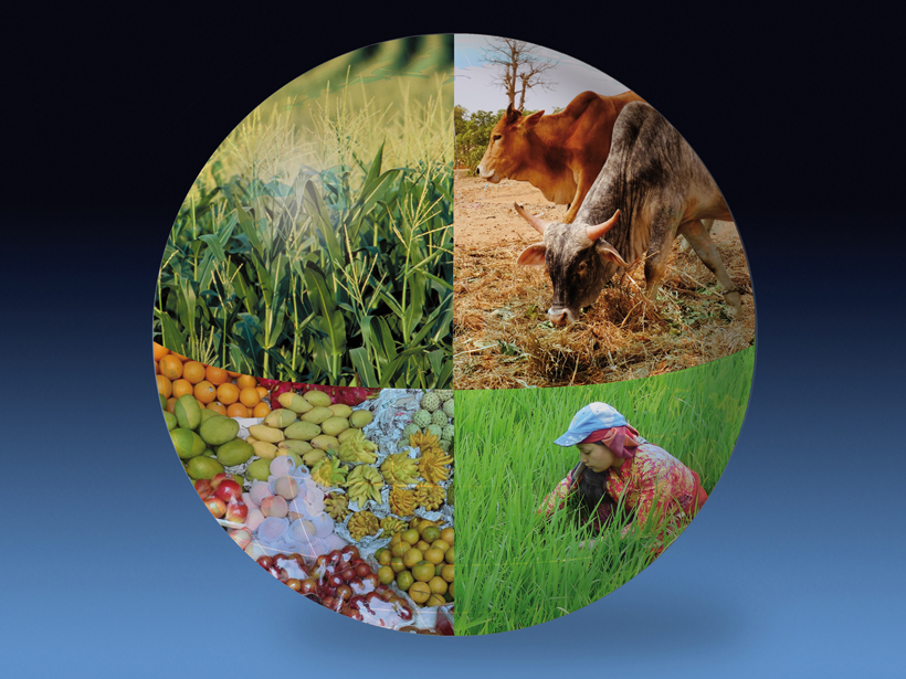
Assessing Impacts of Climate Change on Food Security Worldwide
AgMIP Workshop on Coordinated Global and Regional Integrated Assessments of Climate Change and Food Security; Aspen, Colorado, 13–18 September 2015
Posted inNews
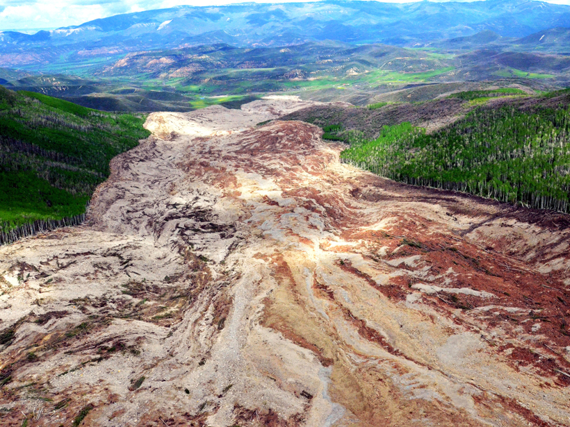
Forensic Analysis of Landslide Reveals Rocky Secrets
Scientists used drones, seismic data, and eyewitness accounts to figure out what unleashed an unthinkably large landslide on a spring day in Colorado.
Posted inResearch Spotlights
Are Earthquakes Predictable?
Researchers have been searching for precursory warning signals for decades with little success.

Posted inScience Updates
Predicting the Risks and Occurrence of Extratropical Cyclones
5th Workshop on European Storms: Impacts and Predictability; Bern, Switzerland, 31 August to 2 September 2015

Posted inNews
Dirty Water: Unintended Consequence of Climate Resiliency
Scientists testing the quality of floodwater in a Florida city find potentially harmful bacteria.
Posted inResearch Spotlights
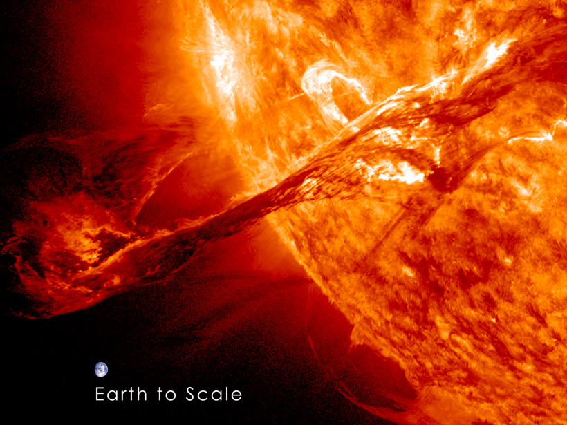
New Solar Wind Model Could Improve Space Weather Forecasts
Real-world data drive a simulation that successfully predicts Sun structures and interplanetary solar wind dynamics.
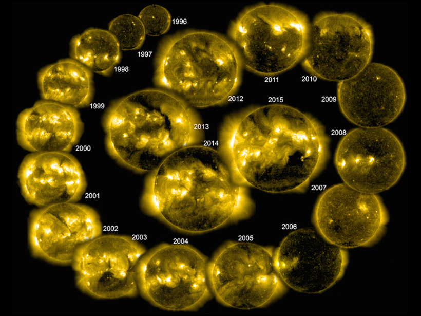
Posted inResearch Spotlights
Sun's Magnetic Fields Best at Forecasting Solar Cycle Peaks
Models based on the Sun's polar magnetic fields performed best in simulating the solar cycle and predicting solar behavior.