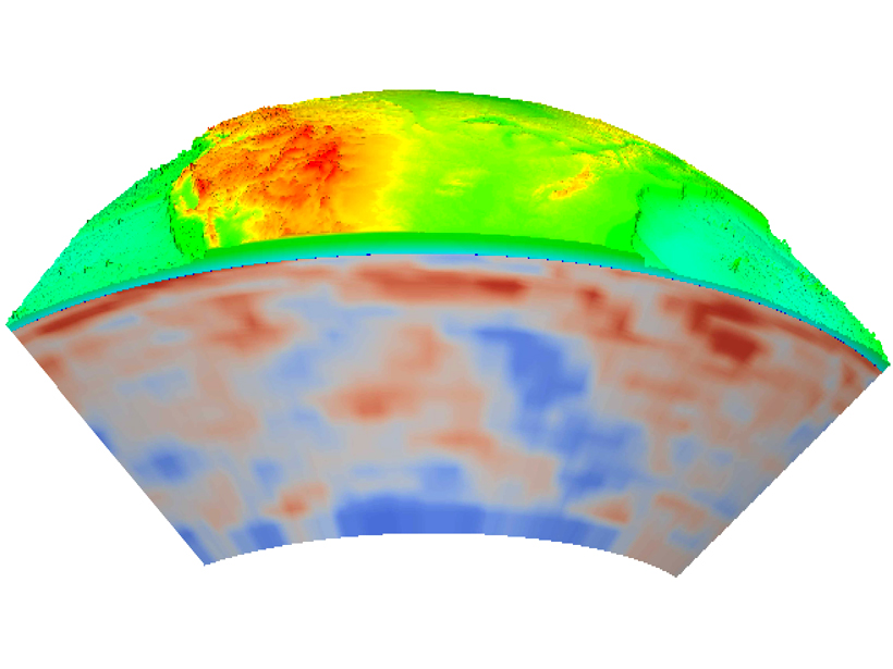
Source: Reviews of Geophysics
What makes Earth’s surface move up and down? The answers could help locate petroleum reservoirs, predict long-term sea level changes, and enable a host of other scientific and economic applications. To tackle this question, Liu reviewed leading studies of North America’s topographic evolution to identify what drives large-scale movement along the continent’s surface.
After analyzing almost 150 publications on surface topography evolution since the Mesozoic Era (252–66 million years ago), the author found that a west‐to‐east wave has rippled the surface of North America over the past 100 million years. This wave is driven by the sinking motion of the Farallon tectonic plate.
During the Jurassic period (201–145 million years ago), the ancient continent of Pangaea broke apart, and subsequently, the Farallon plate began to plunge under the west coast of the North American plate. Relative to the westward moving North American continent, fragments of the Farallon plate migrated eastward underneath, forming widespread sedimentary basins, influencing the courses of rivers, and lifting up mountain ranges as far east as the Appalachians.
This journey occurred because tectonic plates ride on top of the mantle layer, which is stirred by convection currents—the cold oceanic plate sinks, forcing nearby mantle material to rise. Current models of Earth’s mantle integrate information from multiple disciplines to help scientists better determine how and where the mantle carries tectonic plates. Although a consistent big picture of mantle evolution is emerging, different models produce predictions that sometimes differ significantly from each other, depending on modeling tools and input parameters.
Seismic images provide information on mantle temperature and composition, but precision varies from place to place. Reconstructing the history of surface plate motion is a big challenge as well. New tomographic imaging techniques, which represent mantle structures as a series of “slices,” may help resolve some of these issues—and, ultimately, assimilating data with predictive models offers a promising option for future research.
Incorporating multiscale and multiphysics observations into computer models, routinely done in atmospheric and oceanic studies, is still in the early stages for solid Earth geophysics. Closing the existing gap between surface process modeling and mantle dynamic modeling could yield valuable insights into landscape evolution, surface erosion, and the interplay between deep mantle processes and climate variability. (Reviews of Geophysics, doi:10.1002/2015RG000489, 2015)
—Nancy McGuire, Freelance Writer
Citation: McGuire, N. (2015), North America does the wave (slowly), Eos, 96, doi:10.1029/2015EO038663. Published on 3 November 2015.
Text © 2015. The authors. CC BY-NC 3.0
Except where otherwise noted, images are subject to copyright. Any reuse without express permission from the copyright owner is prohibited.

