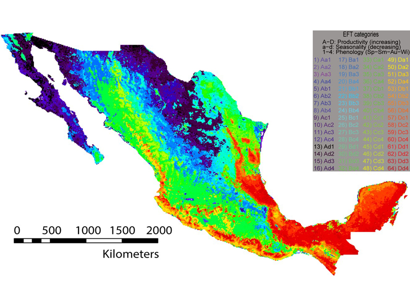
Mexico’s megadiverse biota challenge observation network design for efficient sampling, but novel methods can provide guidance and tests of representativeness.
Ankur R. Desai
Department of Atmospheric and Oceanic Sciences, University of Wisconsin–Madison
Posted inEditors' Highlights
The Acid Tongue of Climate Change Strikes Our Streams
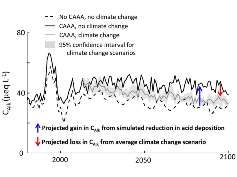
Clear air policies have led to dramatic reductions in acid rain and improved ecosystem health, but it now appears that climate change could counteract those gains.
Posted inEditors' Highlights
What Lies and Waits Beneath Lake Ice?
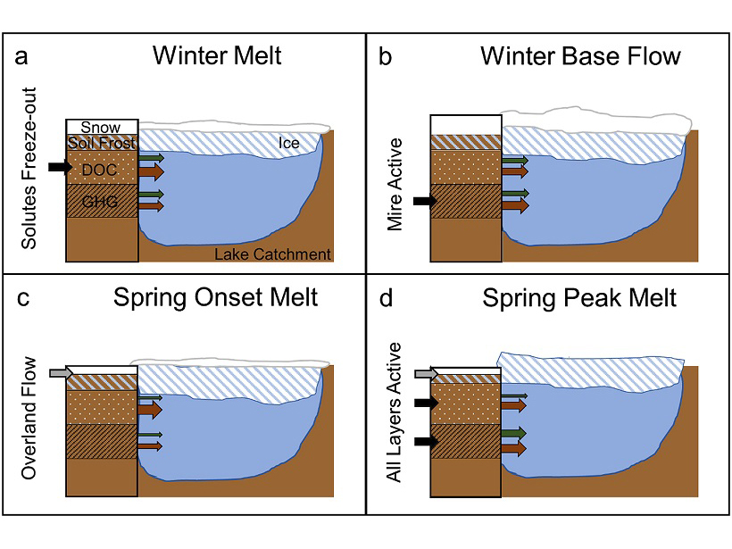
Rarely made detailed measurements of carbon dioxide and methane under lake ice reveal a story more complex than simple models of gas buildup, with surprising findings for climate change impacts.
Posted inEditors' Vox
It’s So UnFAIR!
A recent paper in JGR: Biogeosciences demonstrates that sharing data has positive benefits not just for the scientific community but also for the one doing the sharing.

Posted inEditors' Highlights
Getting Littoral with Lake Carbon Efflux
Next generation forced diffusion chambers reveal dynamic environment for lake carbon exchange with distance from shoreline.

Posted inEditors' Highlights
Drones Hunt for Impacts of Oil Exploration on Wetland Emissions
Seismic lines, constructed for petroleum resource exploration, disturb Canadian peatlands, but how can we detect their impact on greenhouse gas budgets?

Posted inEditors' Highlights
Ocean Wind Satellites Observe an Amazonian Drought
Satellites designed to observe ocean winds can also be used to map both forest structure and water content, allowing researchers to disentangle factors of carbon loss due to drought in the Amazon.

Posted inEditors' Highlights
What Will Redwood Trees Do Without Foggy Days?
Coastal California fog—a key source of water for the iconic redwood tree—has declined by a third. Can a trace gas, carbonyl sulfide, be used to assess the effect on plant productivity?
Posted inEditors' Vox
Thawing Permafrost: Monitored, Quantified, Predicted
With thawing permafrost projected to release significant amounts of carbon in response to climate change, one of the editors of JGR: Biogeosciences reflects on the slew of recent papers in this field.

Posted inEditors' Vox
Your Science Is Your (Openly Shared) Data
Your data are no less important than your words.