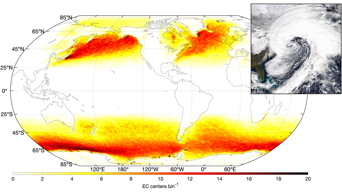
A new way of tracking ocean waves with satellite measurements was developed and applied to extratropical cyclones, revealing the effects of storm characteristics on extreme sea states.
Editors’ Highlights
Posted inEditors' Highlights
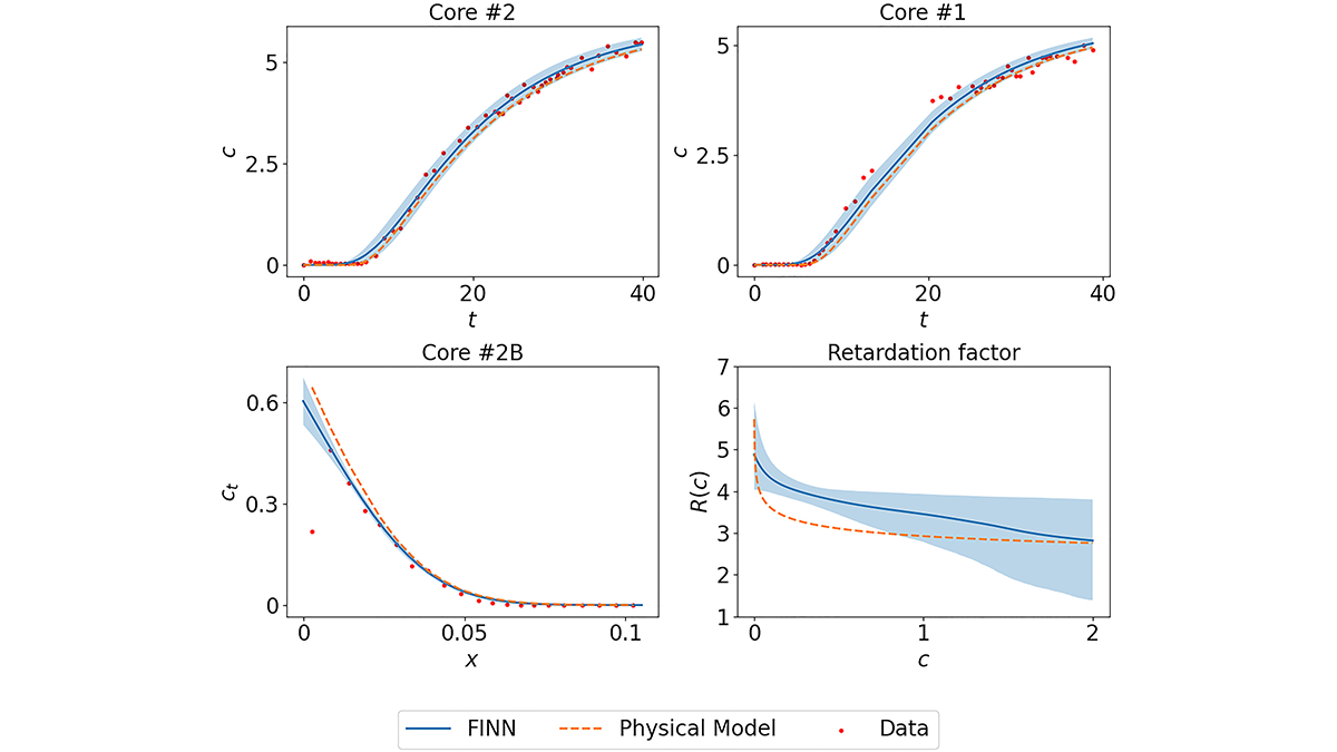
Playing Bricks with Neural Networks to Learn Sorption Processes
Designated neural network modules are combined to mimic numerically-discretized diffusion-sorption equations, which allows learning “missing pieces” in system understanding and their uncertainties.
Posted inEditors' Highlights
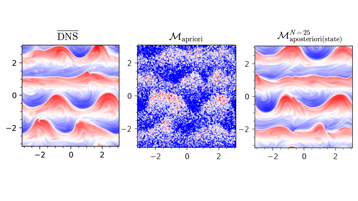
Interactive Learning for Better AI-Based Subgrid-Scale Modeling
A study shows that interactive learning can significantly enhance the performance of artificial intelligence-based parameterization of small-scale processes, a critical component of climate models.

Posted inEditors' Highlights
An Innovative Approach to Model Complex Hurricane Flood Hazards
A new study shows that it is possible to produce regional assessments of how hurricane flood hazards change due to both evolving storm tides and precipitation rates in a warming climate.
Posted inEditors' Highlights
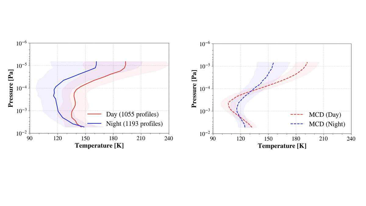
Unprecedented Constraint on the Martian Mesopause Temperature
The middle atmosphere of Mars is a critical region influenced by both waves from below and solar radiation from above, but until now there have been very few observational constraints on this region.

Posted inEditors' Highlights
How Can We Sample More Ethically?
Ryan-Davis and Scalice describe a path towards sampling more ethically, going beyond legal permitting requirements to engagement of Indigenous expertise and respect of peoples’ relationship to place.
Posted inEditors' Highlights
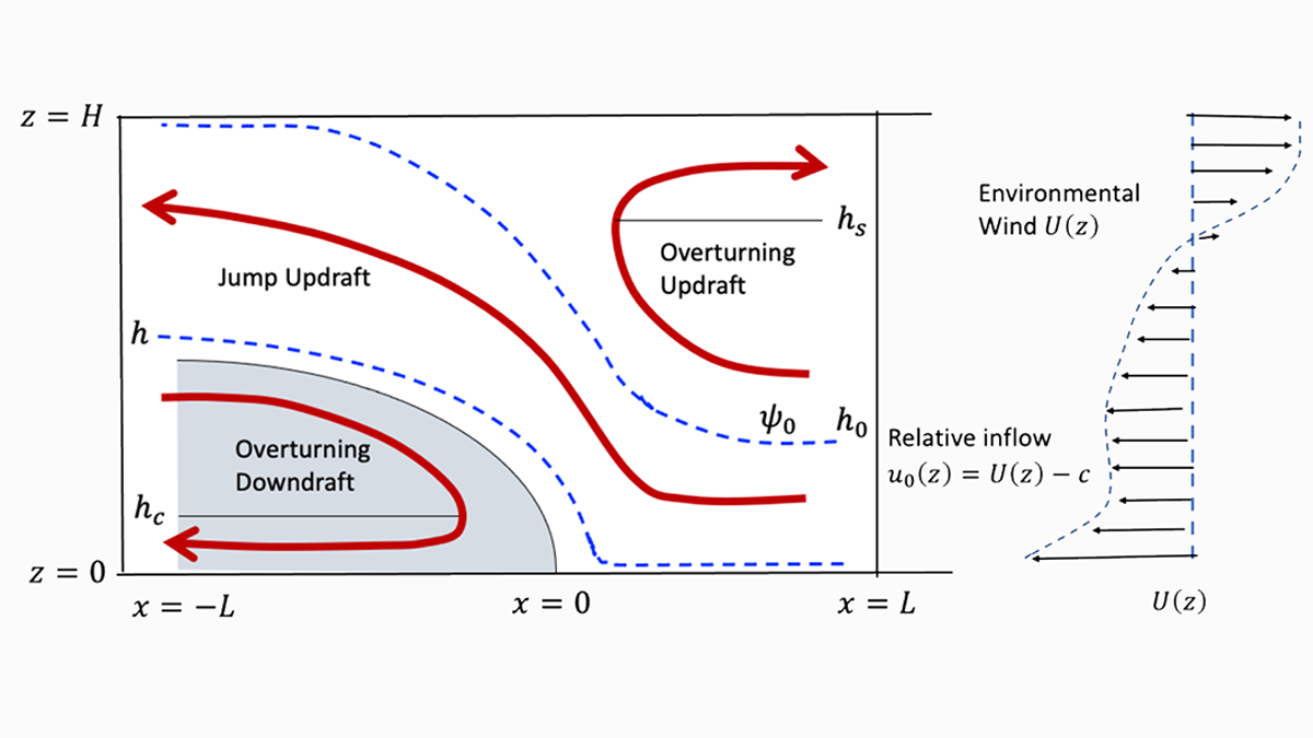
A Theory of Squall Lines
About 50 years ago, vorticity thinking helped unveil basic properties of squall lines. Zhang now provides a closed theory, demystifying one of nature’s most important forms of convective organization.
Posted inEditors' Highlights
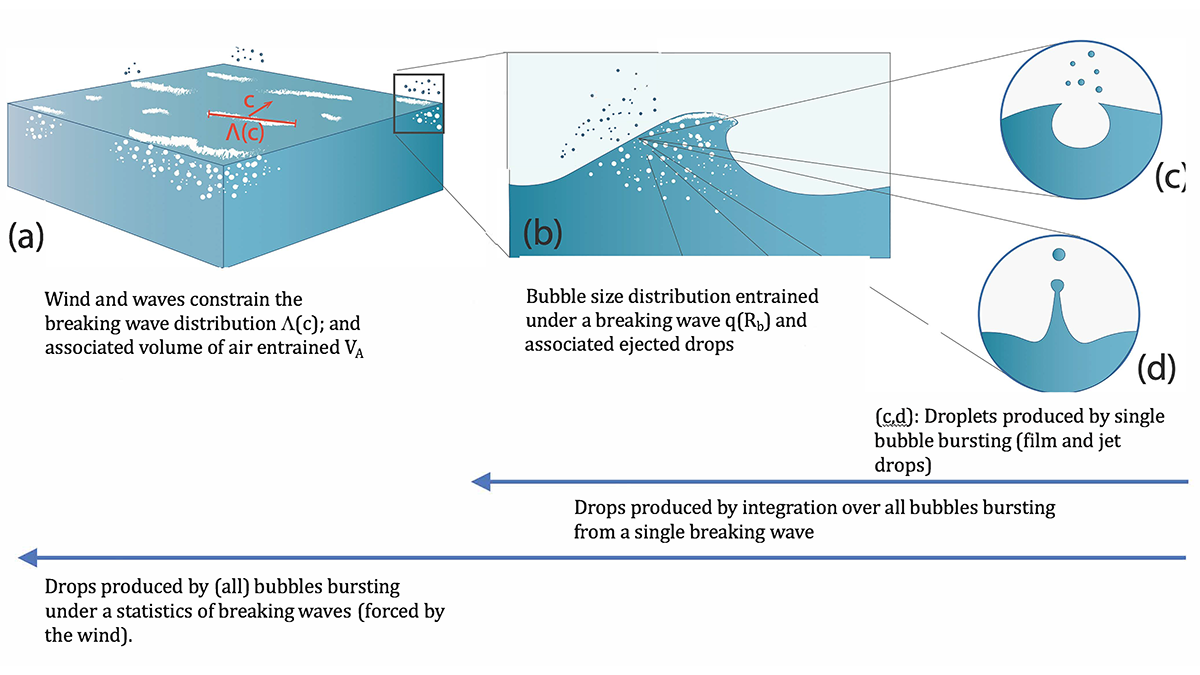
A New Approach to Sea Spray Aerosol Production and Prediction
Sea spray aerosols play a critical role in atmospheric processes. A new approach is in strong agreement with observations, paving the way for improved models of atmospheric aerosols of oceanic origin.

Posted inEditors' Highlights
First in Line to Track Blue Water From Space
“Blue water” is the water in rivers, lakes, and reservoirs. A new NASA mission will track blue water levels globally at least once a month. Early Adopters are eager and ready to use the data!

Posted inEditors' Highlights
Roadside Plants Witness COVID Traffic
Radiocarbon in roadside plants revealed a decline in auto emissions during COVID lockdown and a 2021 rebound. Could this improve emission estimates in countries without CO2 monitoring infrastructure?