• About
  • Sections
  • Topics
    • Climate
    • Earth Science
    • Oceans
    • Space & Planets
    • Health & Ecosystems
    • Culture & Policy
    • Education & Careers
    • Opinions
  • Projects
    • ENGAGE
    • Editors’ Highlights
    • Editors’ Vox
    • Eos en Español
    • Eos 简体中文版
    • Print Archive
  • Science Policy Tracker
  • Blogs
    • Research & Developments
    • The Landslide Blog
  • Newsletter
  • Submit to Eos
  • AGU.org
  • Career Center
  • Join AGU
  • Give to AGU
  • About
  • Sections
  • Topics
    • Climate
    • Earth Science
    • Oceans
    • Space & Planets
    • Health & Ecosystems
    • Culture & Policy
    • Education & Careers
    • Opinions
  • Projects
    • ENGAGE
    • Editors’ Highlights
    • Editors’ Vox
    • Eos en Español
    • Eos 简体中文版
    • Print Archive
  • Science Policy Tracker
  • Blogs
    • Research & Developments
    • The Landslide Blog
  • Newsletter
  • Submit to Eos
Skip to content
  • AGU.org
  • Career Center
  • Join AGU
  • Give to AGU
Eos

Eos

Science News by AGU

Support Eos
Sign Up for Newsletter
  • About
  • Sections
  • Topics
    • Climate
    • Earth Science
    • Oceans
    • Space & Planets
    • Health & Ecosystems
    • Culture & Policy
    • Education & Careers
    • Opinions
  • Projects
    • ENGAGE
    • Editors’ Highlights
    • Editors’ Vox
    • Eos en Español
    • Eos 简体中文版
    • Print Archive
  • Science Policy Tracker
  • Blogs
    • Research & Developments
    • The Landslide Blog
  • Newsletter
  • Submit to Eos

CC BY-NC-ND 2016

A large waterfall plunge pool system within the Seven Tea Cups, Dry Meadow Creek, California.
Posted inResearch Spotlights

Plunging into Waterfall Sediment Transport Modeling

Sarah Stanley, Science Writer by Sarah Stanley 7 June 20163 May 2022

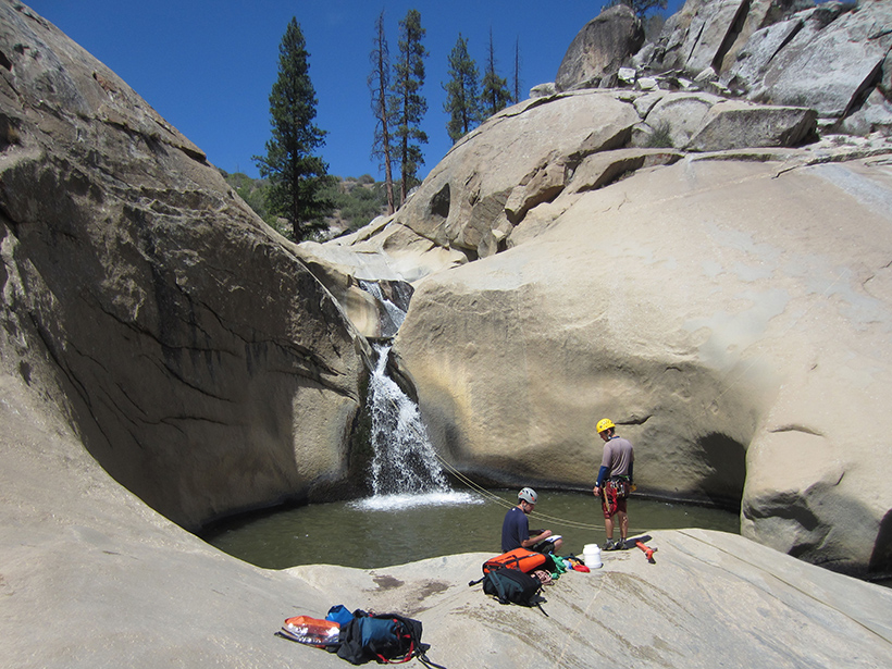
A first-of-its-kind model describes how pools at the base of waterfalls adjust their depth to keep up with sediment flow.

Trained storm reporters learn to use environmental cues, like these swaying trees, to determine wind speeds.
Posted inNews

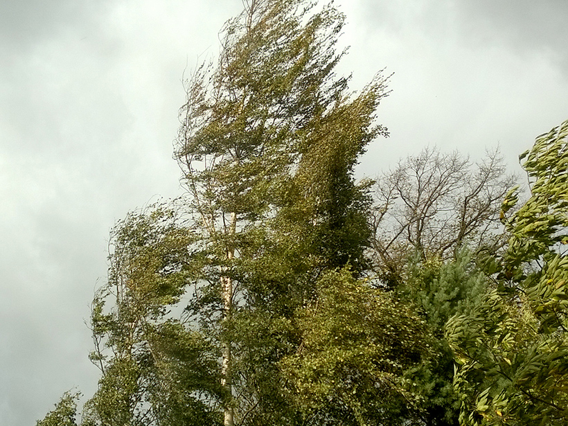
Humans Misread Wind Speeds, Skewing a Major Hazards Database

by E. Deatrick 6 June 201626 October 2021

Weather spotters who report storm measurements and observations to a U.S. national compendium of storm data often exaggerate winds speeds—by about one third, on average.

Micrograph of a recrystallized quartz aggregate from a high-temperature shear zone in Italy’s Truzzo granite, showing a grain boundary migration microstructure.
Posted inResearch Spotlights

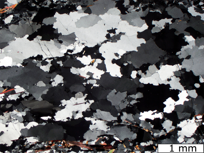
Despite Dryness, Quartz Grains Can Deform in Earth's Crust

by Terri Cook 6 June 20161 October 2021

A comparison of water content in undeformed and deformed quartz indicates that grains may change shape via weakening processes that cannot be duplicated in laboratory experiments.

Posted inResearch Spotlights

How Regional Wind Patterns Will Influence Climate Change

by W. Yan 6 June 201612 January 2022

Climate change is expected to cause wet regions to get wetter and dry regions to get drier, but new research suggests that the truth is more complicated.

Posted inEditors' Vox

They Got to “Ask-Me-Anything.” So, What Did They Want to Know?

by Kristopher B. Karnauskas 6 June 201616 February 2023

On behalf of JGR: Oceans, I consented to a Reddit Science AMA. What did an anonymous public want to learn about oceanography and climate science? More importantly, what can we learn from them?

Posted inNews

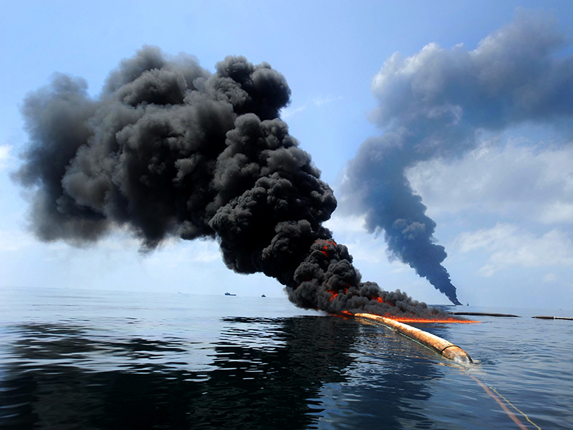
Deepwater Horizon Oil Lingered and Sank, Stuck to "Marine Snow"

Amy Coombs by A. Coombs 3 June 201618 May 2022

A new study may explain how supposedly buoyant oil from the huge 2010 oil spill coated corals and other organisms on the ocean floor.

Michael Conway, chief of the Geologic Extension Service at the Arizona Geological Survey, maps Earth fissures in the Queen Creek area south of Phoenix, Ariz.
Posted inNews

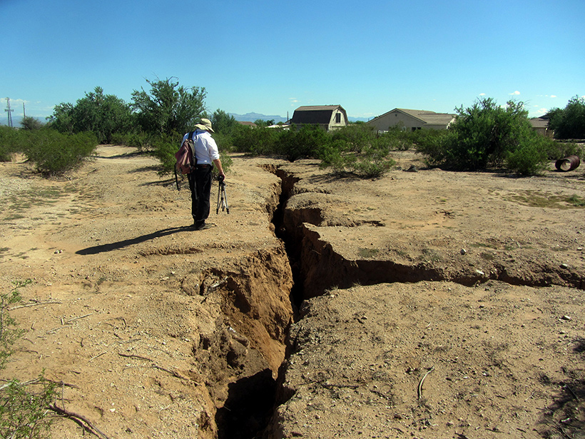
New Law Puts the Squeeze on the Arizona Geological Survey

by Randy Showstack 3 June 201627 March 2023

Arizona state services at risk include a program to map Earth fissures; the state's earthquake-monitoring network; and the Survey's mineral resources program.

Jicamarca-Radio-Observatory-array-Peru
Posted inResearch Spotlights

Mysterious "Necklace Echoes" in the Sky Explained

by Mark Zastrow 3 June 201622 March 2023

Scientists studying a 50–year–old mystery in the Earth's ionosphere have come up with their best explanation of it yet.

A large earthquake devastated parts of coastal northern Ecuador in April 2016.
Posted inResearch Spotlights

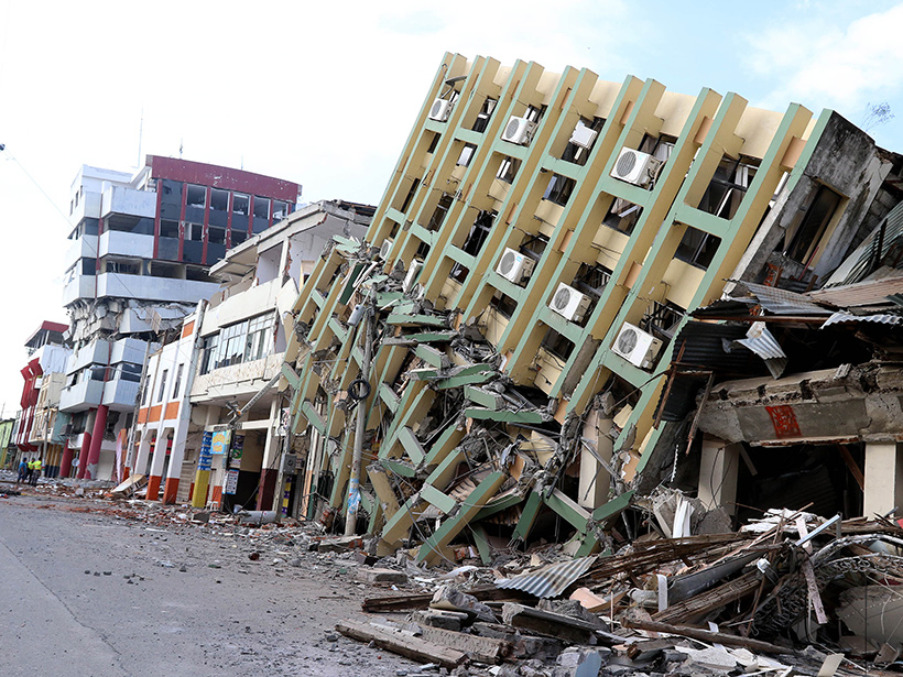
A New View of the Plate Dynamics Behind Earthquakes in Ecuador

Sarah Stanley, Science Writer by Sarah Stanley 2 June 20162 May 2022

Scientists get one step closer to an updated seismic hazard map that could help Ecuador prepare for future tremors.

Clouds and smoke over southeastern Asia in March 2015.
Posted inResearch Spotlights

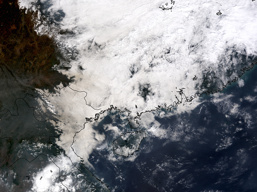
Measuring Atmospheric Aerosols Despite the Clouds

by W. Yan 2 June 20162 March 2023

Researchers devise ways for remote sensors to integrate aerosol content above clouds into current methods of measurement.

Posts pagination

Newer posts 1 … 39 40 41 42 43 … 55 Older posts
A view of a Washington, D.C., skyline from the Potomac River at night. The Lincoln Memorial (at left) and the Washington Monument (at right) are lit against a purple sky. Over the water of the Potomac appear the text “#AGU24 coverage from Eos.”

Features from AGU Publications

Research Spotlights

Droughts Sync Up as the Climate Changes

18 September 202518 September 2025
Editors' Highlights

Are There Metal Volcanoes on Asteroids?

18 September 202516 September 2025
Editors' Vox

In Appreciation of AGU’s Outstanding Reviewers of 2024

18 September 202518 September 2025
Eos logo at left; AGU logo at right

About Eos
ENGAGE
Awards
Contact

Advertise
Submit
Career Center
Sitemap

© 2025 American Geophysical Union. All rights reserved Powered by Newspack