Source: Tectonics
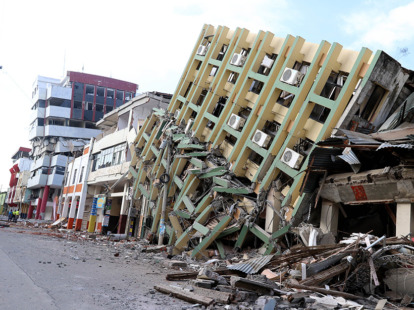
On 16 April, a magnitude 7.8 earthquake struck coastal northern Ecuador, killing hundreds of people and injuring thousands more. The quake hit in the midst of ongoing efforts to update a map of seismic hazards throughout the earthquake-prone country. In a recent paper, Yepes et al. present a new interpretation of the mantle dynamics behind Ecuadorean tremors, and they identify 19 seismic zones that contribute to earthquake risk.
Ecuador is no stranger to deadly quakes. It lies above a subduction zone where the Nazca Plate plunges beneath the South American Plate, giving rise to a long history of seismic activity. Complicating this subduction is how the Nazca plate itself seems split into two sections by the Grijalva rifted margin, which cuts southwest to northeast beneath central Ecuador. Grijalva separates the relatively younger ocean floor of the Nazca plate, to the north, from relatively older ocean floor called the Farallon plate—named after an older plate thought to be Nazca’s predecessor—to the south.
A simplified picture models the subduction interface as dipping fault planes. However, Ecuador’s individual crustal faults and fault systems are complex. Despite their importance to hazard assessments, these systems are still poorly studied so Yepes’s team focused on defining seismic zones.
The researchers combined countrywide earthquake data, compiled in 2013 by Yepes and colleagues, with probabilistic seismic hazard assessments and additional data on Ecuador’s geology and plate dynamics. They found that age-related differences between the Nazca and Farallon plates contribute to the observed earthquake trends. Data suggest that the Farallon plate bends dramatically beneath central Ecuador, generating one of the country’s earthquake clusters. The convex shape of the edge of the South American Plate also appears to drive earthquake-promoting plate movement.
Based on their updated model of Ecuadorean geodynamics, the researchers identified 19 specific zones of seismic activity. Investigating seismic trends in each of these zones will allow for an updated probabilistic map of seismic hazard for Ecuador. Such a map could help inform engineering standards and planning to minimize devastation wrought by future earthquakes. (Tectonics, doi:10.1002/2015TC003941, 2016)
—Sarah Stanley, Freelance Writer
Citation:
Stanley, S. (2016), A new view of the plate dynamics behind earthquakes in Ecuador, Eos, 97, https://doi.org/10.1029/2016EO053605. Published on 02 June 2016.
Text © 2016. The authors. CC BY-NC-ND 3.0
Except where otherwise noted, images are subject to copyright. Any reuse without express permission from the copyright owner is prohibited.