一项新研究揭示了不同模型训练方法的优缺点。
earthquakes
Posted inEditors' Highlights
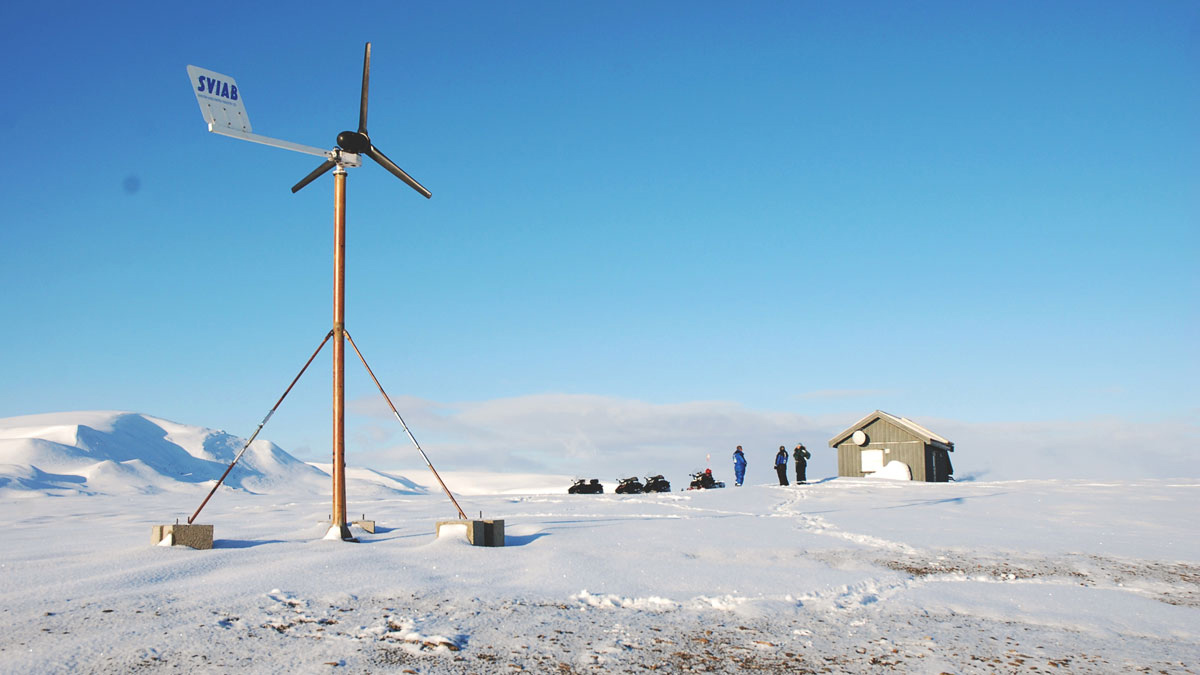
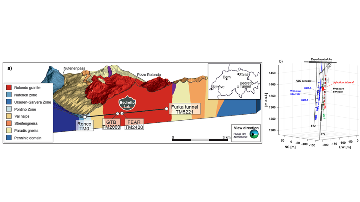
Enhancing Induced Seismicity: A New Window into Earthquake Physics
Controlled multi-day hydraulic stimulation experiments in the BedrettoLab aim to generate seismicity in order improve the understanding for rupture processes of natural and induced earthquakes.

Posted inNews
Small Faults Add to Seattle’s Quake Story
A new study of the Seattle Fault Zone is revealing records of smaller, hidden earthquakes that could inform future hazard research.

Posted inResearch Spotlights
AI Improves Earthquake Detection
A new study shows the pros and cons of different model training methods.
Posted inEditors' Highlights
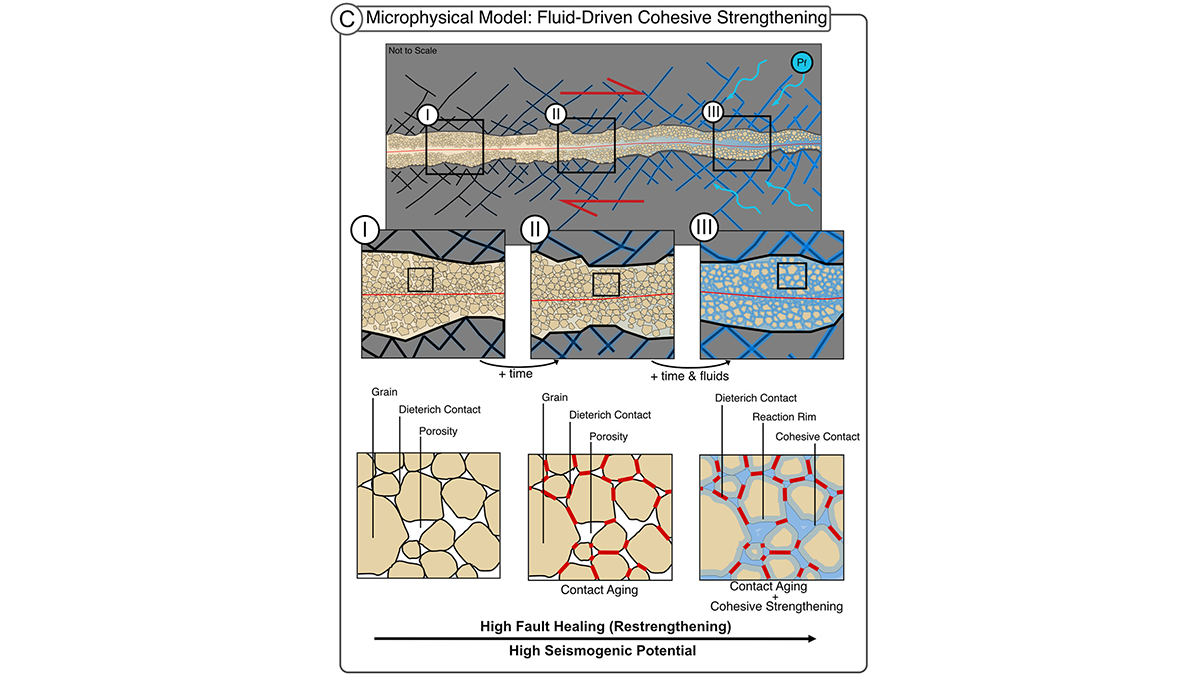
Fluid-Driven Reactions Restore Fault Strength Between Earthquakes
In fault gouge, fluids drive chemical healing by cementing grains, a mechanism for seismic slip in rocks frictionally expected to creep. This cohesion matters for fault stability.
Posted inEditors' Highlights
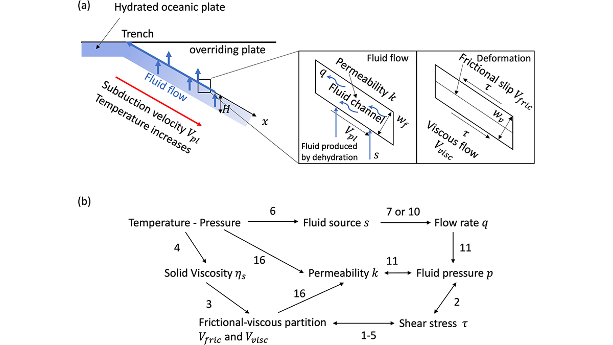
How Dehydration-Driven Fluid Pressure Shapes Megathrust Slip Modes
By modeling dehydration-driven fluid pressure, a new study links deep fluids to where megathrust earthquakes end and slow slip begins.
Posted inResearch & Developments
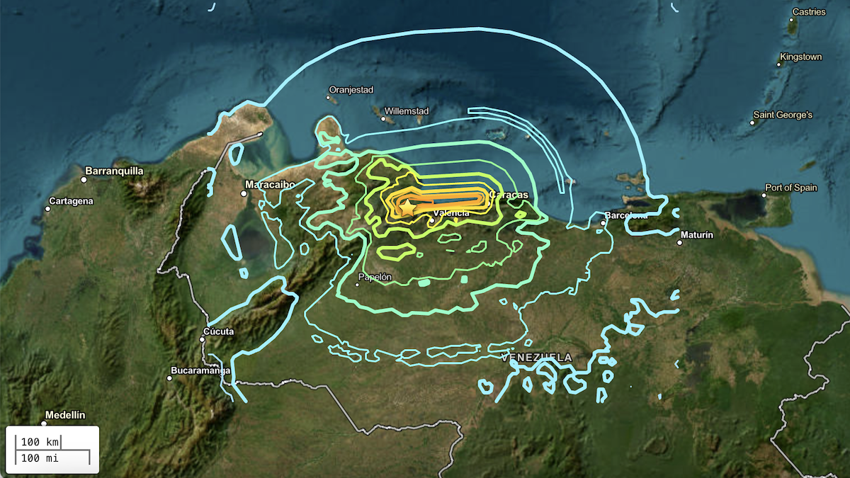
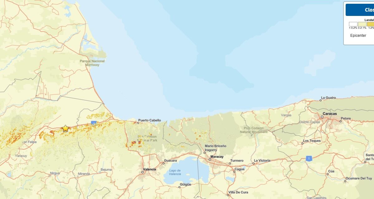
Venezuelan Earthquakes Struck in a Complex Zone of Faults
Two powerful earthquakes hit Venezuela within less than a minute on the evening of 24 June, causing widespread damage to buildings, likely spurring landslides, and killing at least 164 people, though the full extent of the damage is still being assessed.
Posted inThe Landslide Blog
Landslides and liquefaction from the 24 June 2026 “double tap” earthquakes in Venezuela
The Landslide Blog is written by Dave Petley, who is widely recognized as a world leader in the study and management of landslides. The news this morning of the “double tap” M=7.2 and M=7.5 earthquakes in Venezuela late on 24 June 2026 is grim. These are large earthquakes in their own right occurring at a […]
Posted inThe Landslide Blog
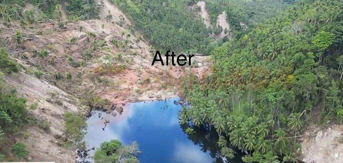
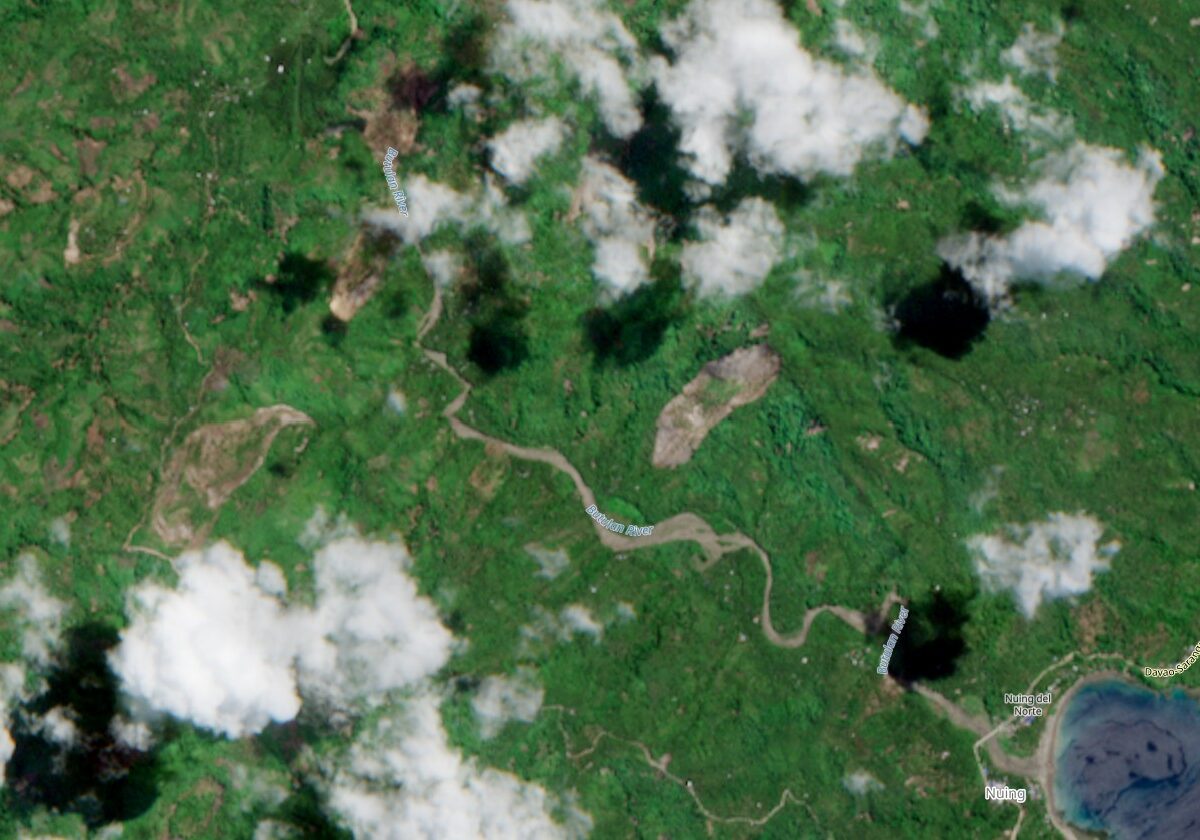
The valley blocking landslide between barangays San Isidro and Nuing in Mindanao
A significant “quake lake” has developed in a remote area of the Philippines, threatening four communities located downstream. In the aftermath of the 8 June 2026 M=7.8 earthquake in the Philippines, a major challenge has developed in the Jose Abad Santos region of Mindanao. Here, a landslide has blocked the valley between barangays (villages) San […]
Posted inThe Landslide Blog
An update on landslides from the 8 June 2026 M=7.8 earthquake offshore Mindanao in the Philippines
It is now clear that more than half the fatalities from last week’s earthquake in the Philippines were caused by landslides. In the areas of the Philippines affected by the 8 June 2026 M=7.8 earthquake offshore Mindanao, operations have shifted from rescue to recovery. Inquirer has an interesting report about information provided by an official […]