A new rate- and roughness-dependent friction law incorporates multi-scale fault processes to reproduce earthquake fracture energy scaling.
earthquakes
Posted inThe Landslide Blog
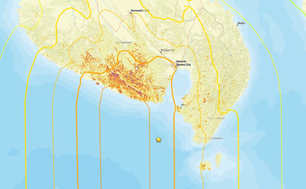
Reports of landslides triggered by the 8 June 2026 M=7.8 earthquake offshore Mindanao in the Philippines
To date news reports suggest two fatal landslides with a combined toll of 17 people. There are various news reports trickling in about the landslides triggered by the 8 June 2026 M=7.8 earthquake offshore Mindanao in the Philippines. As usual, the remote locations of many of the landslides means that the information is a bit […]
Posted inThe Landslide Blog
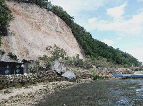
Potential landslides and liquefaction from the 8 June 2026 M=7.8 earthquake offshore Mindanao in the Philippines
Initial analyses suggest that the earthquake this morning has the potential to have triggered significant numbers of landslides and areas of liquefaction. At the time of writing, the impacts of the M=7.8 earthquake that occurred offshore the south coast of Mindanao in the Philippines remain unclear. Initial reports in the local press suggest 15 fatalities […]
Posted inEditors' Highlights
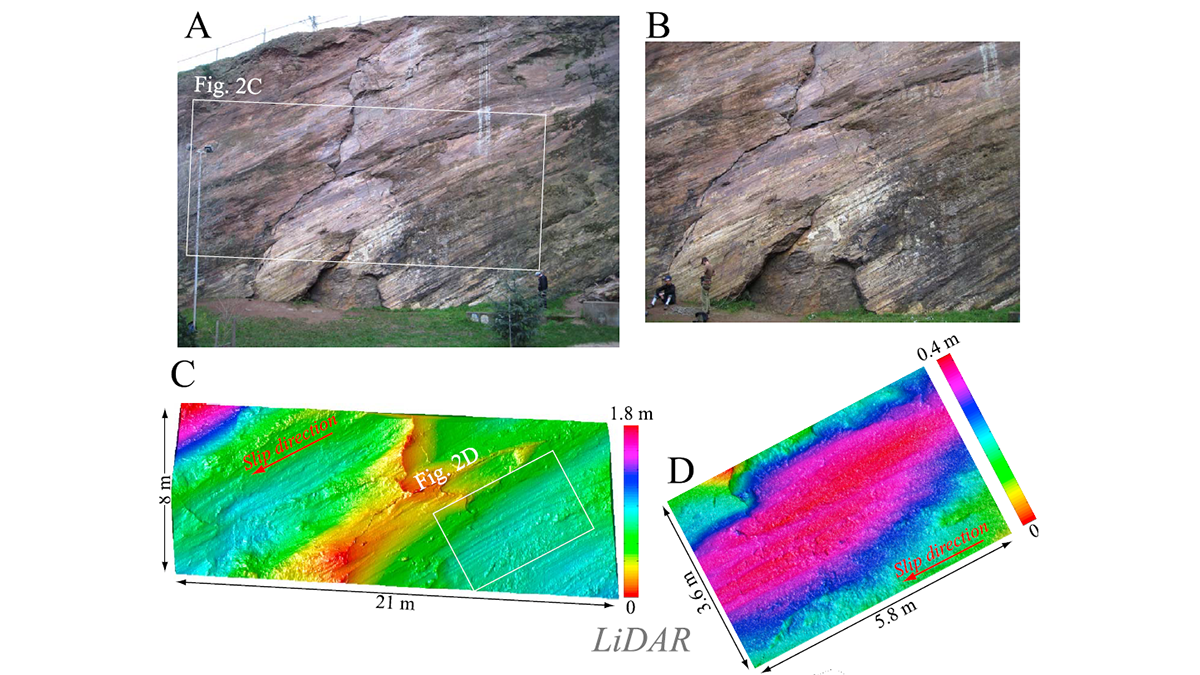
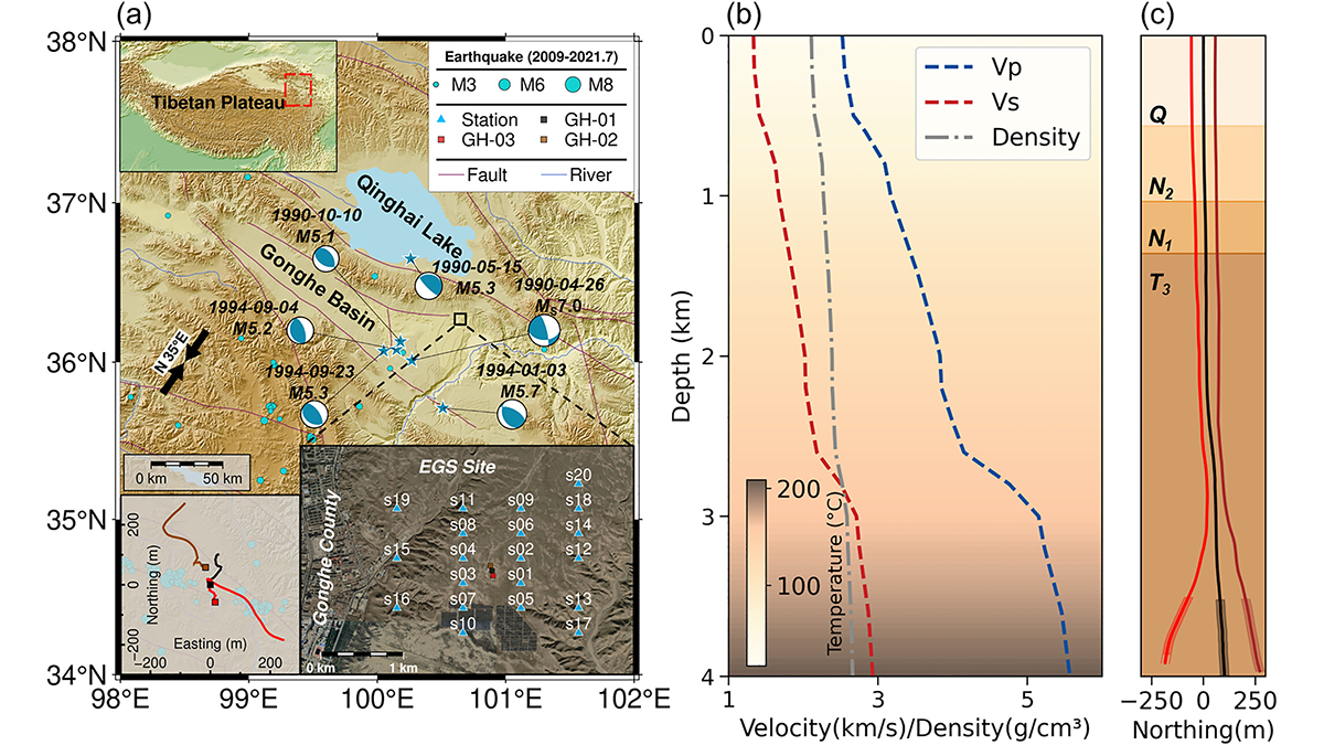
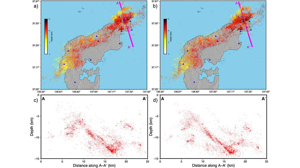
Pre-Existing Structure and Stress Shape Geothermal-Induced Seismicity
At China’s first Enhanced Geothermal System site, dense seismic observations, integrated with borehole data and stress modeling, reveal weak faults and scale-dependent control of stress and structure on induced seismicity.
Posted inThe Landslide Blog
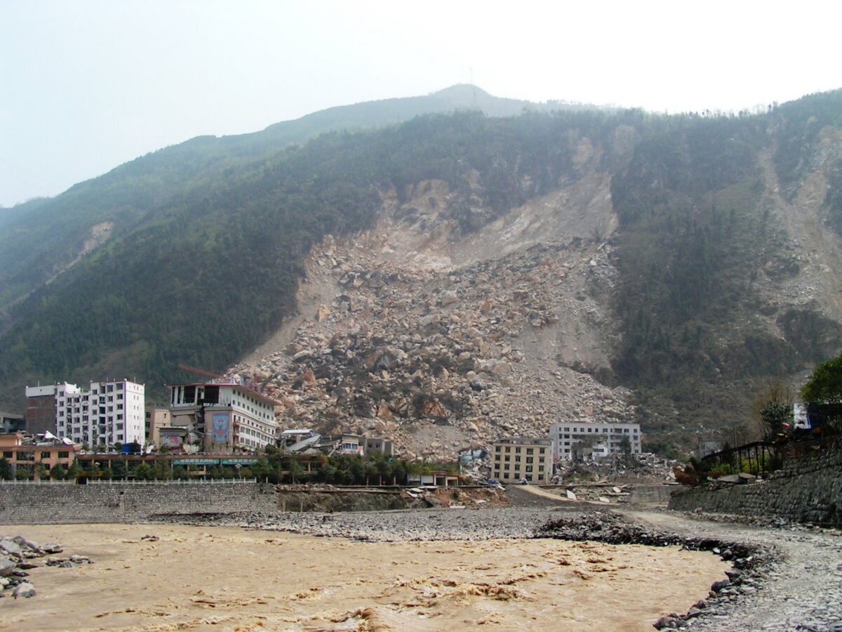
Fatalities from landslides in earthquakes
A new study (Sun et al. 2026) shows that in six earthquakes in China between 2010 and 2022, landslides and rockfalls were responsible for at least half of the total fatalities. It is well-established that landslides are a major cause of loss of life in earthquakes in mountainous areas. The seismology maxim that “it is […]
Posted inNews
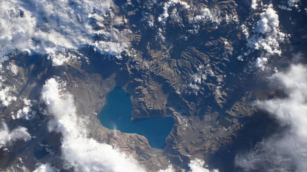
Weak Faults Play a Strong Role in the Tibetan Plateau’s Deformation
Ten years’ worth of data reveal that two theories about how the Tibetan Plateau deforms are both probably right.
Posted inNews
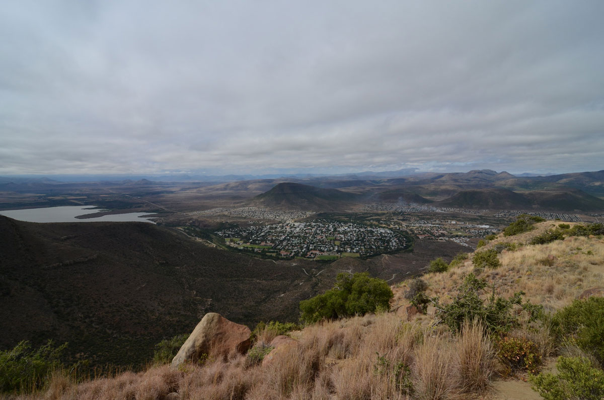
A Swarm of Earthquakes in South Africa’s Karoo Basin Poses Questions for Oil and Gas Development
A recent study cautions that the Karoo, a potential target for shale gas exploration, might not be as seismologically calm as it appears.
Posted inScience Updates
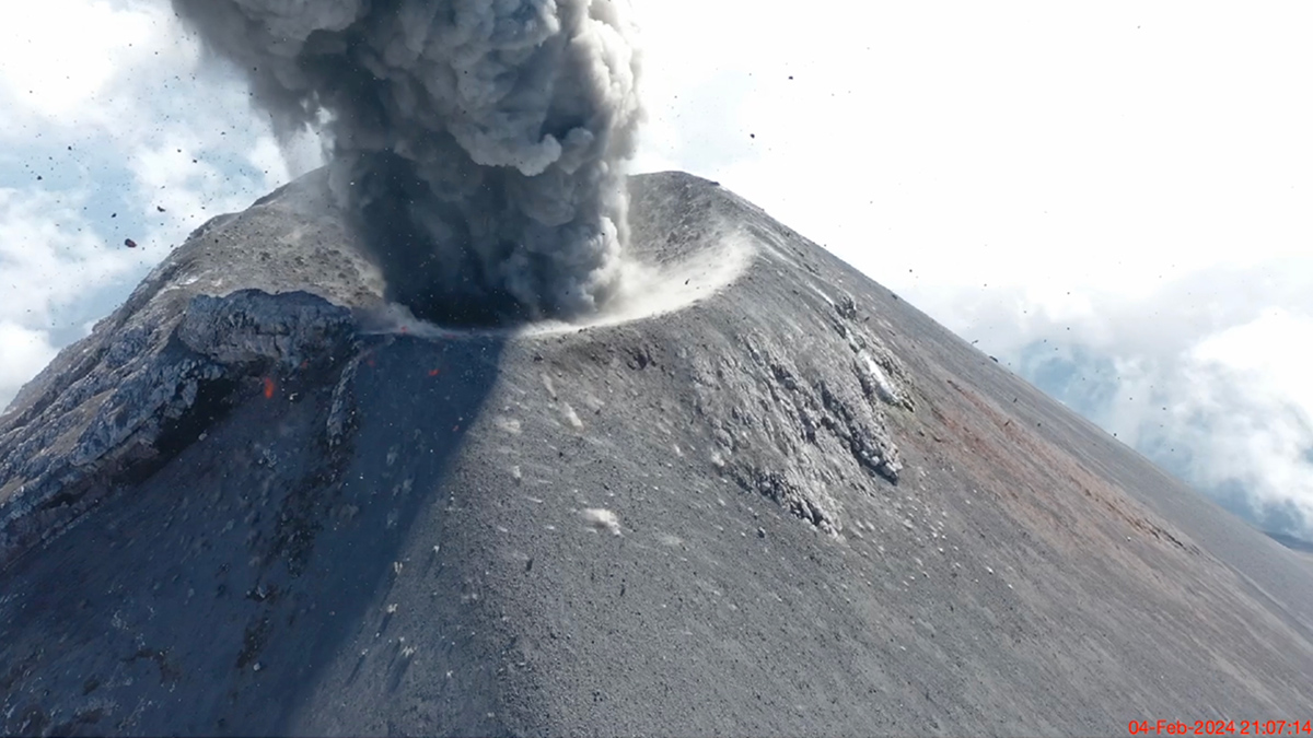
Sensing the Sounds from Earth’s Hazardous Environments
Low-cost infrasound sensors, deployed in large numbers, provide a practical means of data collection near volcanoes, earthquakes, wildfires, and other geophysical phenomena.

Posted inNews
On the Seattle Fault, the Biggest Quakes Aren’t the Most Likely
Smaller quakes from secondary faults—which are not included in national seismic hazard modeling—occur more frequently than previously thought.
Posted inEditors' Highlights
Taming the Seismicity Tsunami with a Scalable Bayesian Framework
By combining the power of artificial intelligence with advanced physics simulations, a new framework called “SPIDER” allows us to map seismic activity with unprecedented clarity.