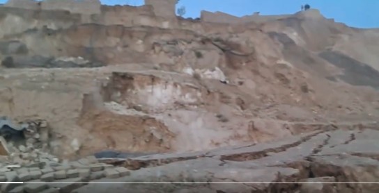
Some videos have emerged from Afghanistan this morning, reportedly showing landslides and rockfalls triggered by the M=6.3 earthquake. At 12:59 am on 3 November 2025 (local time, which is 20:29 UT on 2 November 2025), an M=6.3 earthquake struck near to Mazar-E Sharif in Afghanistan. Initial reports suggest at least 20 fatalities have occurred, but […]
earthquakes

Posted inNews
AI is Changing our Understanding of Earthquakes
Machine learning is expanding scientists’ catalogs of quakes and refining maps of underground faults. It also promises to improve quake forecasts.
Posted inResearch Spotlights
New Earthquake Model Goes Against the Grain
Subducting plates are stronger in certain directions than others, which may be a factor in how earthquakes occur and how seismic waves propagate.
Posted inEditors' Vox
When the Earth Moves: 25 Years of Probabilistic Fault Displacement Hazards
Surface ruptures causing earthquakes pose risks to infrastructure and human lives, but advances in models and data in the last few decades have improved our ability to mitigate their effects.

Posted inThe Landslide Blog
The 22 May 1960 earthquake-induced landslides and tsunami at Lake Rupanco in Chile
Reconstruction of landslides on the banks of Lake Rupanco in Chile, triggered by the 22 May 1960 Mw-9.5 earthquake, suggests that a slope failure with a volume of 161 million cubic metres triggered a tsunami with a maximum amplitude of 33.3 metres. About 120 people were killed. A very interesting paper (Quiroga et al. 2025) […]
Posted inNews
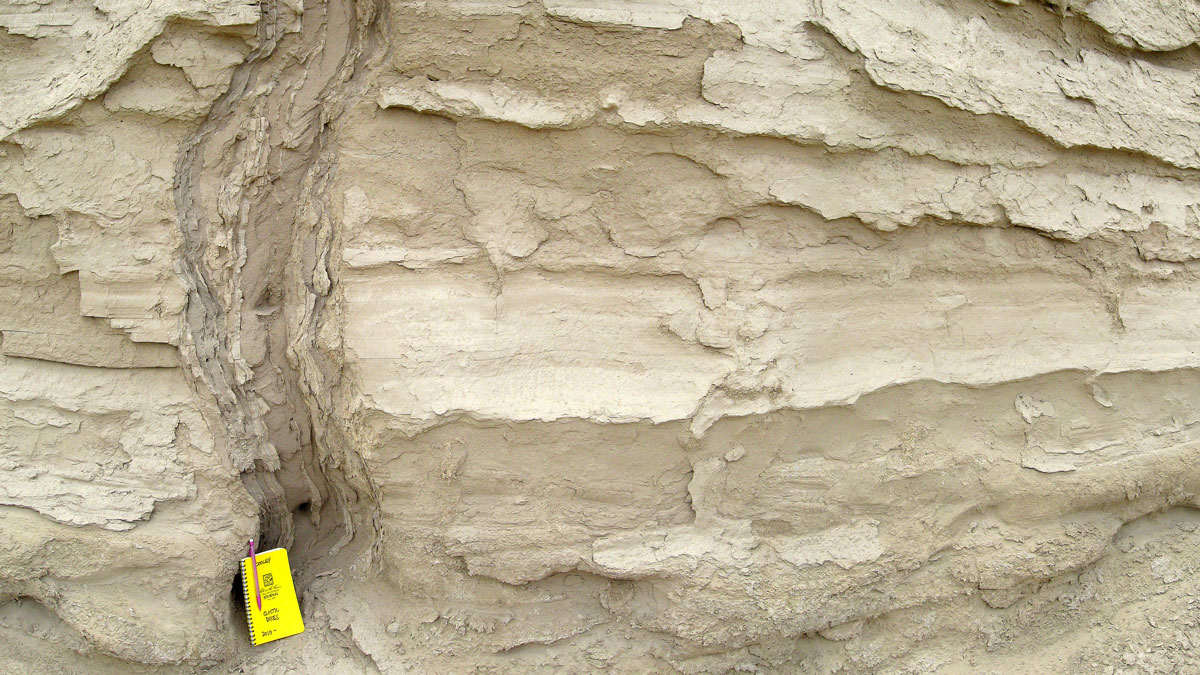
Spiky Sand Features Can Reveal the Timing of Ancient Earthquakes
Icicle-shaped features known as sand dikes form during ground shaking. New work reveals how these features can be used to date long-ago earthquakes.

Posted inNews
“Passion Project” Reveals Auckland’s Hidden Urban Faults
An innovative analysis has identified 10 likely and 25 possible faults in the region.
Posted inEditors' Vox
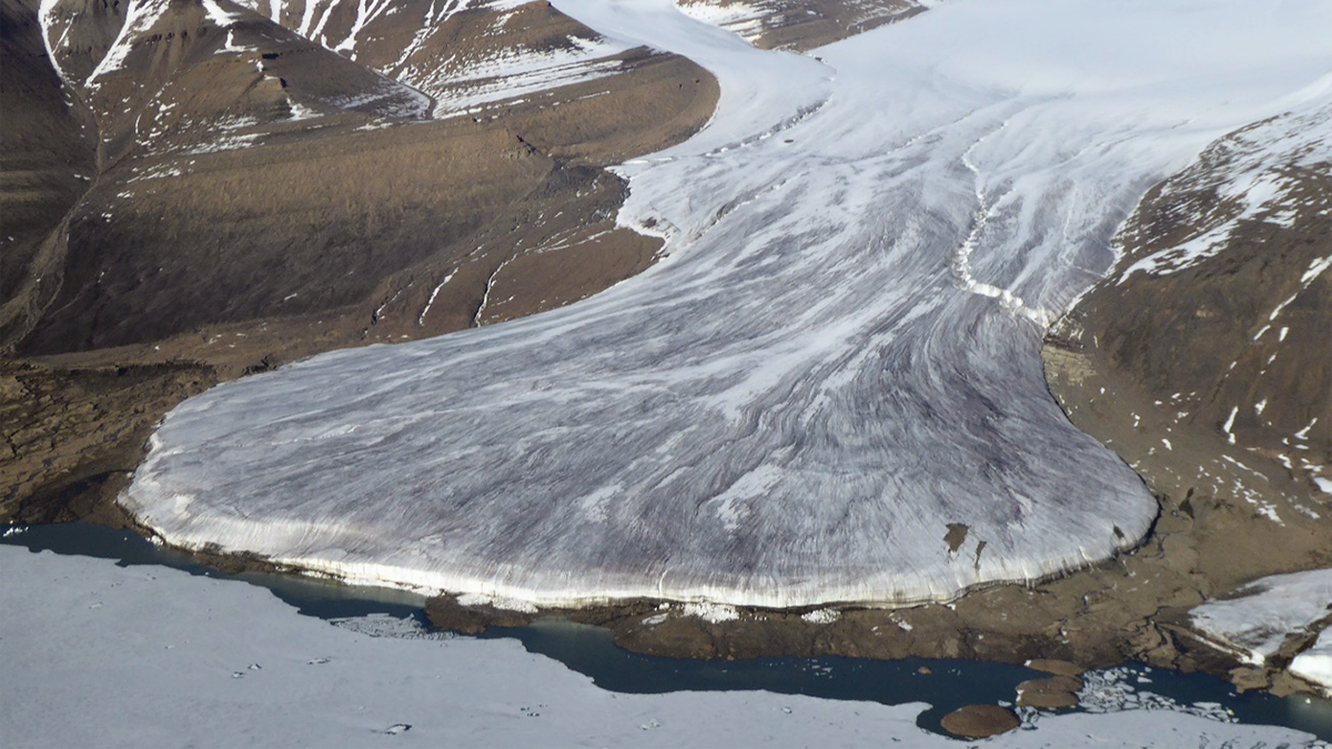
How Glacial Forebulges Shape the Seas and Shake the Earth
A glacial forebulge is a bending-related upheaval of the lithosphere that has a strong effect on the sea level change pattern and on lithospheric stresses, which can induce intraplate earthquakes.
Posted inEditors' Highlights
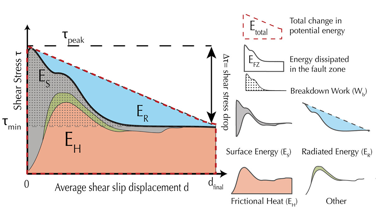
New Perspectives on Energy Sinks During Seismic Events
Laboratory earthquakes shed new light on energy partitioning during earthquakes, which is allocated to seismic radiation, creation of new surfaces, and heat dissipation.
Posted inNews
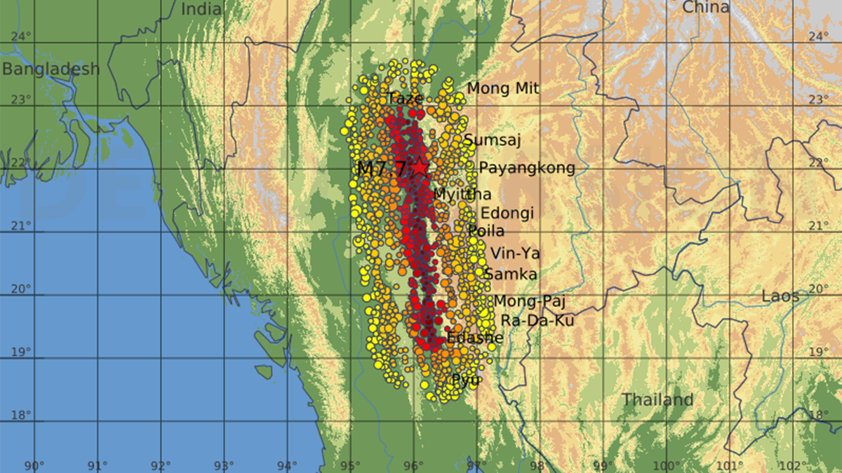
Video Shows Pulsing and Curving Fault Behavior
A chance video captured a fault rupture during March’s devastating Myanmar earthquake, delivering real-time evidence of how major seismic tremors propagate.