Some videos have emerged from Afghanistan this morning, reportedly showing landslides and rockfalls triggered by the M=6.3 earthquake.

At 12:59 am on 3 November 2025 (local time, which is 20:29 UT on 2 November 2025), an M=6.3 earthquake struck near to Mazar-E Sharif in Afghanistan. Initial reports suggest at least 20 fatalities have occurred, but the USGS PAGER estimate is a 40% probability of fatalities in the range of 100 – 1,000, and a 37% probability of fatalities of >1,000. That this earthquake has struck as winter approaches is likely to increase the impact over the coming months.
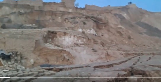
There are some initial reports and images of landslides. Of course, at this stage these are unconfirmed. But on social media there are two reports of particular interest. The first purportedly shows a large failure in in Marmal district of Balkh province. I have stopped using Twitter, but Jahanzeb Khan, who is an independent journalist for women and human rights violations in Afghanistan, has posted this video there:-
This appears to show a large, complex landslide, possibly rotational in nature:-
Meanwhile, another journalist, Abdulhaq Omeri, has posted a video that appears to show a road severely damaged by rockfalls. There appears to be some injured people from these events:-
There are reports that the road between Kabul and Mazar is blocked by landslides. The USGS initial map of intensity and landslides looks like this:-
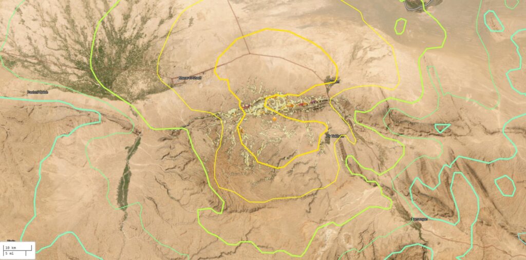
The east-west orientated ridge just to the north of the earthquake epicentre appears to have high landslide potential, and the Kabul-Mazar highway, which cuts through this area, is reported to be blocked. This could impede the delivery of assistance, worsening the impact of building collapses.