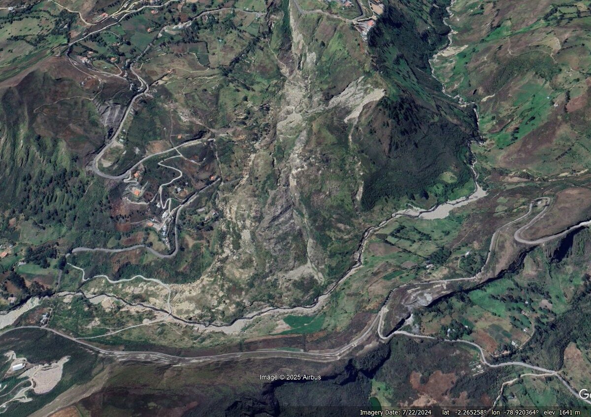
The Landslide Blog is written by Dave Petley, who is widely recognized as a world leader in the study and management of landslides. As landslides in Ecuador are currently in the news, it is interesting to reflect on perhaps the largest failure there in recent years. On 12 February 2021, the massive Chunchi landslide occurred […]
Ecuador
Posted inThe Landslide Blog
A large landslide near to Chanazana in Nabón, Ecuador
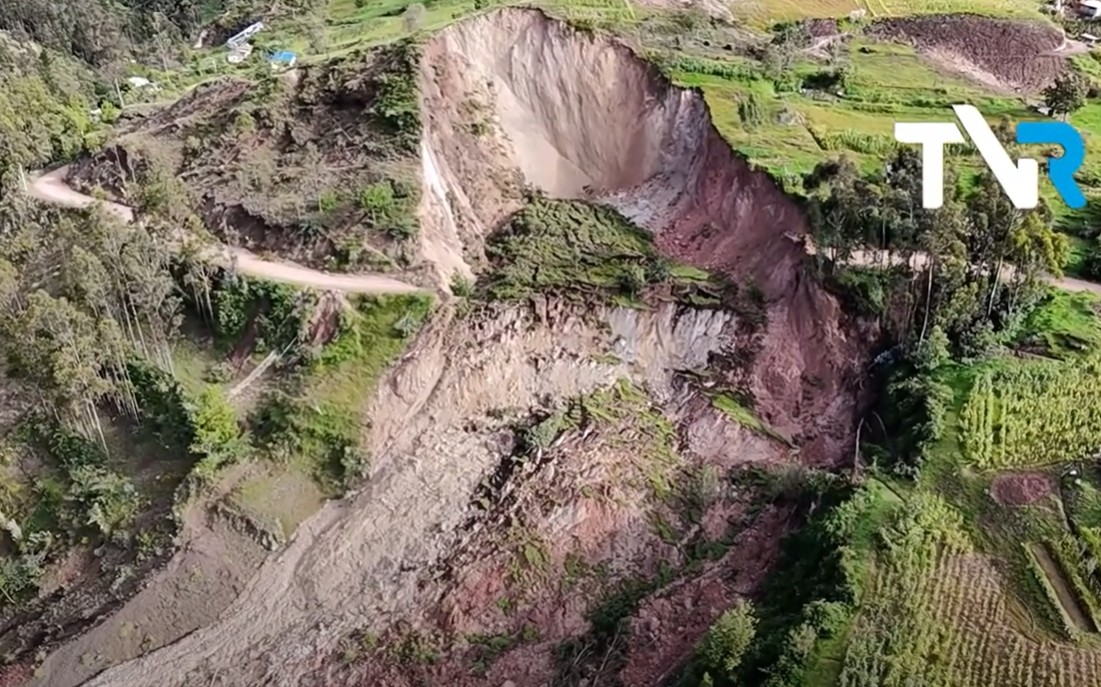
The Landslide Blog is written by Dave Petley, who is widely recognized as a world leader in the study and management of landslides. I highlighted yesterday that Ecuador is being very significantly affected by landslides triggered by high levels of rainfall at the moment. A good example occurred on 30 March 2025 close to Chanazana […]
Posted inNews
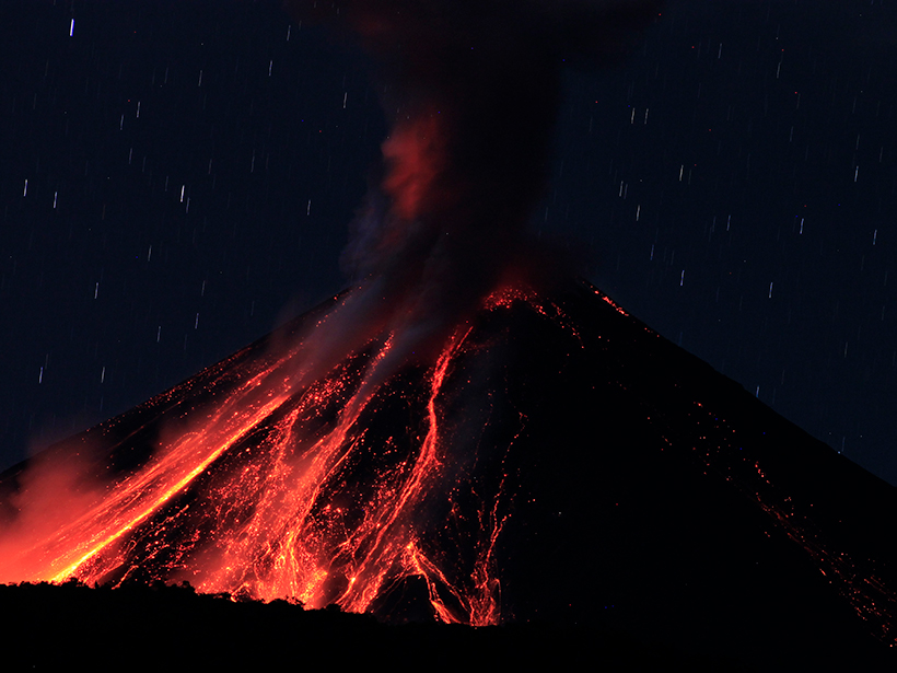
Cómo el volcán Tungurahua arrojó metales pesados en el suministro alimentario de Ecuador
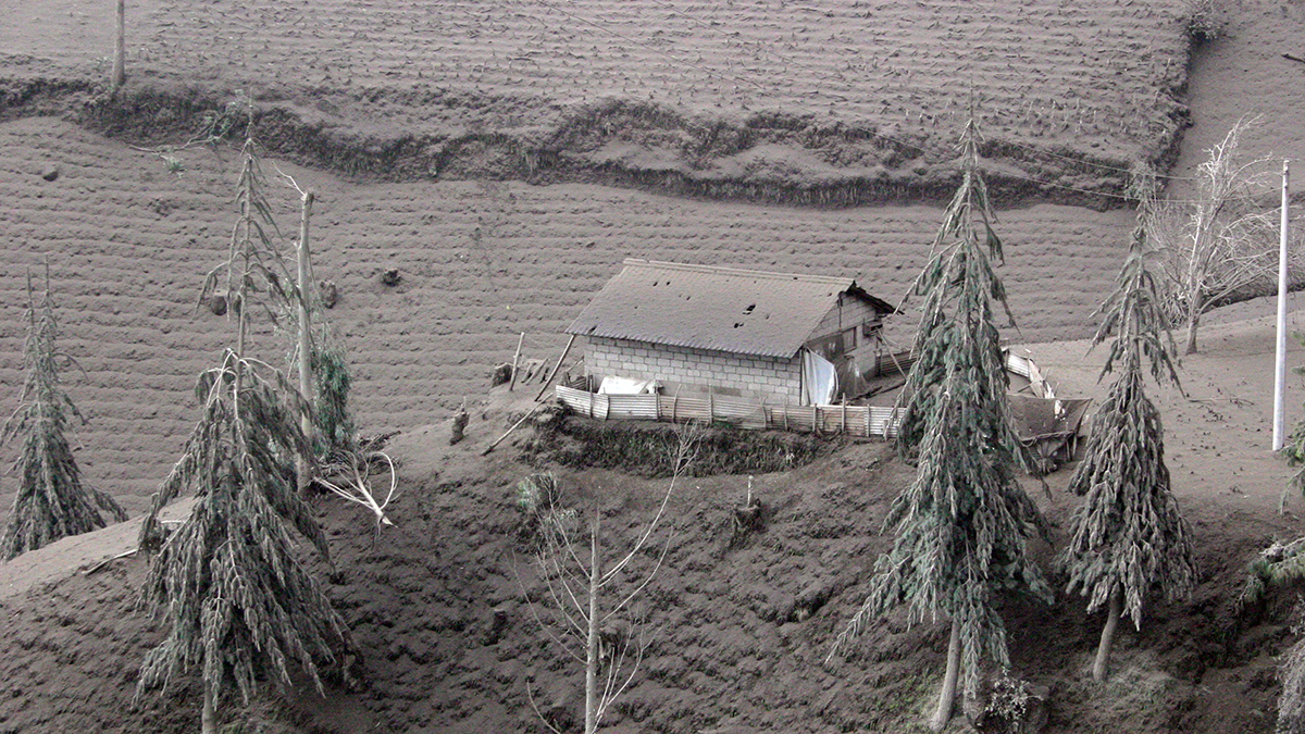
Cuando el volcán Tungurahua de Ecuador entró en erupción múltiples veces entre 1999 y 2016, las comunidades agrícolas cercanas fueron cubiertas por ceniza, la cual dejó metales pesados en sus cultivos.

Posted inNews
How Tungurahua Volcano Dropped Heavy Metals into Ecuador’s Food Supply
When Ecuador’s Tungurahua volcano erupted multiple times between 1999 and 2016, nearby farming communities were covered in ash, which left heavy metals in their crops.

Posted inEditors' Highlights
Mapeo de la convergencia entre pobladores, pesticidas y áreas protegidas
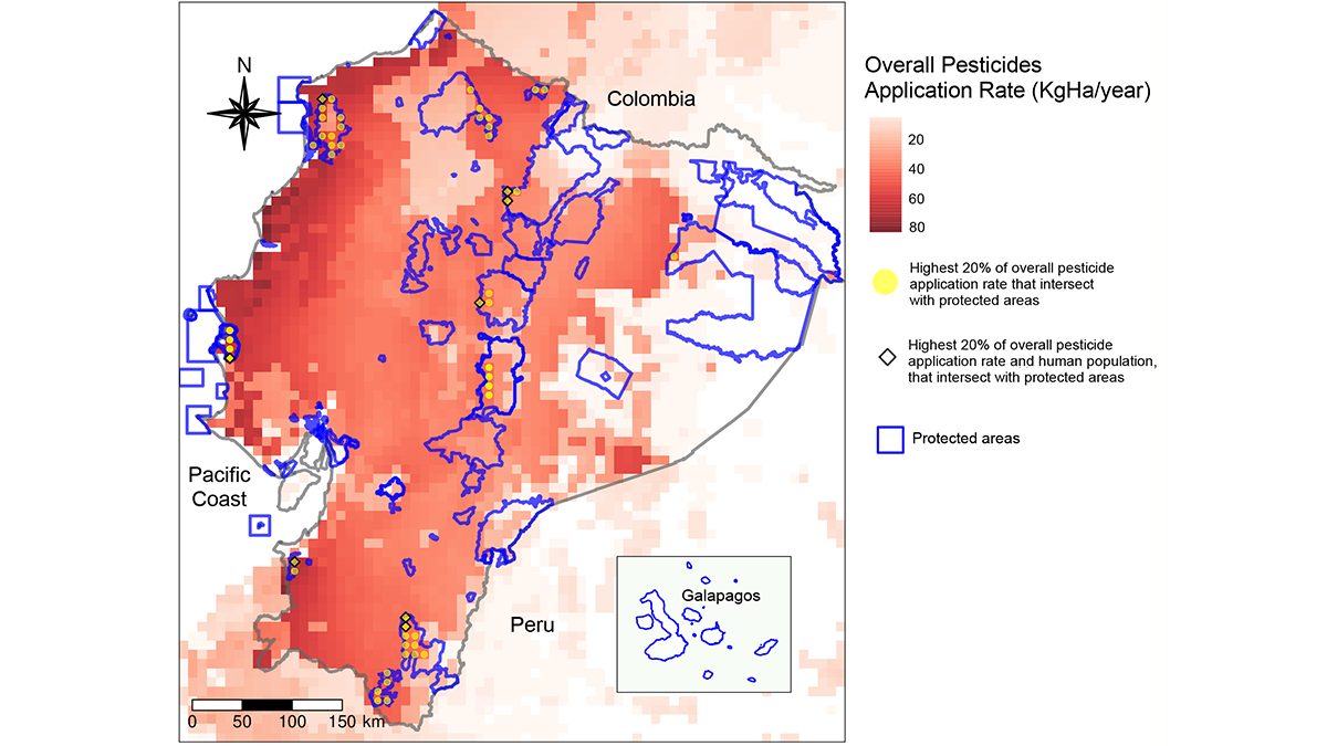
La exposición a pesticidas puede afectar la salud humana y de los ecosistemas. Una investigación reciente aplica modelos cartográficos en Ecuador, los cuales pueden ser exportados a otras escalas para limitar estos impactos adversos en otras regiones.
Posted inEditors' Highlights
Mapping Intersections of Pesticides, Protected Areas, and People
Pesticide exposures can impact human and ecosystem health, and new research uses a modeling approach applied to Ecuador that can be scaled and exported to limit negative impacts in other regions.
Posted inResearch Spotlights
Amazon Basin Tree Rings Hold a Record of the Region’s Rainfall
New research provides a 200-year reconstruction of interannual rainfall in the Amazon basin using oxygen isotopes preserved in tree rings in Ecuador and Bolivia.
Posted inNews
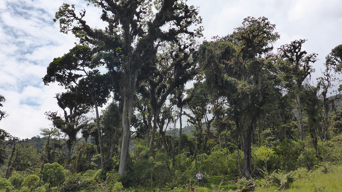
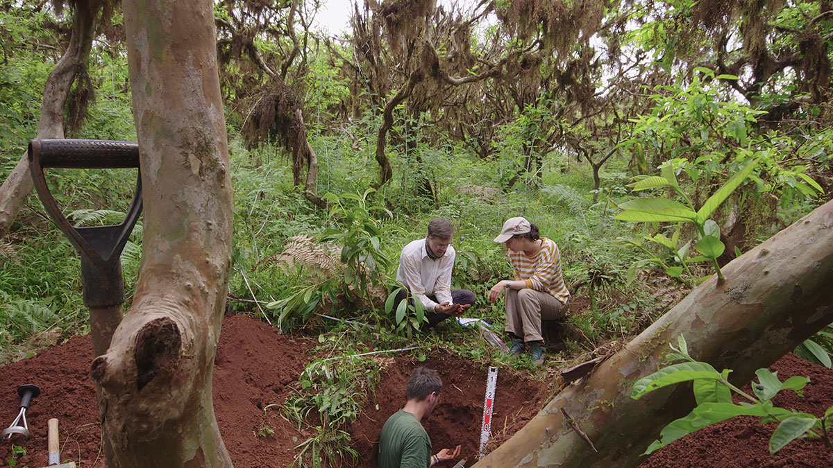
The Galápagos Islands: The Ultimate Outdoor Soil Science Laboratory
A new study has spurred further research into the impacts of soil formation on modern-day problems like heavy metal contamination in agricultural soils.
Posted inScience Updates
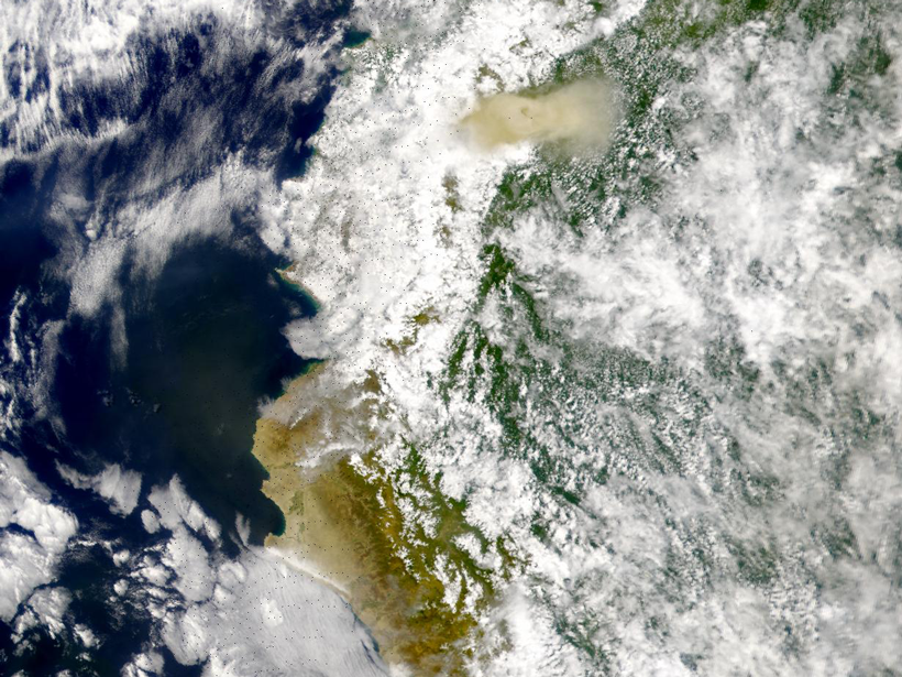
Ecuador’s El Reventador Volcano Continually Remakes Itself
A research team from Ecuador’s Geophysical Institute keeps a close eye on an unusually active and unstable volcano in the nation’s remote jungles.
Posted inResearch Spotlights
Using Radar to Understand How Volcanic Eruptions Evolve
Radar satellite imagery can be used to measure constructional changes in the topography of long-lived volcanoes, according to a new study of Ecuador’s El Reventador volcano.