Editors’ Highlights are summaries of recent papers by AGU’s journal editors.
Source: GeoHealth
This article also may be read in Spanish.
Agricultural pesticide use has resulted in increased quantity and quality of produced foodstuffs, but at a cost—these pesticides can have negative, and not fully understood, impacts on human and ecosystem health. Some pesticide application techniques can result in product being transported away from the farm fields and onto proximal locations, causing concerns about exposures should those locations be protected areas or areas of relatively dense human population.
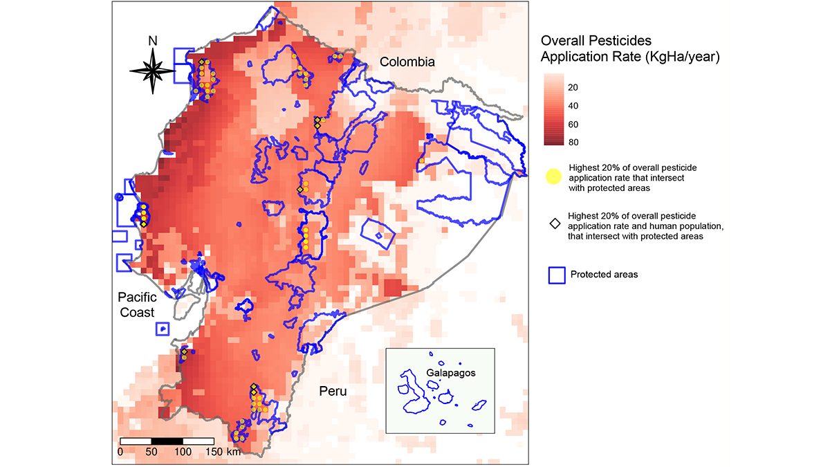
To better constrain this issue, Andrade-Rivas et al. [2023] examine pesticide application rates in Ecuador, a nation that uses a significant amount of pesticides in agricultural production and is part of a region of high natural biodiversity. The authors specifically focus on amphibian health in protected areas, as well as human health, and use a modular modeling approach to define the regions of significant overlap between pesticide application rates, protected areas, and population centers.
By defining the regions of highest potential vulnerability (i.e., those that display either high numbers of protected areas, high human populations or both), this research also has the practical component of informing agrochemical use policy. Different application approaches can limit the off-site movement of agricultural chemicals and thus can be prioritized in these vulnerable regions. The approach used here is scalable and exportable to other regions that have a similar confluence of agricultural regions, vulnerable ecosystems, and human populations.
Citation: Andrade-Rivas, F., Paul, N., Spiegel, J., Henderson, S. B., Parrott, L., Delgado-Ron, J. A., et al. (2023). Mapping potential population-level pesticide exposures in Ecuador using a modular and scalable geospatial strategy. GeoHealth, 7, e2022GH000775. https://doi.org/10.1029/2022GH000775
—Gabriel Filippelli, Editor in Chief, GeoHealth