一项新研究揭示了不同模型训练方法的优缺点。
Modeling

Posted inNews
Stratospheric Aerosol Injection Might Make Flights Smoother
A new study suggests an intervention aimed at cooling the planet could have the additional benefit of reducing aircraft turbulence.
Posted inFeatures
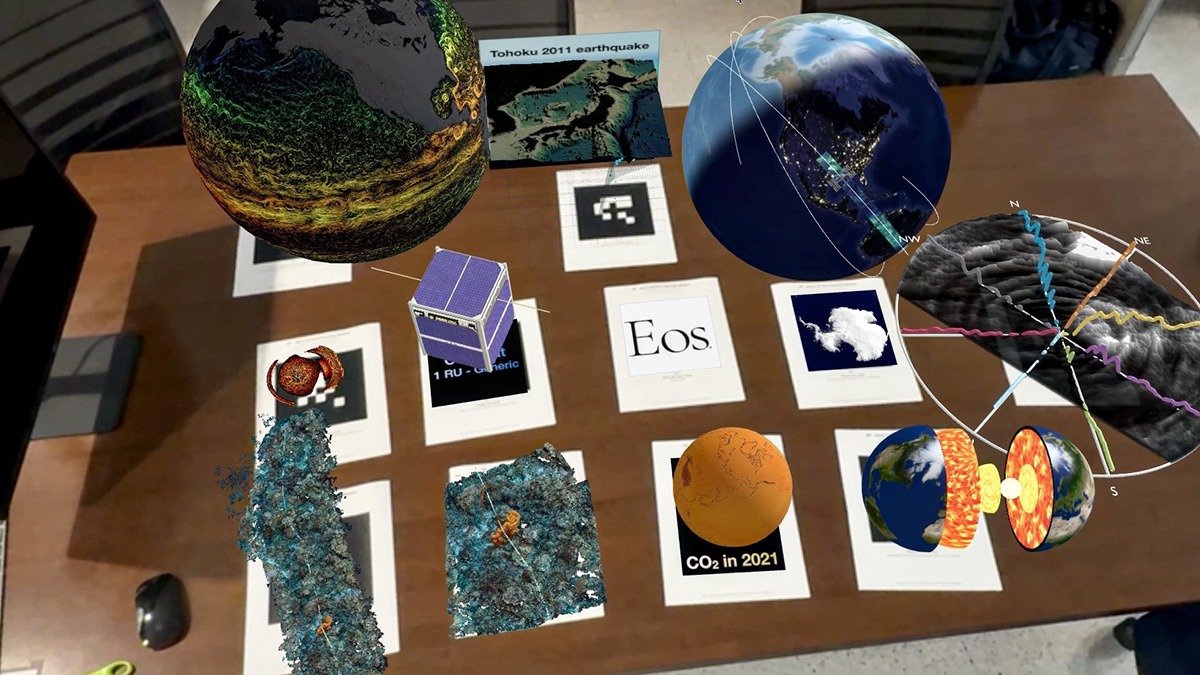
Extended Reality Offers Opportunities for Scientific Show-and-Tell
Advances in virtual and augmented reality, spatial computing, and other technologies offer chances to work with data more intuitively, benefiting Earth and space science research and education.
Posted inResearch Spotlights
Comparing Machine Learning Models of Raindrop Formation
The simplest model, based on polynomials, yields the best performance.
Posted inResearch Spotlights
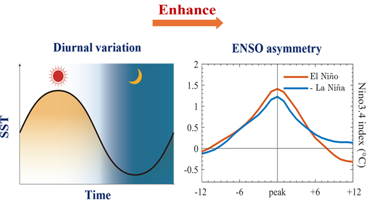
El Niño Warming Is Stronger Than La Niña Cooling. What’s the Right Way to Model This Asymmetry?
A new study looks at daily swings in sea surface temperatures for new insights.
Posted inNews
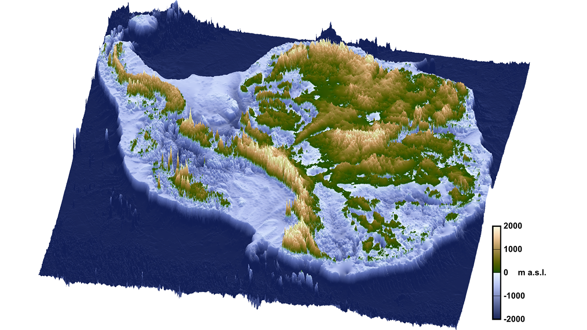
The Breakup of Gondwana Over 100 Million Years Ago May Be Why Antarctica Has Ice Today
A rift event set off a domino effect of geologic processes that created conditions ripe for Antarctica’s glaciation, a new study suggests.

Posted inResearch Spotlights
AI Improves Earthquake Detection
A new study shows the pros and cons of different model training methods.

Posted inEditors' Highlights
Seeing Earth’s Most Common Minerals from Space
A novel method marks an important step toward mapping quartz and feldspar globally.
Posted inResearch Spotlights
Machine Learning Rediscovers Equations Governing Ocean Biogeochemistry
Researchers used a process called symbolic regression to derive the equations from a biogeochemical model of the ocean.
Posted inFeatures
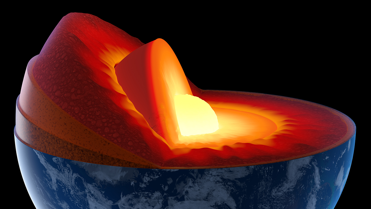
A Quiet Quantum Revolution in Earth’s Deep Interior
A subtle change in iron ions’ electronic configuration produces a measurable difference in seismic wave speeds through mantle rocks.