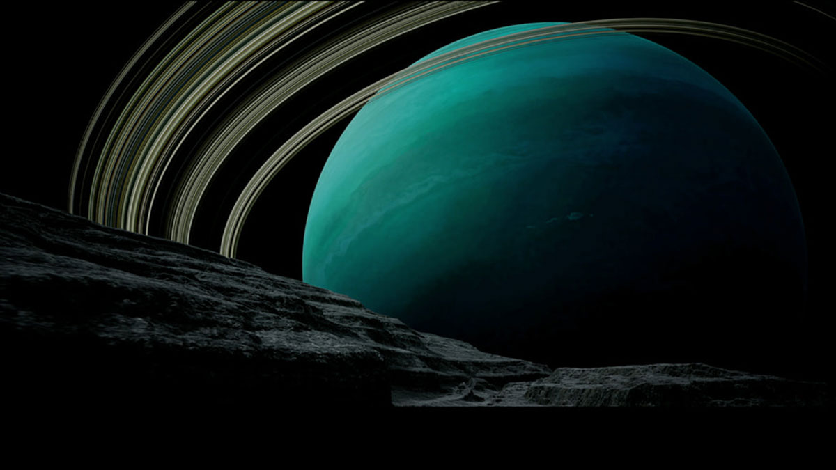
New simulations suggest that a spacecraft-mounted detector of energetic neutral atoms could improve our understanding of the ice giant’s environment, as well as the relationship between the planet, its magnetosphere, and the heliosphere.
Modeling
Posted inEditors' Highlights
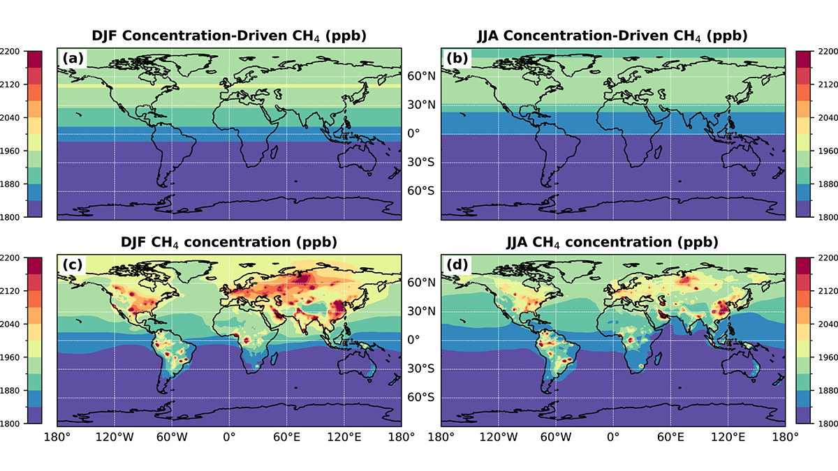
Where Methane is Emitted Matters for Global Burden
Methane emitted at higher latitude regions (Europe) tends to stay in the atmosphere longer, contributing to higher global concentrations than other regions (Asia, North America).
Posted inEditors' Highlights
Soil Biogeochemistry Models Omit Key Processes Due to Geographic Bias
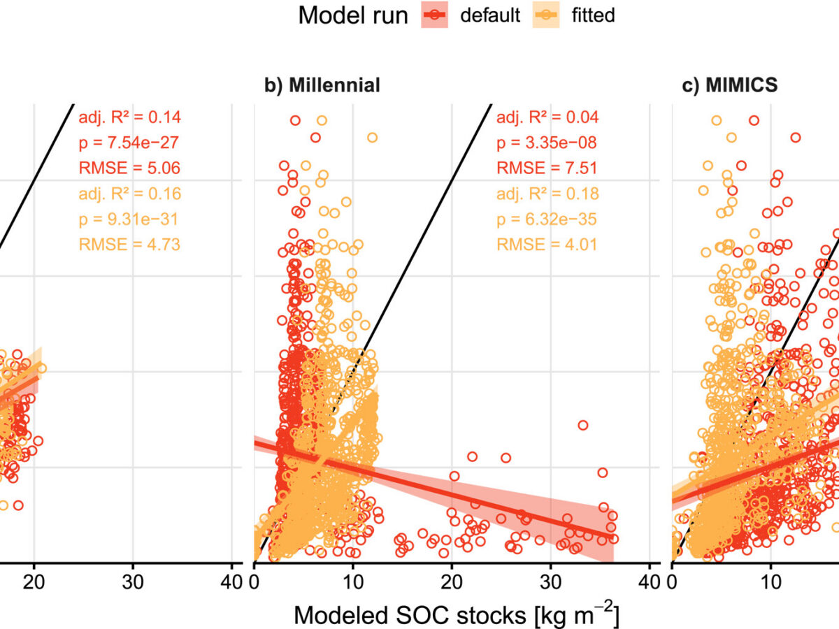
Popular soil biogeochemistry models inadequately represent regionally-important processes and lack transferability, resulting in poor predictions of soil organic carbon stocks in sub-Saharan Africa.


Posted inResearch Spotlights
As Wildfires Increase in the West, So Does Suppression Spending
A new study projects the intertwined relationship between fires and the money spent fighting them.
Posted inResearch Spotlights
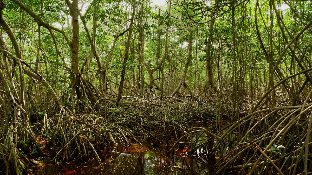
Mangroves May Be Losing Their Grip on Carbon Storage as Sea Levels Rise
Locally, mangroves can sometimes adapt to rising seas, but global trends look troubling.

Posted inEditors' Vox
Small-Scale Indian Ocean Dynamics Underpin Marine Ecology and Climate
With unique monsoon, mesoscale and submesoscale processes, the Indian Ocean offers critical insights and new challenges to achieving a full understanding of marine environments and the Earth system.

Posted inResearch & Developments
Judge Blocks NSF From Dismantling NCAR
“NSF’s failure to provide any explanation for its decision—let alone a reasonable one—thwarts meaningful judicial review and renders the challenged action arbitrary and capricious,” the judge wrote.
Posted inEditors' Highlights
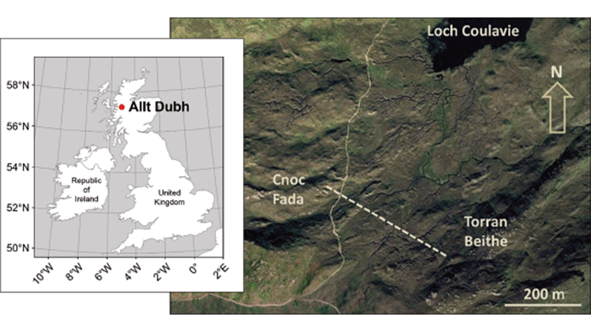
Model of Complex Blanket Bog Improves Prediction of Peat Expansion
Peat expansion is tightly coupled to the global climate cycle. As a nature-based solution to climate change, we need to know how they will respond to different climate scenarios.
Posted inResearch Spotlights
The Surprising Link Between a Cold Blob and the Indian Monsoon
Climate processes that at first glance appear separate can actually be intimately linked, modeling shows.