In the Philippines, an incredibly useful manual has been published that guides local government agencies in preparing for and responding to landslides. The Philippines has a long term landslide problem, with most events being triggered by either rainfall associated with typhoons or by earthquakes. However, the Philippines is also proactively trying to manage the losses […]
disaster preparedness
Posted inNews
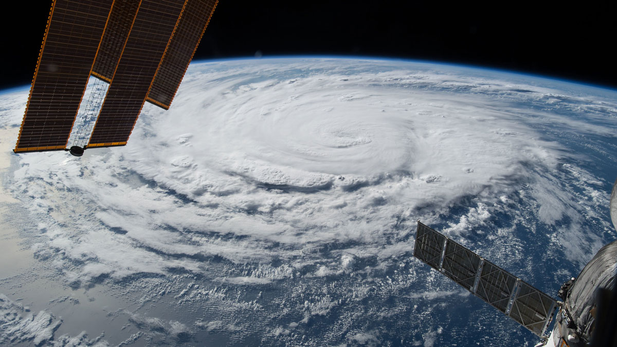
NOAA Forecasts a Below-Average Hurricane Season
A potentially record-breaking El Niño may reduce the likelihood of storms, but the agency still stressed the importance of preparedness.
Posted inOpinions
The Genesis Mission Needs Hydrology: Here’s How to Incorporate It
By positioning water security as one of the “most challenging problems of this century,” the Genesis Mission can become the sandbox in which AI reshapes how the United States measures, models, and manages water.
Posted inResearch & Developments
Partial Shutdown Over DHS Funding Ensnares Education, Health
The U.S. government entered a partial shutdown Saturday at 12:01 Eastern after the Senate failed to resolve a showdown over funding for DHS and restrictions on ICE.
Posted inNews
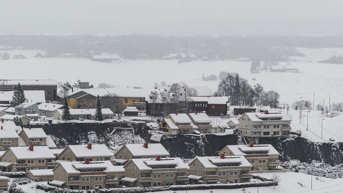
Insights for Making Quick Clay Landslides Less Quick
In a quick clay landslide, solid soil liquefies suddenly, sometimes washing over entire towns. New modeling examines what kinds of salts could help stabilize these clays.
Posted inOpinions
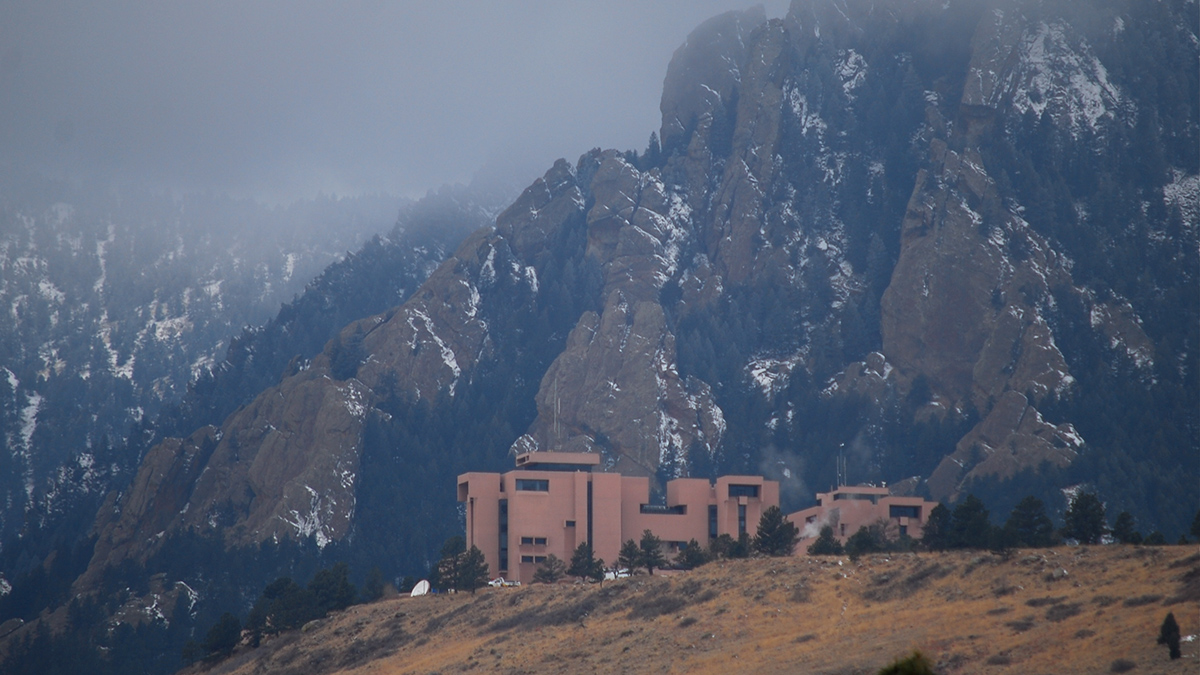
What Americans Lose If Their National Center for Atmospheric Research Is Dismantled
Five ways dismantling NCAR will cost the American people, and two ways to save it.
Posted inOpinions
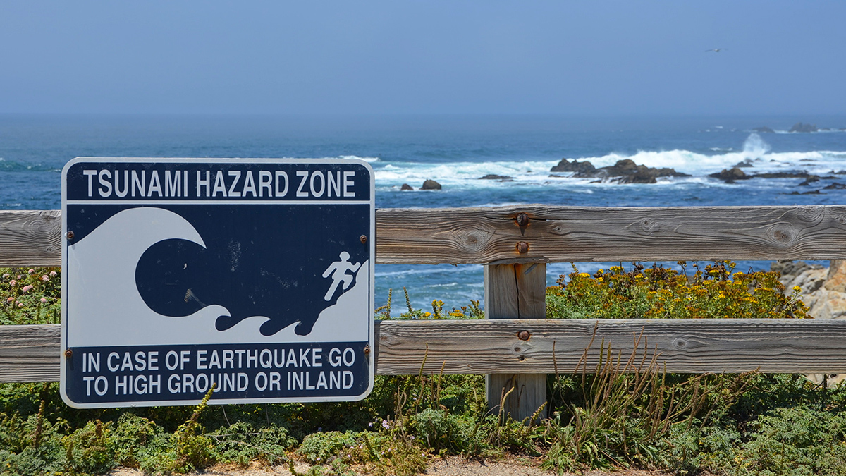
When Should a Tsunami Not Be Called a Tsunami?
It’s time to redefine the term so it more clearly conveys meaningful risks to coastal communities and prompts them to act when needed.
Posted inNews
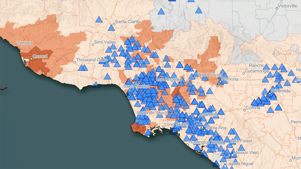
New Tool Maps the Overlap of Heat and Health in California
CalHeatScore creates heat wave warnings for every zip code in California, using temperature data, socioeconomic indicators, and the history of emergency room visits, to predict heat-related health risk.
Posted inNews
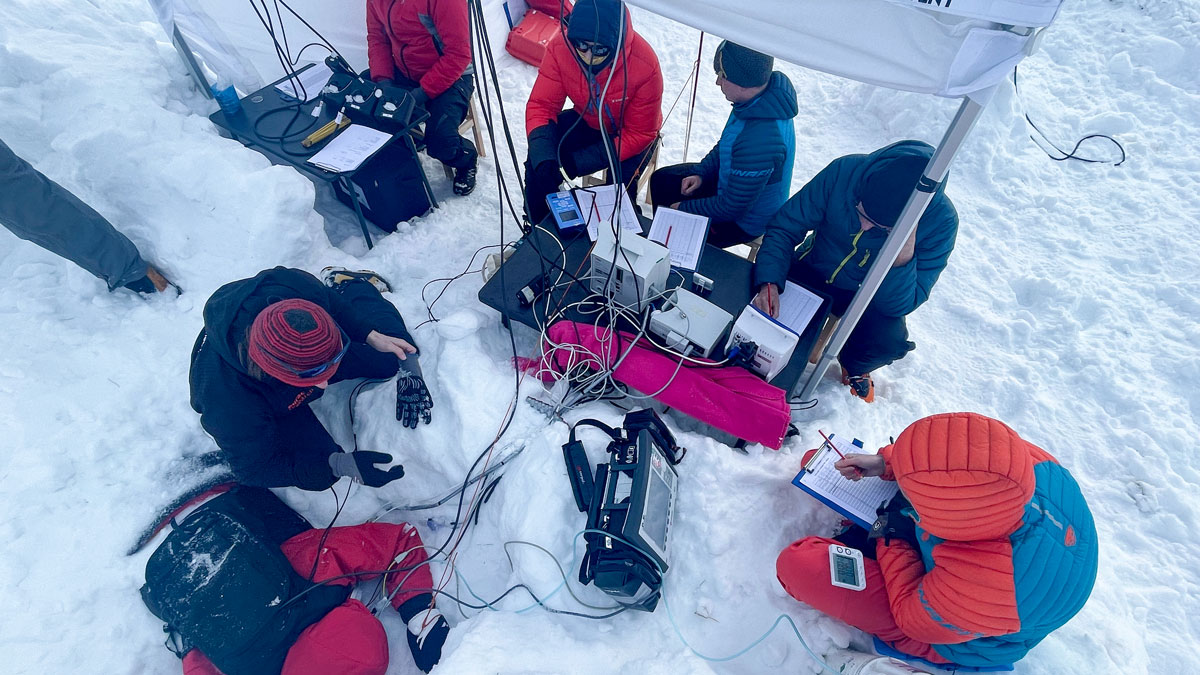
Safety Device Supplies Life-Saving Air in an Avalanche
An Alpine medical team buried 24 volunteers in a mountain pass. Their study confirmed the efficacy of the Safeback SBX, which uses snow’s natural porosity to supply air to buried avalanche victims.
Posted inResearch & Developments
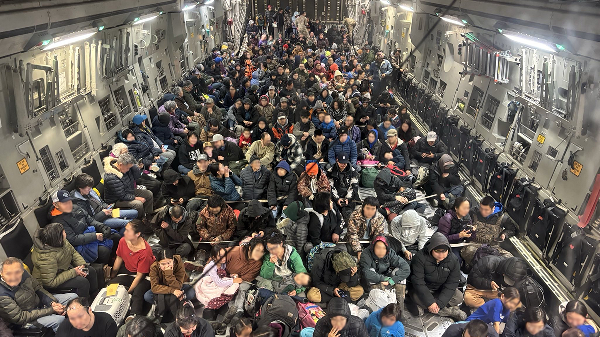
Alaska Awaits Response from FEMA in the Aftermath of Major Floods
Major floods in Alaska have caused the death of at least one person and displaced thousands more over the course of the last two weeks. Many of the displaced may not be able to return home for 18 months or longer, according to Alaska Gov. Mike Dunleavy.