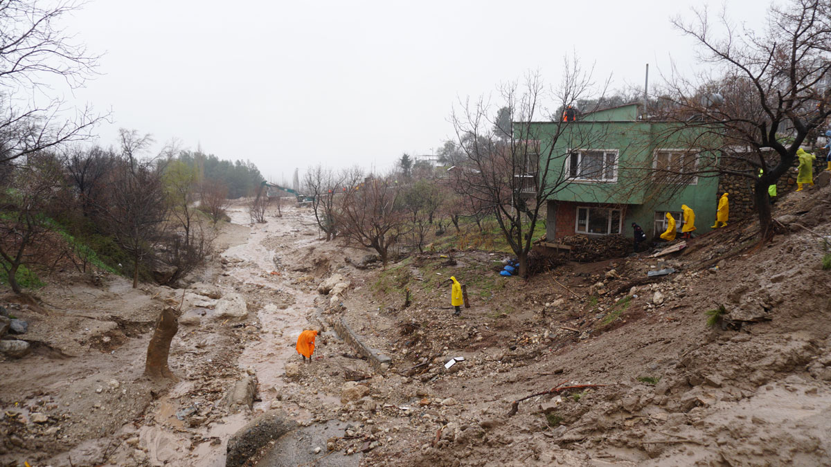
A new study reveals how an atmospheric river led to more devastation after two earthquakes hit Türkiye and Syria, highlighting the need for better risk assessment models.
disaster preparedness
Posted inEditors' Highlights
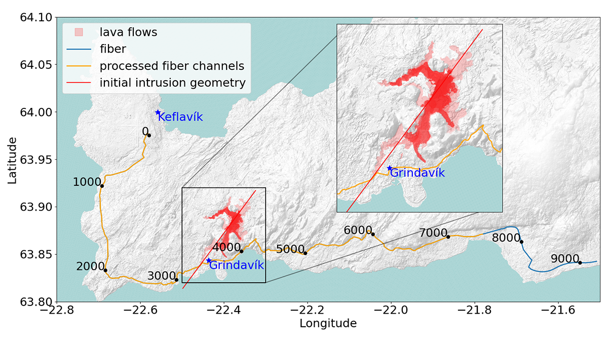
Observing Magma-Induced Seismic Velocity Changes with Fiber-Optics
A new high-resolution method for tracking volcanic activity utilizes fiber-optic sensing to detect magma intrusion by measuring seismic velocity changes.
Posted inNews
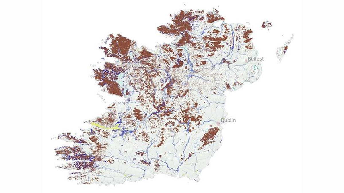
Where the Wetlands Are
Researchers have crafted the most comprehensive map yet of Europe’s wetlands.

Posted inNews
U.S. Power Grids are Vulnerable to Extreme Weather
Different kinds of severe weather, including multiple kinds at once, have different impacts on the grid in different places.

Posted inEditors' Highlights
Using Satellite Data for More Effective Disaster Response
Satellite data play a crucial role in disaster assessment and response. Meeting expanding demand requires not only accelerated data processing but increased collaboration with responders.

Posted inNews
Improving Earthquake Early Warning Access for the Deaf Community
Earthquake early warning systems are rarely accessible to people who are deaf or hard of hearing. A group of scientists is working to change that.
Posted inNews
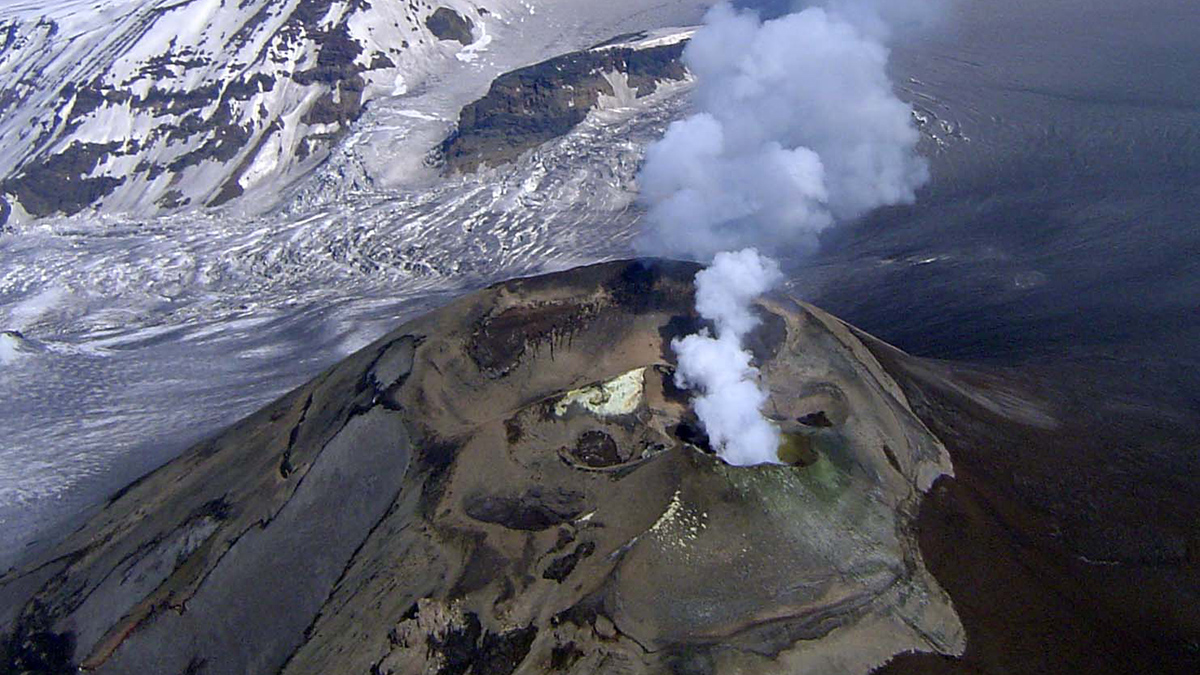
Alaska’s Mount Veniaminof Volcano Is Stealthy—Here’s Why
New research explains why Mount Veniaminof erupts without the usual warming signs.

Posted inENGAGE, News
Water Testing Builds Trust in Science as Maui Communities Recover
Following fires that ravaged the island in 2023, researchers educated residents about how wildfires affect water quality, and gathered data to determine how wildfire impacts change over time.

Posted inENGAGE, News
Seismometers Track Atmospheric Shock Waves from Incoming Space Debris
A Chinese spacecraft that burned up high over Los Angeles created a sonic trail detected by ground-based sensors.
Posted inNews
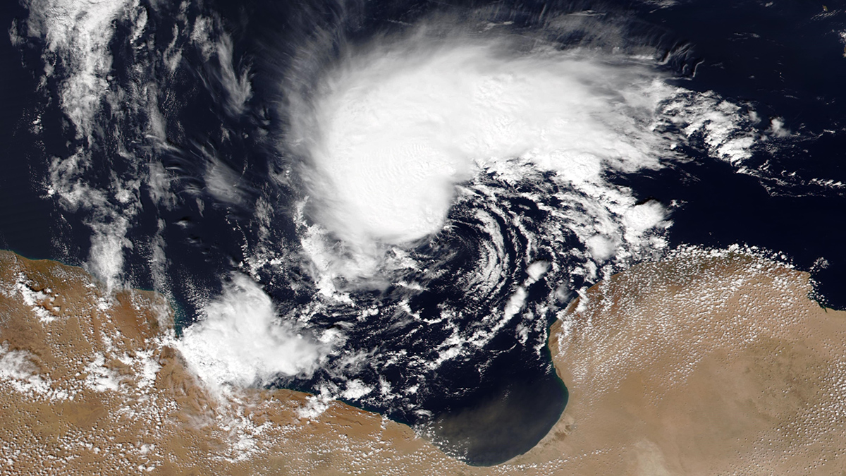
Torrents of Sediment-Laden Water Worsened Disastrous Libyan Floods
Drought followed by torrential rain can unleash deadly floods in arid regions, like those that affected Libya in 2023.