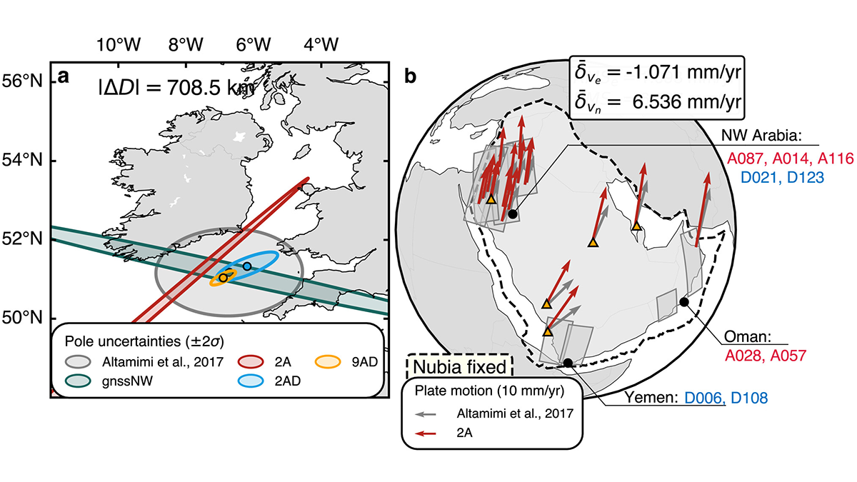
A new method integrates Interferometric Synthetic Aperture Radar (InSAR) with conventional ground geodetic networks, taking us closer to high-resolution mapping of plate motions.
Editors’ Highlights
Posted inEditors' Highlights
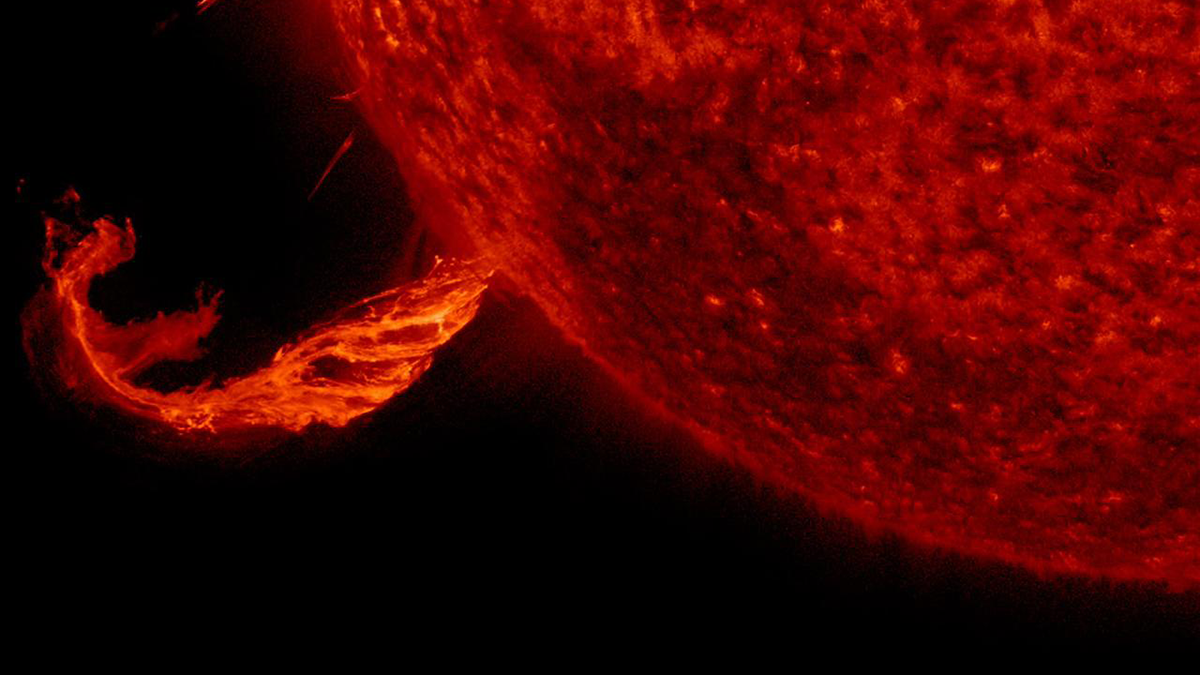
Why Subsequent ICMEs are More Geoeffective
A new study demonstrates how an interplanetary coronal mass ejection (ICME) clears the path for following transients and explains why subsequent ICMEs are more geoeffective.
Posted inEditors' Highlights
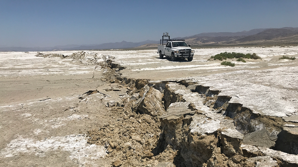
New Insights into How Rocks Behave Under Stress
New 3D imaging techniques show hidden patterns of stress that help explain how and why rocks break.
Posted inEditors' Highlights
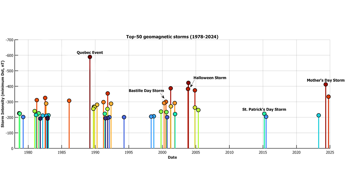
The Power of Naming Space Weather Events
Mother’s Day Storm? Why not! Bastille Day Storm? Mais oui! Space scientists make the case for a standardized naming convention for geomagnetic storms, to increase public awareness and preparedness.
Posted inEditors' Highlights
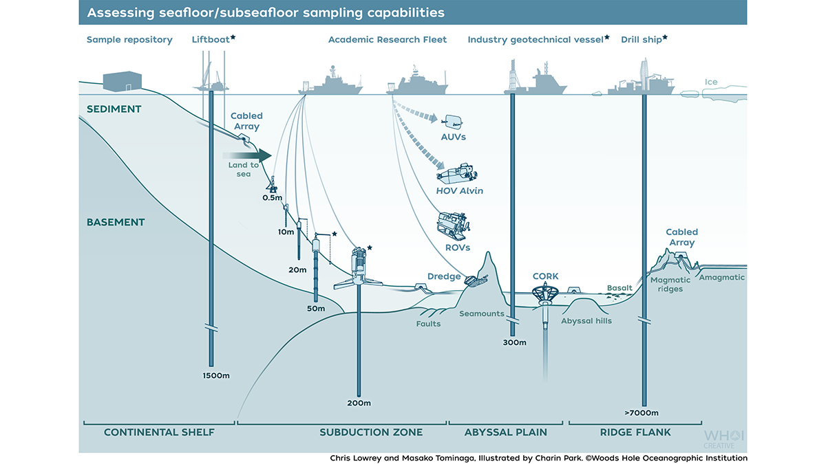
Scientists Face Limitations Accessing Seafloor Information
Recent reductions in U.S. oceanographic assets are limiting scientists’ ability to access vital materials in the ocean.
Posted inEditors' Highlights
Midlatitude Storm Dynamics Better Explained by Lagrangian Analysis
Examining the growth of storms using ERA-5 reanalysis data reveals a nonlinear relationship between baroclinicity and storm activity under extreme conditions.

Posted inEditors' Highlights
Defining the Tropopause in Chemical Transport Models
Synthetic tracers are useful in defining the chemically-heterogeneous tropopause in chemical transport models, especially where more traditional gradient-based tropopause methods may be lacking.
Posted inEditors' Highlights
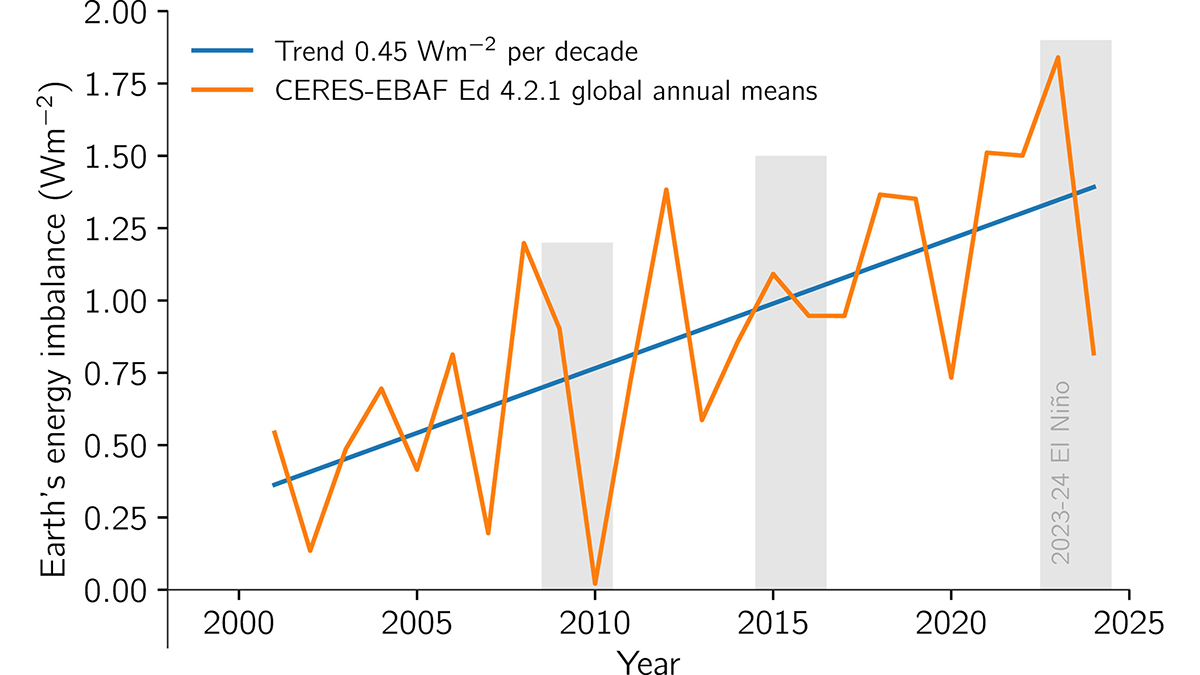
Earth’s Energy Imbalance is Growing Faster Than Expected
Satellite observation of the imbalance between incoming and outgoing radiation in the atmosphere, which causes global warming, shows growth beyond what climate models have predicted.
Posted inEditors' Highlights
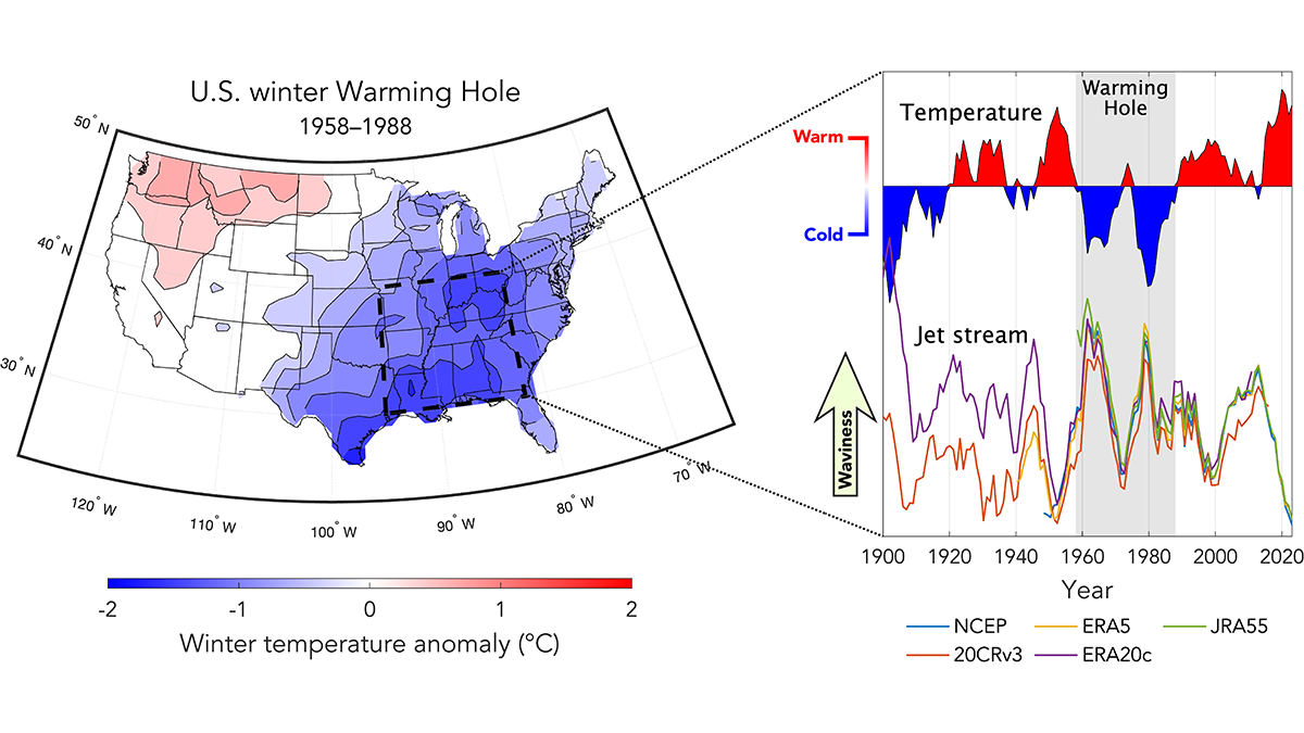
The Mid-20th Century Winter Cooling in the Eastern U.S. Explained
A new analysis of historical jet stream behavior reveals that increases in jet stream waviness accounted for 55-71% of winter cooling in the eastern United States from 1958 to 1988.

Posted inEditors' Highlights
Deep Root Respiration Helps Break Down Rocks
The carbon dioxide that results from respiration in and around deep roots is an essential component in the chemical weathering of sandstone rock soils.