Using in-situ observational data, scientists reveal that Kuroshio intrusions through the Luzon Strait increase small phytoplankton in the South China Sea.
Editors’ Highlights
Posted inEditors' Highlights
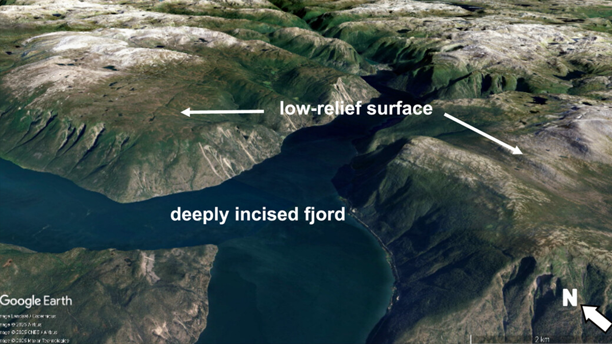
High Relief, Low Relief — Glaciers Do It All
Contrary to conventional wisdom that glaciers just carve landscapes, they can also form low-relief surfaces by sheltering rock from erosion, enriching understanding of how mountain landscapes evolve.
Posted inEditors' Highlights
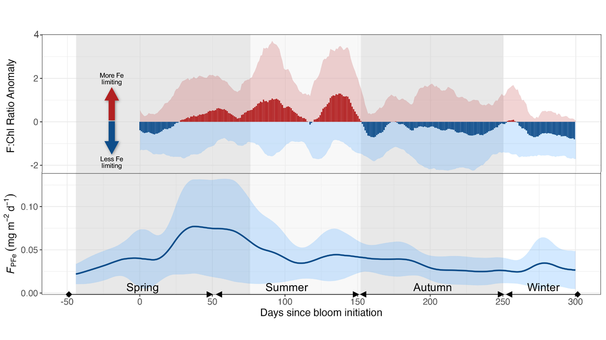
Seasonal Iron Cycle and Production in the Subantarctic Southern Ocean
Long-term monitoring at a site in the subantarctic region south of Australia combined with ship-based observations reveals three distinct phases between cycles of phytoplankton productivity and dissolved iron.
Posted inEditors' Highlights
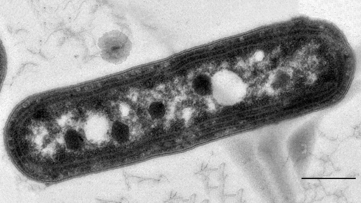
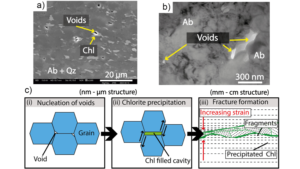
Creep Cavitation May Lead to Earthquake Nucleation
Ultramylonites, rocks of ultrafine grainsize, bring records of nanometer-scale cavities generated at the base of seismogenic crust along Japan’s largest on‐land fault.

Posted inEditors' Highlights
Rock Solid Augmentation: AI-Driven Digital Rock Analysis
Boosting digital rock images with AI-powered augmentation and quality analysis could improve subsurface engineering decisions.
Posted inEditors' Highlights
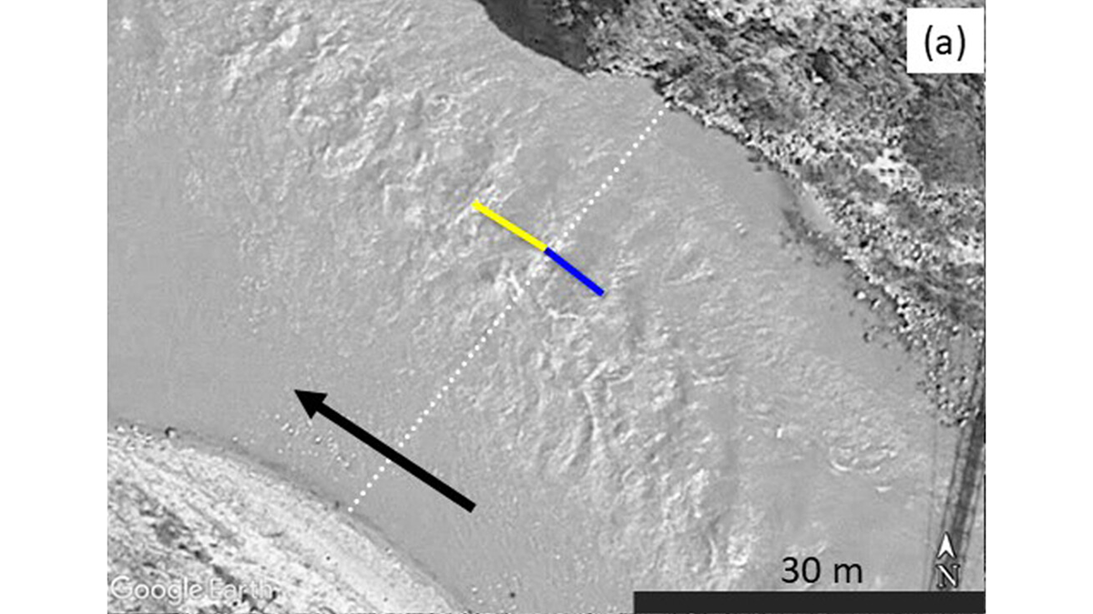
Inferring River Discharge from Google Earth Images
Critical flow theory can predict river discharge based on the spacing of standing waves captured by Google Earth images.

Posted inEditors' Highlights
Bringing Storms into Focus
A new study evaluates the performance of kilometer-scale models in predicting large tropical storms, which are key drivers of extreme rainfall and severe weather.
Posted inEditors' Highlights
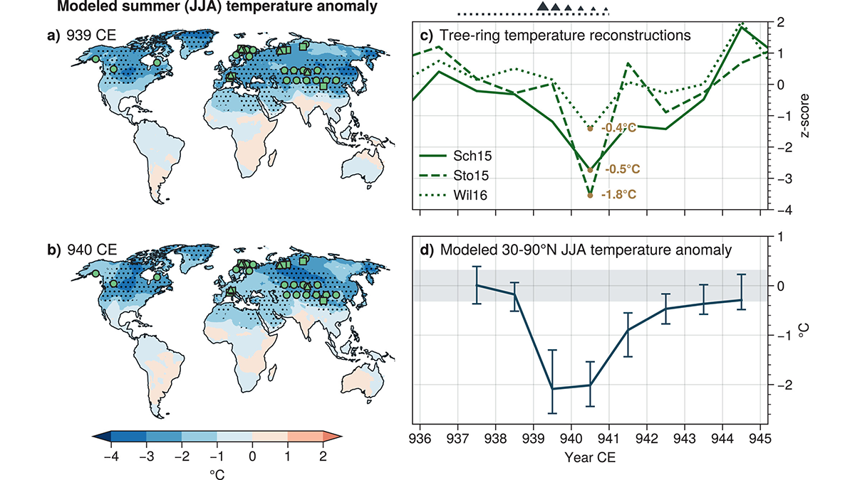
Revised Emissions Show Higher Cooling in 10th Century Eruption
The associated cooling from the Eldgjá eruption is larger than previously predicted and better matches tree-ring temperature reconstructions based on updated estimated emissions.

Posted inEditors' Highlights
Old Forests in a New Climate
It’s usually cooler under a forest than outside the forest, but that natural temperature buffering didn’t make global warming any less strong during the last 45 years in an old-growth forest of Oregon.
Posted inEditors' Highlights
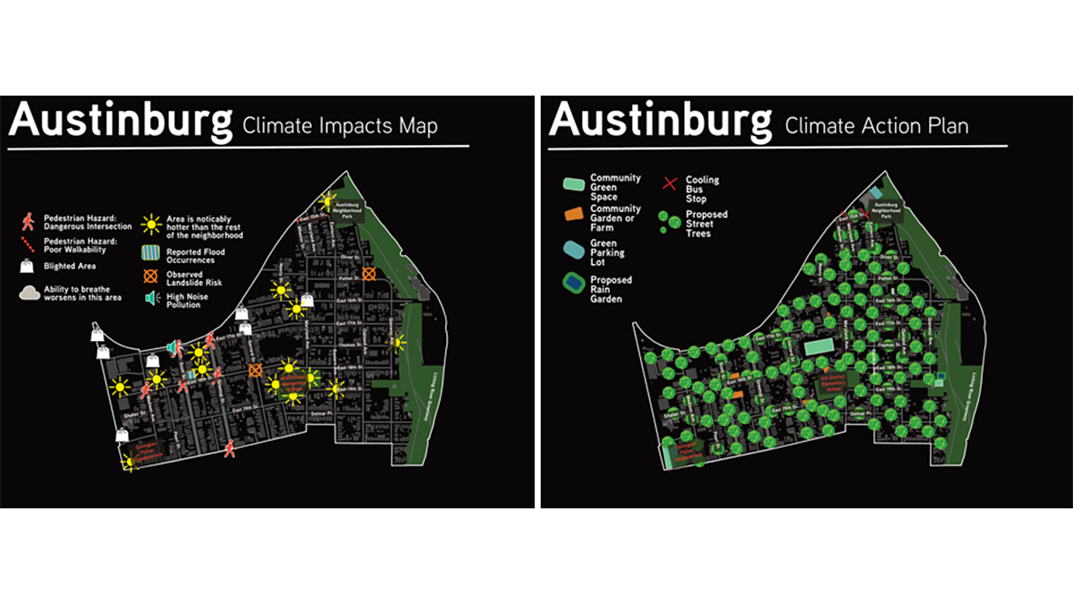
Resilient Solutions Involve Input and Data from the Community
Data dashboards assist in understanding a community’s vulnerability to climate impacts, but input from the communities themselves helps identify and support actionable solutions.