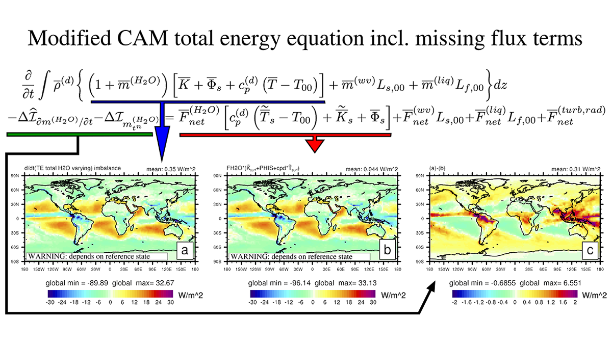
Researchers review the challenges and prospects of Earth System Models that incorporate a consistent closed energy budget.
Editors’ Highlights
Posted inEditors' Highlights
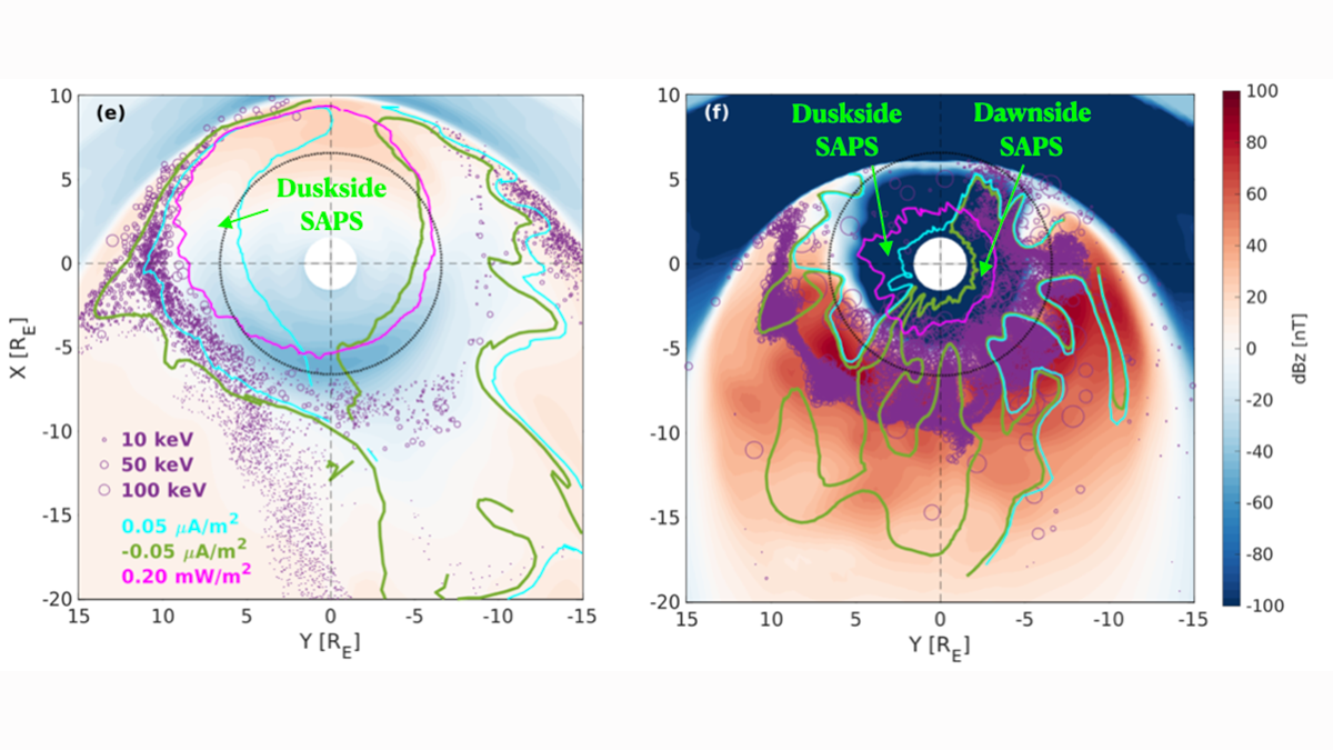
Origin of Dawnside Subauroral Plasma Flows in Geomagnetic Storms
Geomagnetic storms induce fast plasma flows next to the aurora and affect space weather. Lin et al. explain the origin of a special “dawnside” plasma stream that occurs only during extreme storm events.
Posted inEditors' Highlights
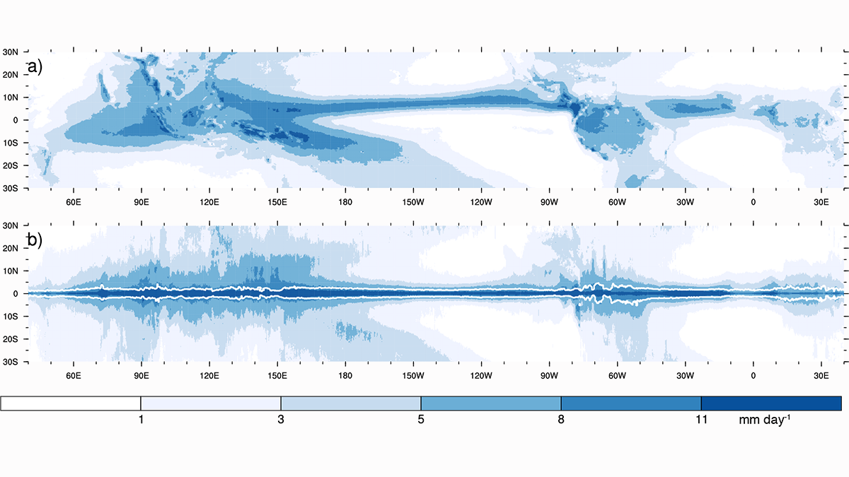
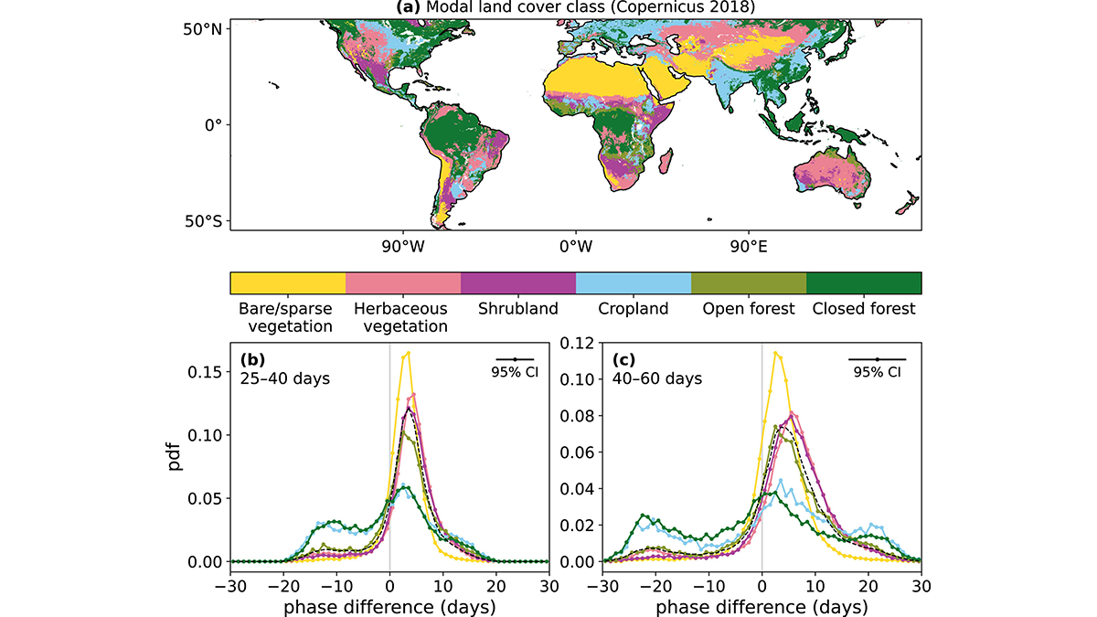
Why Does It Rain So Much Over Tropical Land?
Analyses of observations show that tropical land receives more rain than its fair share, owing to a proposed negative feedback that is not captured in current climate models.

Posted inEditors' Highlights
The Long-Lasting Impact of a Nuclear War on the Ocean
Model simulations of the impact of a large-scale nuclear war reveal long lasting effects with much of the ocean not returning to pre-war levels despite the cessation of the initial cooling.
Posted inEditors' Highlights
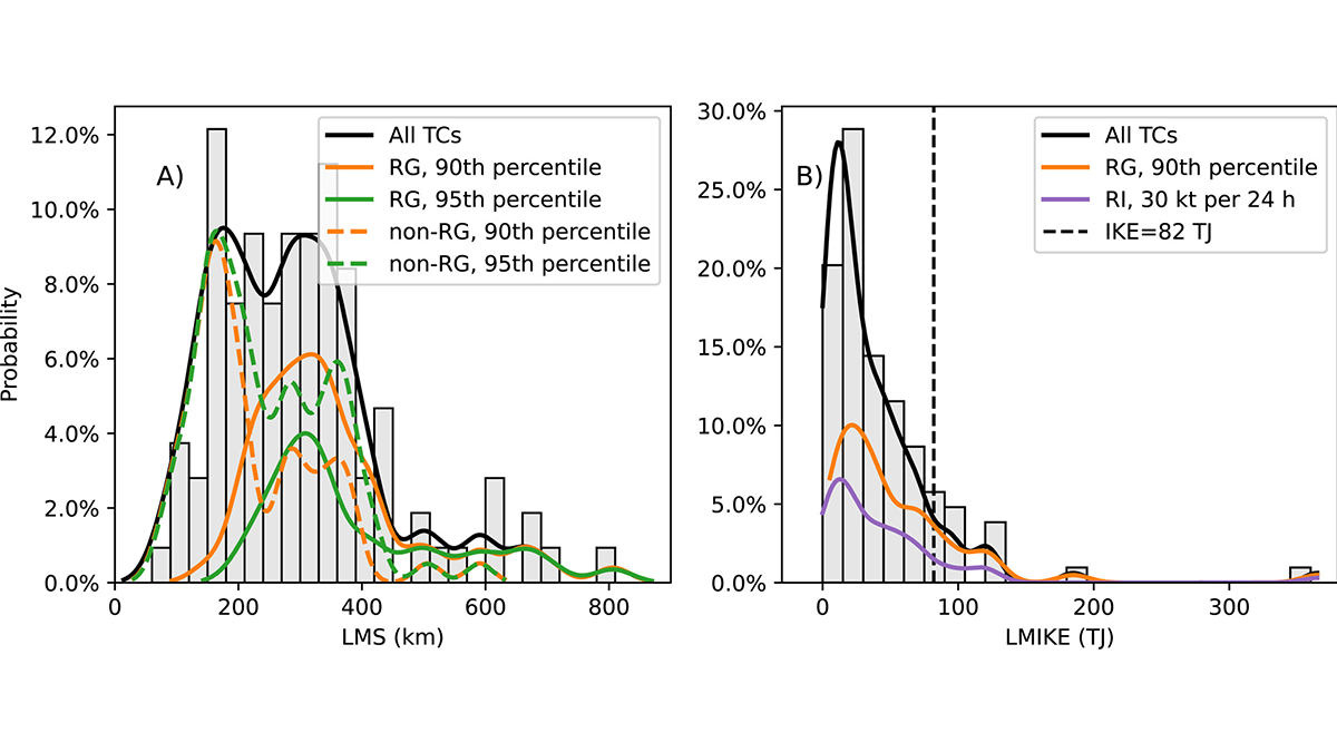
The Rapid Growth of Tropical Cyclones’ Outer Size – A New Concept
A new study focuses on the rapid growth of tropical cyclones and their destructive potential.
Posted inEditors' Highlights
Quantifying Changes in Midlatitude Subseasonal Prediction Skill
The differences between future and present subseasonal predictability in the Northern Hemisphere provided by the tropics are evaluated using neural networks.

Posted inEditors' Highlights
Oceans Warming Increases Xinjiang’s Precipitation, but Scarcity Stays
A transition toward an unusually wet condition due to ocean surface warming-induced increased precipitation will not alleviate the water scarcity risk in Xinjiang, China.
Posted inEditors' Highlights
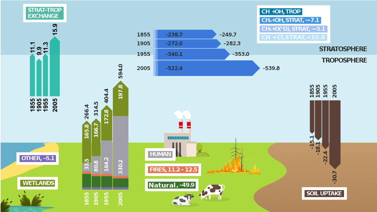
A Significant Advancement in Modeling the Global Methane Cycle
The capability to fully model the global methane cycle advances the international climate science community’s ability of providing essential evidence to underpin climate mitigation policy.
Posted inEditors' Highlights
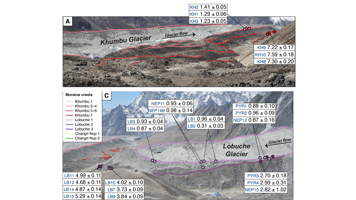
Glacier Advance and Retreat: Insights From the Top of the World
New dating of glacial features reveals predictable glacier behavior in response to climate warming and cooling in the Everest region in the past 8,000 years.

Posted inEditors' Highlights
Probing the Sedimentology of a Continental Megathrust
Detailed analysis of sediments covering the Main Frontal Thrust in Nepal show how climate-driven baselevel changes affect sedimentation and should be considered when inferring thrust activity.