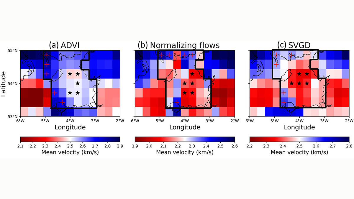
Fundamental questions on subsurface properties are robustly addressed through probabilistic assessment of multiple forward/inverse modelling formalisms using interrogation theory.
Editors’ Highlights

Posted inEditors' Highlights
Arctic Sea Ice is Crucial for Forecasting Ural Blocking
By solving the nonlinear optimization problem, sea ice concentration in Greenland, Barents and Okhotsk Seas is found crucial for prediction of strong and long-lasting Ural blocking formation.

Posted inEditors' Highlights
Arctic Ozone Loss Brings Warming to the Near Surface
New research confirms that ozone loss over the Arctic can lead to widespread warming near the Artic surface during late winter and early spring.

Posted inEditors' Highlights
First Solar Wind Plasma Observations from the Tianwen-1 Mission
Solar wind plasma data captured by the Tianwen-1 probe while in transit to Mars represent an important step toward a new era of cooperative Martian space exploration.
Posted inEditors' Highlights
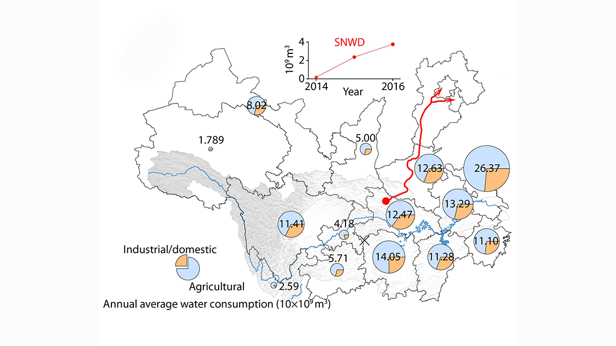
Improved Understanding of Runoff Dynamics in the Yangtze River Basin
Satellite data combined with in-situ observations on terrestrial water storage change and human water consumption provides a more accurate picture of runoff dynamics at sub-basin scale.

Posted inEditors' Highlights
Zircons and Plate Tectonics
New data on ancient zircons points to a transition from stagnant lid to subduction style tectonics at 3.6 Ga ago.

Posted inEditors' Highlights
Meteoric Ions Influence Conductance in the Jovian Ionosphere
Meteoric ions dominate the Jovian lower ionosphere due to their long lifetimes. Due to the large densities of the meteoric ions, conductance is enhanced independently of local time.
Posted inEditors' Highlights
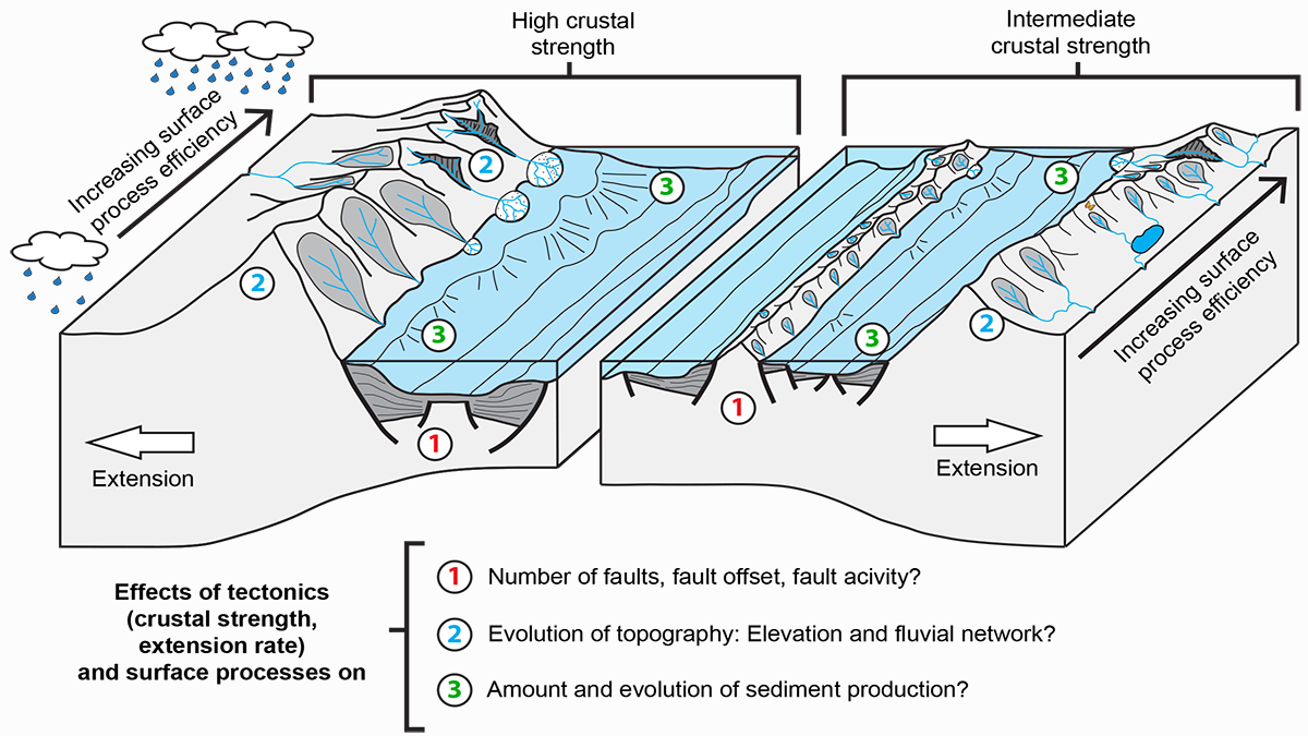
The Lost Topography Around Continental Rifts
Numerical models provide quantitative constraints on topography lost to erosion, showing how the sediment influx in a sedimentary basin reflects its tectonic and topographic evolution.
Posted inEditors' Highlights
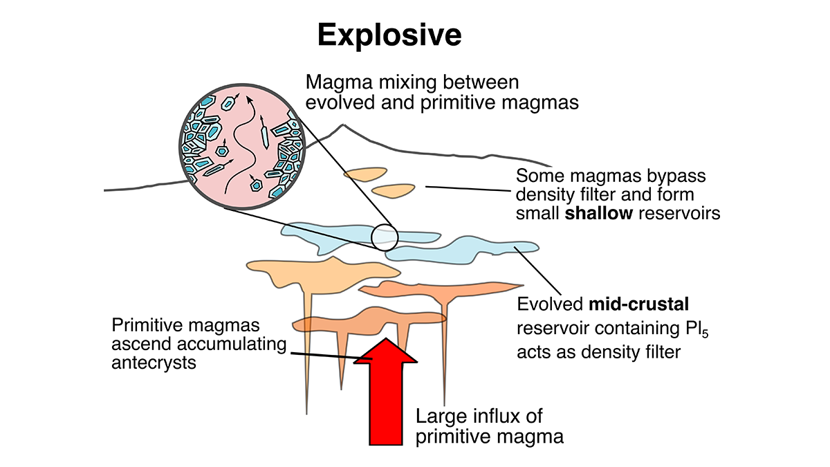
Machine Learning Helps See into a Volcano’s Depths
How big might future volcanic eruptions be? Crystals carry information to answer this and machine learning methods can visualize and interpret this multidimensional data.
Posted inEditors' Highlights
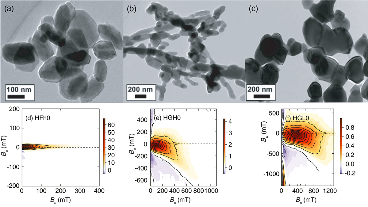
A Step Towards Understanding the Magnetic Properties in Hematite
Scientists present the most comprehensive available magnetic domain state and anisotropy study for synthetic and natural hematite from first-order reversal curve diagrams.