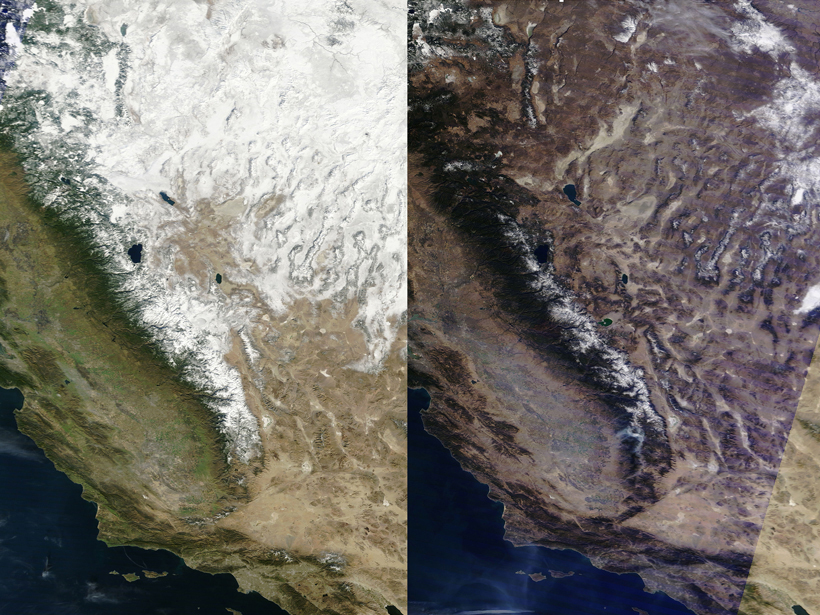
More than one sixth of the world’s population depends on freshwater runoff from glaciers and seasonal snowpack for their annual renewable water resources. Seasonal snow also contributes to dramatic changes in surface energy balance that is defined by the exchange of energy between the Earth’s surface and the overlying atmosphere over one third of all land areas on the Earth. Yet quantifying global snow totals remains challenging even after more than 4 decades of satellite observations. Historic drought conditions in the western United States have further highlighted the need for better monitoring and prediction of snowmelt runoff.
Microwave satellite remote sensing has been a key tool for measuring seasonal snowpack. Recent advances in the understanding of how snow microstructure relates to the microwave signatures of snow have galvanized the snow remote sensing community to try to improve retrieval accuracy. To this end, researchers met in July 2015 for the MicroSnow2 and SnowEx workshops at the Universities Space Research Association facility in Columbia, Md. The main goals of the meetings were to discuss the state of the art in microwave remote sensing of snow and to begin planning a snow experiment involving airborne remote sensing, in situ measurements, and modeling.
MicroSnow2 focused on how snow microstructure information can be used to examine model assumptions and to assess implications for remote sensing of snow.
The Microstructure in Snow Microwave Radiative Transfer 2 (MicroSnow2) workshop addressed micro- to macroscale in situ snow measurements, such as snow grain size, wetness, multiple layering, temperature, snow depth, and snow water equivalent. Building on the MicroSnow1 workshop in Reading, U.K., in 2014, organized by the European Space Agency, MicroSnow2 presenters focused on examining how snow microstructure information can be used in radiative transfer calculations to examine model assumptions and to assess implications for remote sensing of snow.
Even after 30 years of measuring snow water equivalents from space, large uncertainties remain. With an eye toward reducing these uncertainties, workshop participants began planning for SnowEx, a NASA field campaign being organized in coordination with international snow researchers. SnowEx will be a multiyear research effort consisting of airborne and in situ measurements and modeling designed to determine how to combine sensing techniques and supportive modeling to optimize the ability to measure snow properties from space. It also aims to help researchers figure out how to best use multisensor data to characterize terrestrial snow. SnowEx is scheduled to begin during the 2016–2017 Northern Hemisphere winter and will span 3 years.

It has been more than a decade since the last major airborne snow remote sensing campaign, the Cold Land Processes Field Experiment-1 (CLPX-1). This campaign was conducted during 2002–2003, from winter to early spring in the Rocky Mountains of the United States. CLPX-1 focused on developing quantitative evaluations of snow by using models and measurements to improve scientists’ understanding of cold water fluxes, storage, and transformations to regional and global scales. During CLPX-1, researchers conducted comprehensive airborne, tower-based, and in situ measurement campaigns. Even though snow science and its modeling capability have advanced since CLPX-1, there are still large gaps in the understanding of terrestrial snow processes.
SnowEx is designed to build and expand on CLPX-1. It will potentially provide water managers and climate scientists with detailed information to improve continental-scale monitoring of water resources from snowmelt runoff. With the ultimate goal of advancing scientists’ ability to measure snowpack properties via airborne and spaceborne sensors, the multiyear observations and fieldwork will seek to improve the accuracy of in situ measurements and the modeling of snow and its interactions with the ambient atmosphere and vegetation.
Acknowledgments
The meeting was organized by NASA Goddard Space Flight Center (Edward Kim and Dorothy Hall) and the Universities Space Research Association (Charles Gatebe and Ludovic Brucker), in collaboration with a joint effort of the European Space Agency (Melody Sandells and Nick Rutter) and Environment Canada (Chris Derksen). All of the organizing committees contributed to this article.
—Do Hyuk “DK” Kang, Universities Space Research Association, Columbia, Md.; email: [email protected]; Edward Kim, NASA Goddard Space Flight Center, Greenbelt, Md.; and Dorothy Hall, Earth System Science Interdisciplinary Center, College Park, Md.
Citation: Kang, D. H., E. Kim, and D. Hall (2016), Quantifying terrestrial snow from space, Eos, 97, doi:10.1029/2016EO046293. Published on 26 February 2016.
Text © 2016. The authors. CC BY-NC 3.0
Except where otherwise noted, images are subject to copyright. Any reuse without express permission from the copyright owner is prohibited.