Authors and Editors reflect on the lasting impacts of their books in honor of the AGU Books Program’s 70th anniversary.
remote sensing
Posted inNews
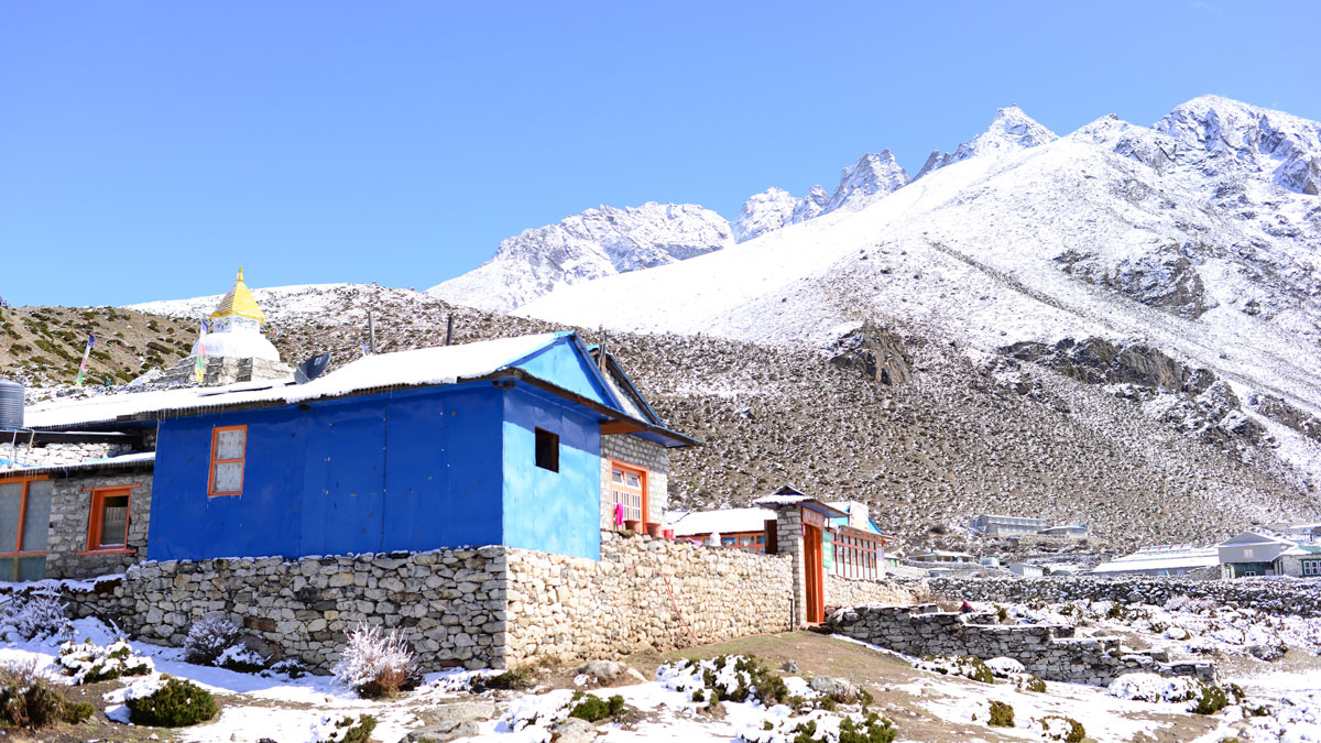
Vegetation Moves Upslope Across the Himalayas
The vegetation line in places like Nepal and Bhutan is shifting upward by meters per year, with implications for how water moves through the planet’s “Third Pole.”
Posted inScience Updates
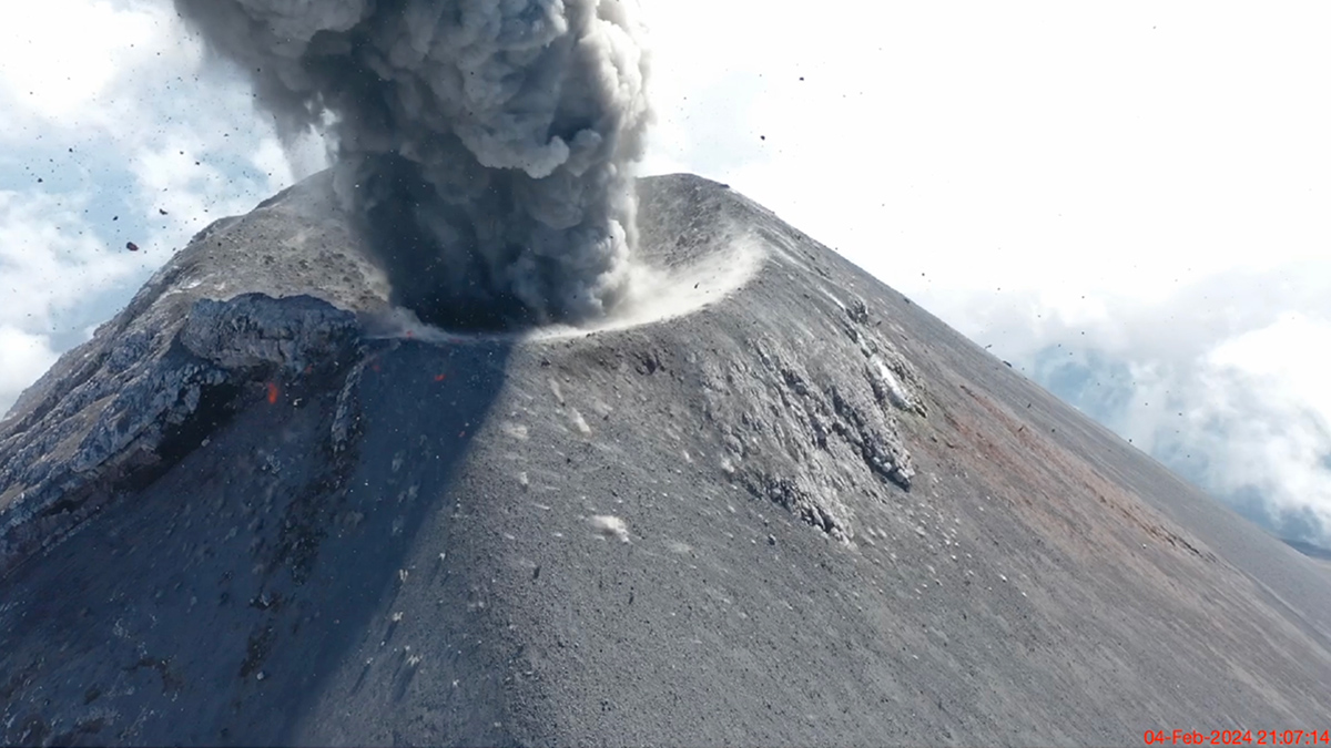
Sensing the Sounds from Earth’s Hazardous Environments
Low-cost infrasound sensors, deployed in large numbers, provide a practical means of data collection near volcanoes, earthquakes, wildfires, and other geophysical phenomena.

Posted inResearch Spotlights
How to Study Coastal Evolution
Researchers reviewed what’s known about how coastlines are changing and made recommendations for how to learn more.
Posted inNews
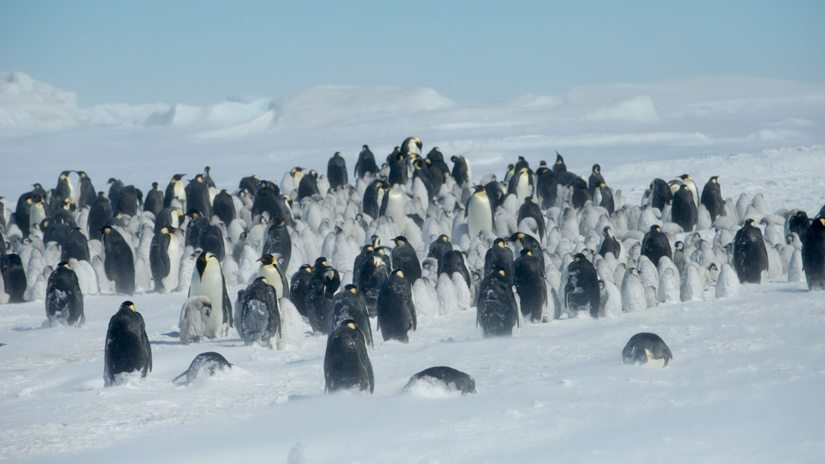
Shrinking Sea Ice Is Ruffling Emperor Penguins’ Feathers
A scientist stumbled upon evidence of penguin molting sites in satellite data, but the sea ice these birds rely on is disappearing.
Posted inEditors' Highlights
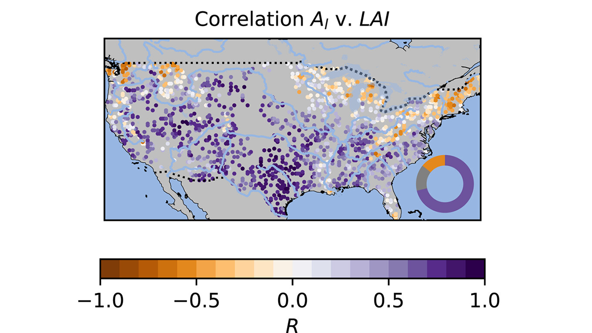
Trees Shed Their Leaves to Adapt to Droughts
The browning or loss of tree leaves that can be observed during droughts may be a coping mechanism to deal with dry circumstances by avoiding additional water stress.
Posted inScience Updates
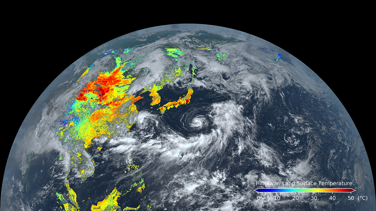
Geostationary Satellite Applications Expand into Land Monitoring
Known for their weather-observing prowess, these satellites can also track land surface processes and disturbances over broad areas in near-real time.

Posted inNews
The Northern Sargasso Sea Has Lost Much of Its Namesake Algae
There’s less than a tenth as much Sargassum as there was a few years ago, a shift that may be linked to increasing sea surface temperatures in the Gulf of Mexico.
Posted inNews
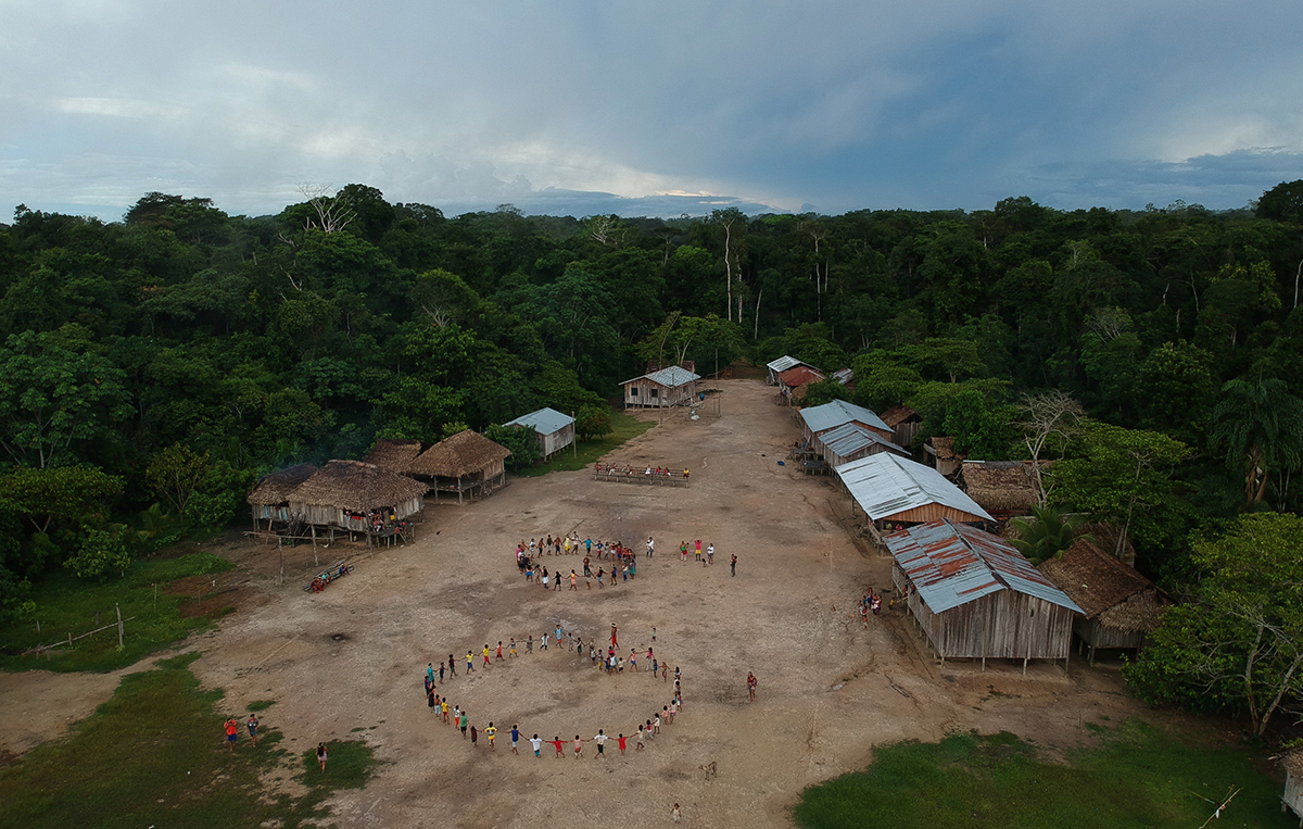
Fire Encroaches on One of the Amazon’s Most Pristine Indigenous Lands
New research shows how recurring wildfires in the buffer zones around Brazil’s Vale do Javari may undermine one of the Amazon’s last great refuges for isolated Indigenous peoples.
Posted inResearch Spotlights
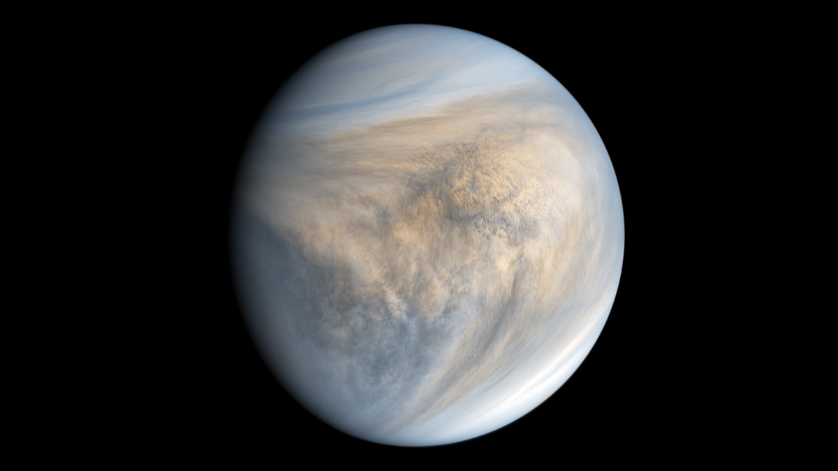
Key Driver of Extreme Winds on Venus Identified
A new study suggests that a once-daily atmospheric tidal cycle may be a bigger driver of rapid Venusian winds than previously thought.