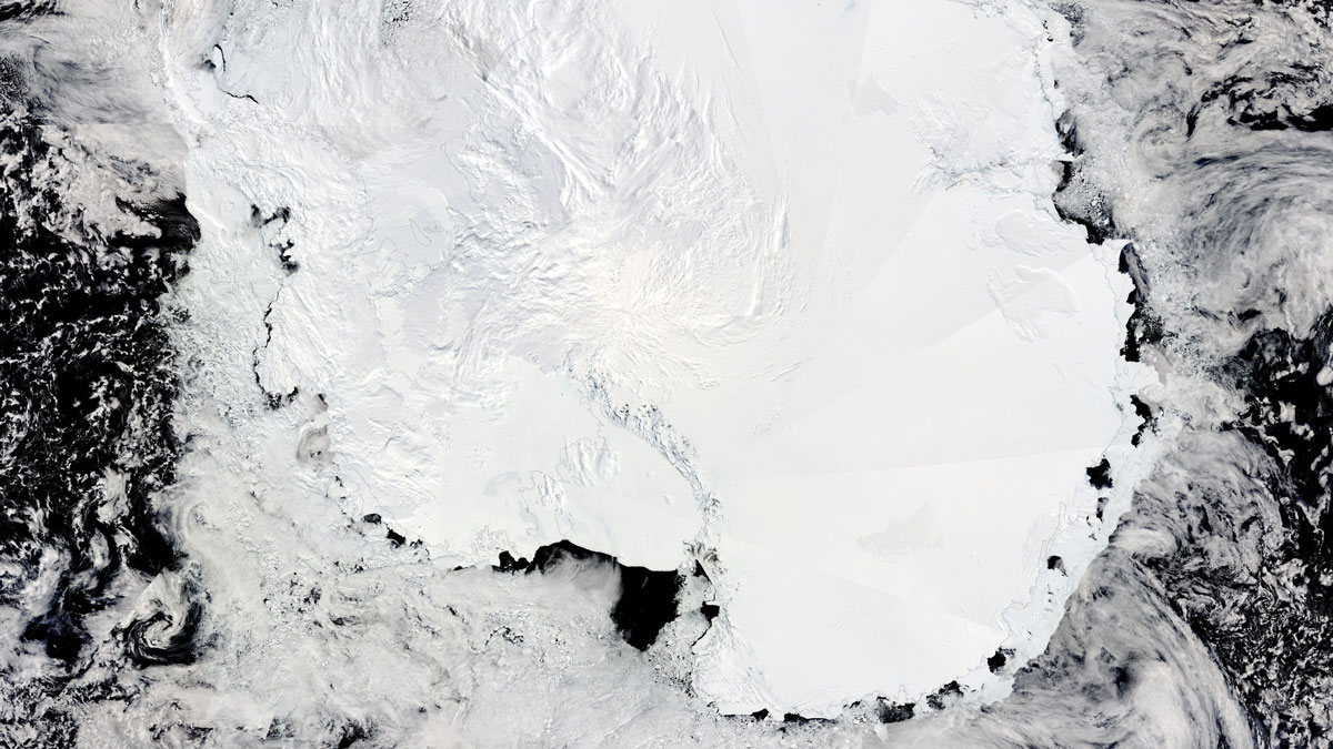
Radar altimetry observations have pinpointed 85 active subglacial lakes, shedding light on how water moves beneath the Antarctic Ice Sheet.
remote sensing
Posted inNews
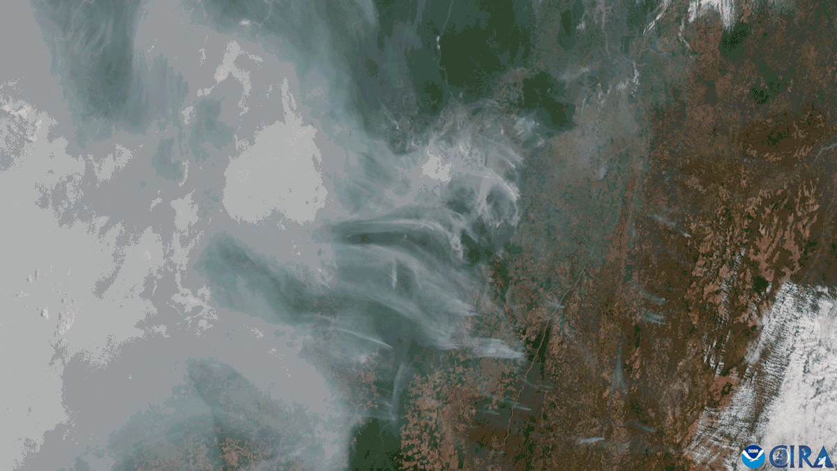
Fire, Not Deforestation, Is Now the Amazon’s Biggest Carbon Emitter
Forest degradation in the Amazon increased by 400% in 2024. It was largely driven by wildfires during the forest’s worst fire season in more than 20 years.
Posted inFeatures
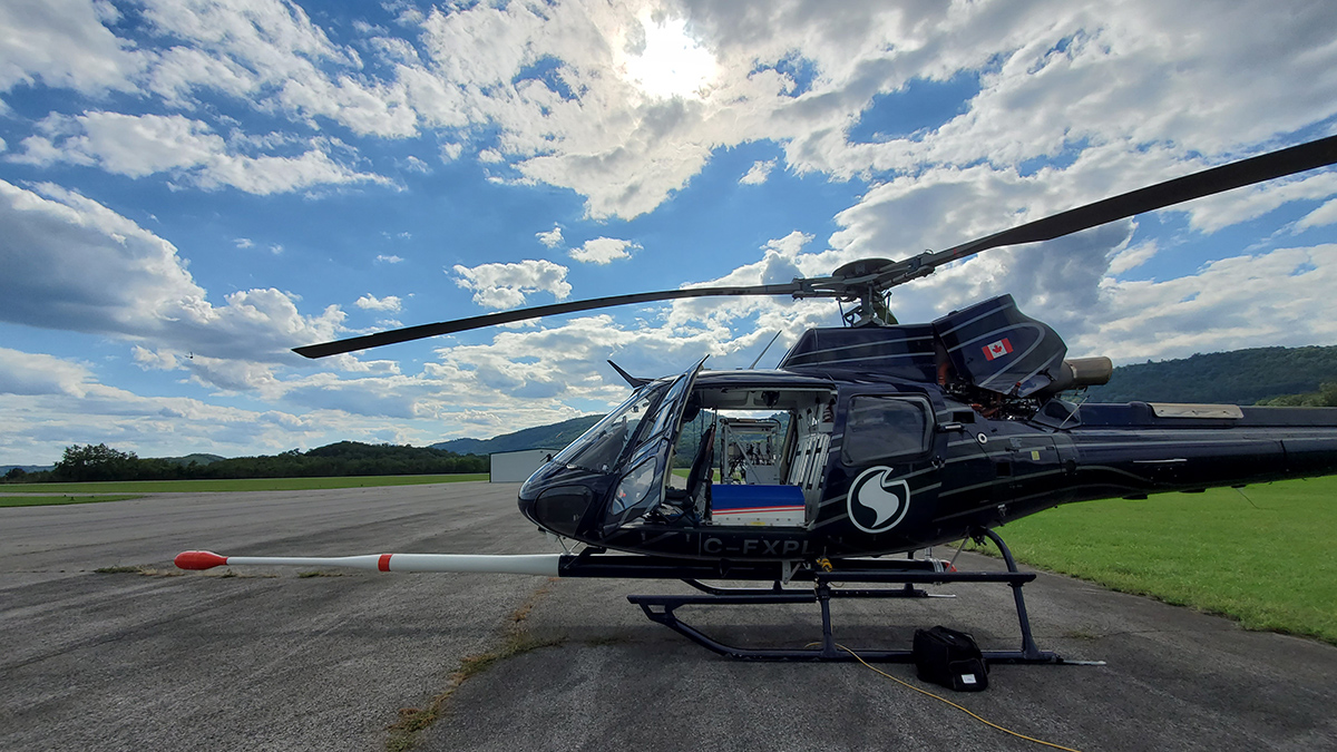
New Maps of Natural Radioactivity Reveal Critical Minerals and More
High-resolution airborne radiometric surveys are covering more ground than ever to provide insights into unseen geology, mineral resource potential, and possible health hazards.
Posted inNews
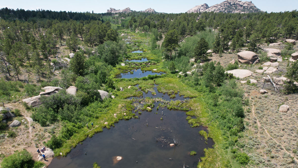
What Makes Beaver Ponds Bigger?
For the first time, researchers are able to add hydrologic estimates to find where reintroducing beavers could best benefit a watershed and the humans who live within it.
Posted inOpinions
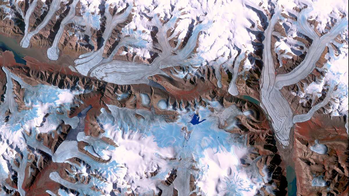
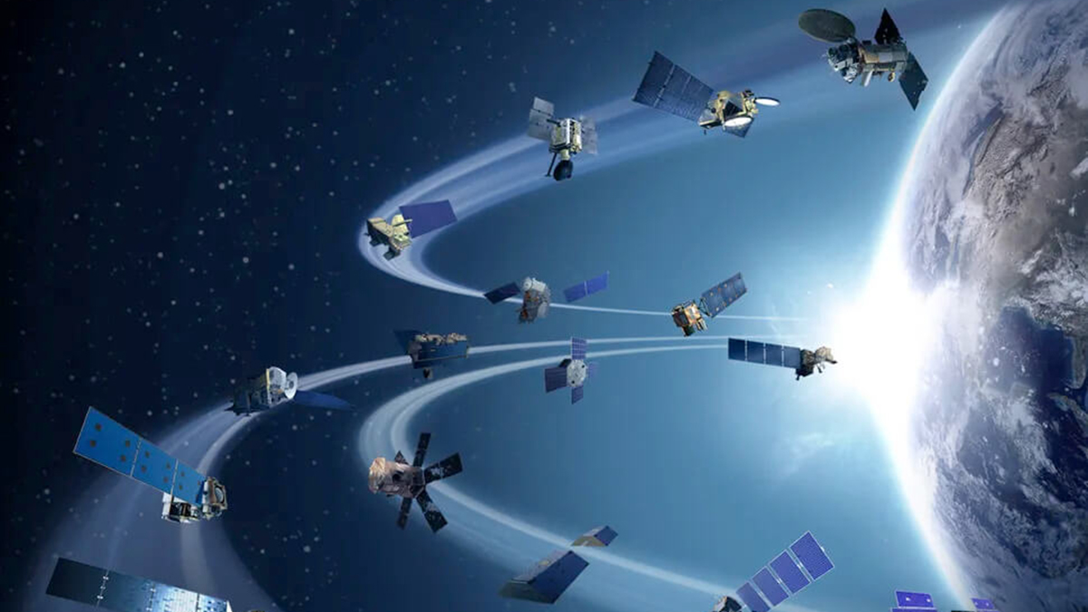
Glacier Monitoring from Space Is Crucial, and at Risk
A new community effort shows that Earth has lost 5% of its global glacier mass since 2000. The work highlights the necessity of spaceborne glacier observations and upcoming gaps in long-term monitoring.
Posted inEditors' Vox
JGR: Space Physics Launches New Instrumentation Article Type
JGR: Space Physics welcomes new and original developments in instrumentation including novel experimental methodologies that are relevant to space physics.
Posted inEditors' Vox
Rising Concerns of Climate Extremes and Land Subsidence Impacts
Increasing interplay among extreme events and land subsidence impacts calls for urgent mitigation and policy action to reduce detrimental ramifications to infrastructure and people.
Posted inEditors' Vox
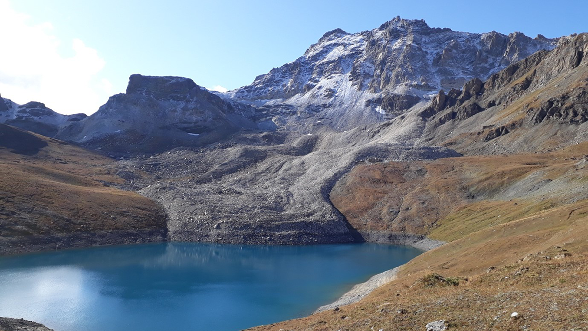
Rock Glacier Velocity: Monitoring Permafrost Amid Climate Change
The movement of unique landforms called “rock glaciers” give insight into how climate change is impacting permafrost in mountainous regions.
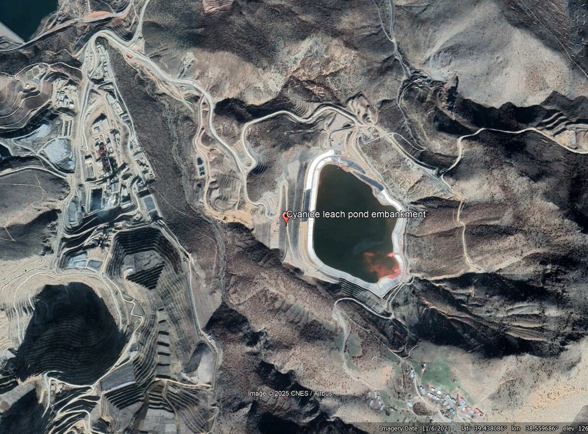
Posted inThe Landslide Blog
Seismic analysis to understand the 13 February 2024 Çöpler Gold Mine Landslide, Erzincan, Türkiye
The Landslide Blog is written by Dave Petley, who is widely recognized as a world leader in the study and management of landslides. On 13 February 2024, the enormous Çöpler Gold Mine Landslide occurred in Erzincan, Türkiye (Turkey), killing nine miners. This was the first of two massive and immensely damaging heap leach mine failures […]

Posted inEditors' Vox
Decoding Crop Evapotranspiration
The intricate factors influencing cropland evapotranspiration is uncovered in a new article, from stressors to diverse management practices, and reveals critical insights into changing climates.