
Long an anomaly among glaciers, advancing while most others shrank, Taku Glacier is starting to succumb to climate change, offering an unprecedented look at the onset of tidewater glacier retreat.
Alaska

Posted inNews
Experimentos Revelan Cómo el Carbono del Permafrost se Convierte en Dióxido de Carbono
Muestras de campo provenientes de Alaska muestran cómo la luz solar y el hierro convierten el carbono del permafrost en dióxido de carbono. Los modelos climáticos ignoran este proceso.
Posted inResearch Spotlights
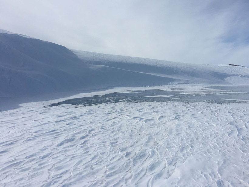
A Census of Snowdrifts in Northern Alaska
Snowdrifts prove less ephemeral than they might seem, occurring in the same places year after year.
Posted inScience Updates
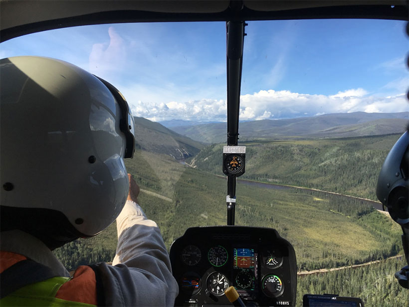
Ancient Rivers and Critical Minerals in Eastern Alaska
Fieldwork is revealing a history of landscape evolution over the past 5 million years that links climate change and river capture to critical mineral resources across the Alaska-Yukon border.
Posted inNews
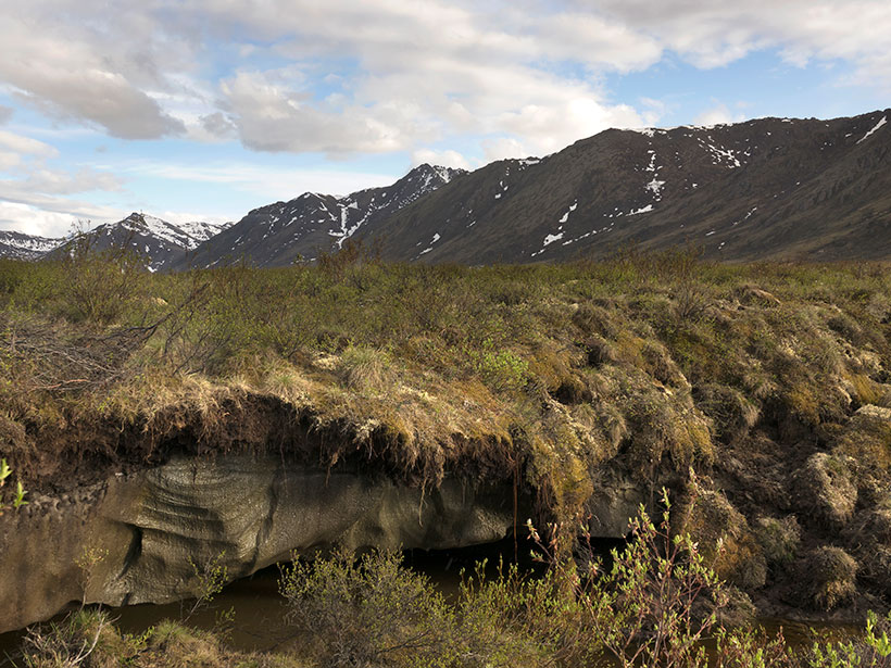
Experiments Reveal How Permafrost Carbon Becomes Carbon Dioxide
Field samples from Alaska show how sunlight and iron convert permafrost carbon to carbon dioxide. Climate models ignore this process.

Posted inOpinions
Building a Culture of Safety and Trust in Team Science
An Arctic research team of 150 members that implemented a culture of safety, inclusion, and trust as the foundation for cross-disciplinary science shares lessons from its experiences.
Posted inEditors' Highlights
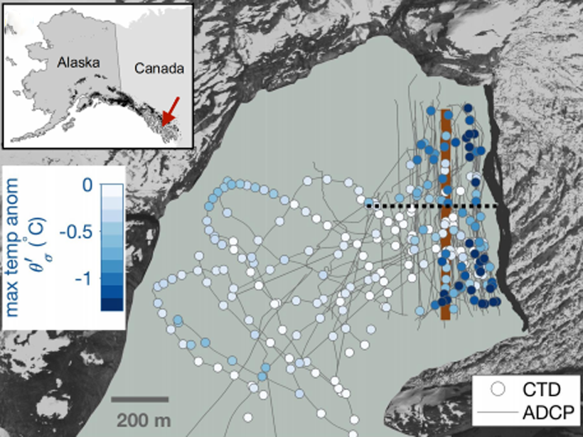
First Field Observations of Ocean Melting a Tidewater Glacier
Using autonomous kayaks, researchers carried out measurements of water properties near the terminus of LeConte Glacier and showed that ice/ocean interactions are more complex than thought.
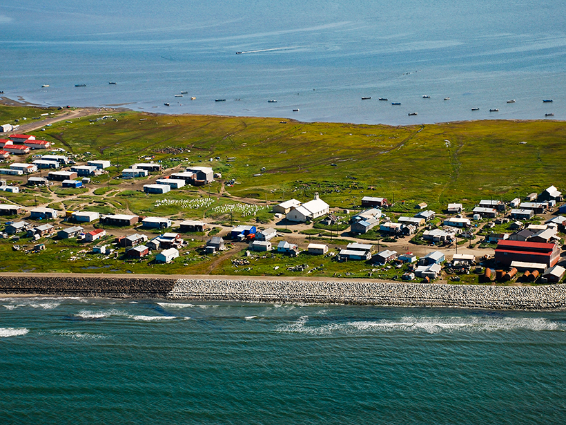
Posted inNews
Helping Alaskan Communities Facing Climate Risks
Scientists examine how best to use science to help communities respond to rapid climate change in the Arctic.

Posted inResearch Spotlights
Methane-Releasing Tundra Soils Freezing Later Each Year
Scientists find links between delayed freezing of Alaskan soils and higher atmospheric methane concentrations during the cold season.

Posted inNews
University of Alaska Faces Budget Crisis
The state legislature decides this week whether to override the governor’s $130 million cuts that could devastate the university and its world-class research.