
Snow on the Southern Alps turned from white to red in 2019-2020. New geochemical evidence points to the color change resulting from red Australian desert dust carried across the Tasman Sea.
Australia

Posted inEditors' Highlights
Upwelling Near Fronts Initiate Offshore Phytoplankton Blooms
A new study finds that phytoplankton blooms, often seen near the separation point of western boundary currents, are supported by nutrient supply upwelling and cross-shelf transport.

Posted inResearch & Developments
Survey from Trump Administration Asks Researchers Abroad About Involvement in DEI, Environmental Justice, and Climate Projects
Various U.S. federal agencies sent a 36-point survey to researchers abroad who receive U.S. funding, asking questions related to the Trump administration’s priorities. The questions cover topics such as “eradicating anti-Christian bias” and defending against “gender ideology,” and asked researchers to disclose ties to “entities associated with communist, socialist or totalitarian parties.”
Posted inNews
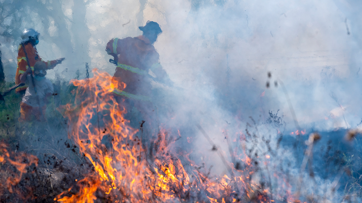
¿Seis mil años de quema controlada arruinados?
Al alterar prácticas milenarias de gestión del fuego, la colonización creó una situación mortal en los bosques australianos, pero aún no se sabe hasta qué punto se extendió la “quema cultural”.
Posted inThe Landslide Blog
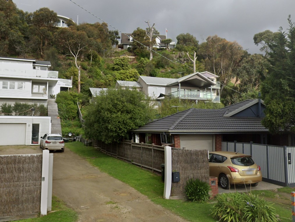
The 14 January 2025 landslide at McCrae in Victoria, Australia
The Landslide Blog is written by Dave Petley, who is widely recognized as a world leader in the study and management of landslides. News outlets in Australia have extensive coverage of a landslide that occurred on 14 January 2025 on Penny Lane in McCrae, Australia. The landslide destroyed totally a large house. A employee of […]

Posted inNews
Six Thousand Years of Controlled Burning, Up in Smoke?
By disrupting millennia-old fire management practices, colonization created a deadly situation in Australian forests, but the jury is out on just how widespread “cultural burning” was.
Posted inEditors' Highlights
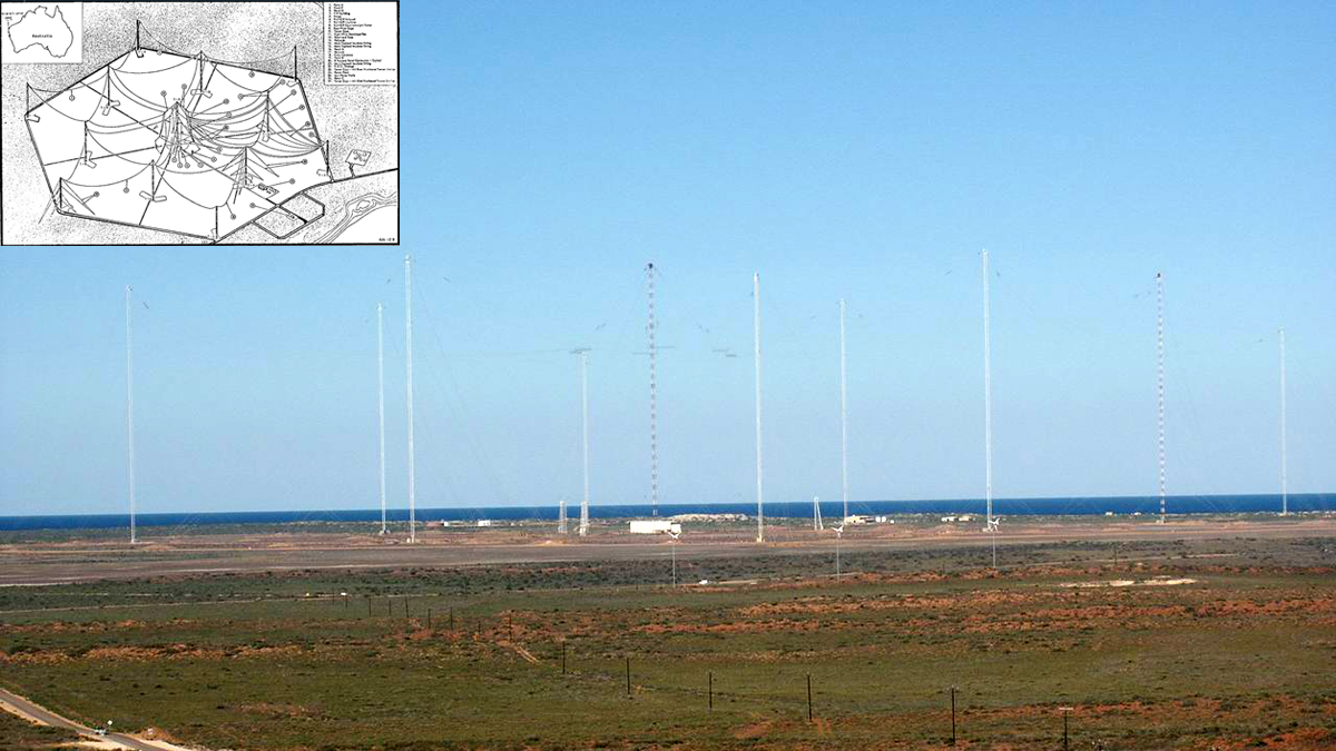
Ground-based Transmitters Cause Radiation Belt Electron Loss
A U.S. Navy transmitter in Australia produces wisps of electron loss as observed by the Colorado Inner Radiation Belt Experiment (CIRBE) CubeSat in Low Earth Orbit.
Posted inResearch Spotlights
Lithospheric Oddities May Be Sculpting Continental Interiors
Researchers propose a novel explanation for vertical motions of Earth’s surface far from active tectonic plate boundaries.

Posted inNews
Hungry Stingrays Shift Serious Amounts of Sediment
While digging for food on estuary bottoms, rays push around literally tons of sediment, changing their habitat in profound ways.
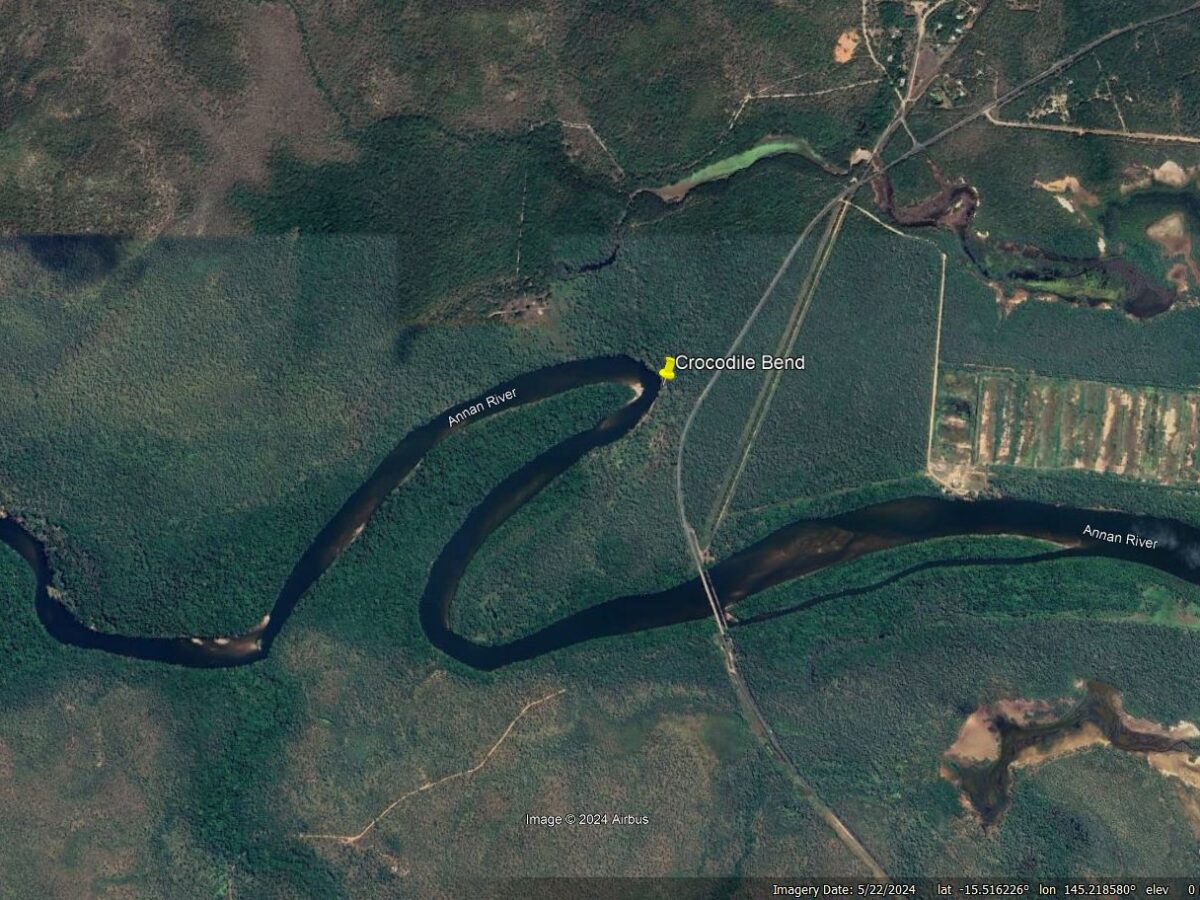
Posted inThe Landslide Blog
A tragic riverbank collapse near to Cooktown in Queensland, Australia
The Landslide Blog is written by Dave Petley, who is widely recognized as a world leader in the study and management of landslides. On 3 August 2024 an unusual and tragic landslide occurred at close to Cooktown in Queensland, Australia. Reports indicate that a man on vacation in the area was fishing on a riverbank […]