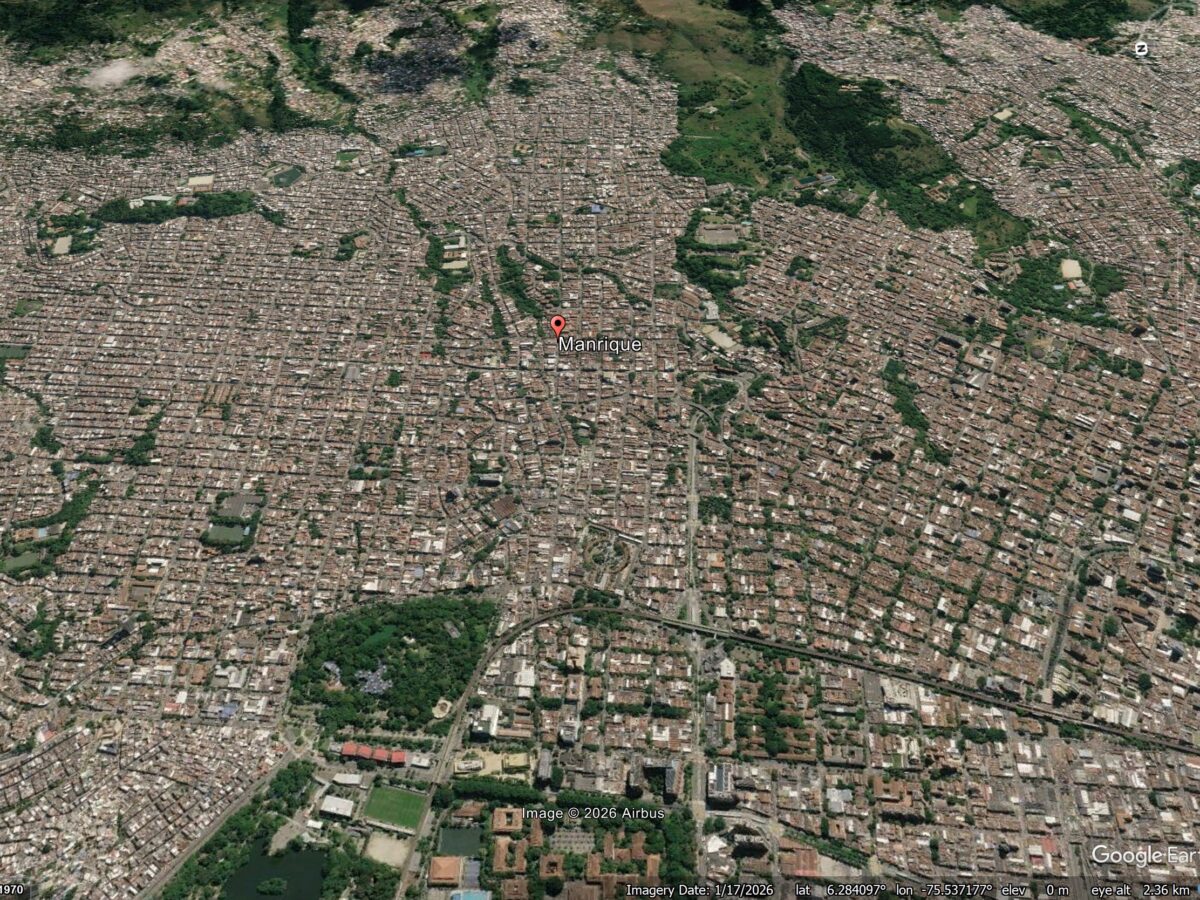
A new study (Vega et al. 2026) shows that patterns of reported structural damage in Medellin are probably caused by deep-seated deformation driven by a series of ancient landslides under the city. Medellin is the second largest metropolitan area in Colombia, with a population of around 4 million people. It has grown rapidly, expanding into […]
cities

Posted inNews
Urban Methane Emissions Are Rising, Despite Cities’ Pledges
Eyes in the sky could help cities get on track to decrease emissions of the potent greenhouse gas—and monitor whether their efforts are working.

Posted inResearch Spotlights
Fixing Baltimore’s Unequal Weather Data Coverage
A new partnership between researchers and community members created a comprehensive network of weather stations across underserved areas of the city.
Posted inThe Landslide Blog
The shifting pattern of landslide risk in cities – an interesting case study from Medellín
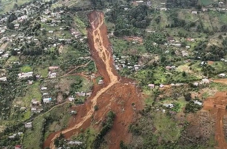
An fascinating case study from the 24 June 2025 Granizal landslide in Medellín, Colombia, which killed 27 people and destroyed 50 homes, shows demonstrates that it is not just the urban poor that are exposed to landslides. That urban areas can be subject to high levels of landslide risk is well-established – commonly cited examples […]

Posted inNews
City Dwellers Face Unequal Heat Exposure En Route to the Metro
Socioeconomic factors drive how much extreme heat public transit users in Chicago, NYC, and Washington, D.C., experience as they walk to and from metro stations.
Posted inNews
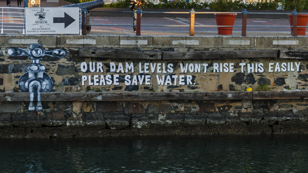
Are “Day Zero Droughts” Closer Than We Think? Here’s What We Know
A new study warns that day zero droughts—when reservoirs fail to supply taps—could become common within this decade.
Posted inResearch Spotlights
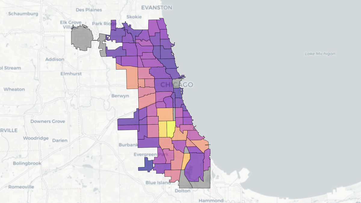
Chicago Soil Maps Childhood Lead Exposure Risk
Researchers combined soil measurements and public health data to identify areas where children may be exposed to unsafe levels of lead in the dirt.

Posted inResearch Spotlights
Satellite Scans Can Estimate Urban Emissions
As more cities strive to meet climate goals, space-based observations may help fill in the gaps on tracking emissions.

Posted inNews
“Passion Project” Reveals Auckland’s Hidden Urban Faults
An innovative analysis has identified 10 likely and 25 possible faults in the region.

Posted inNews
Climate Change May Have Killed 16,469 People in Europe This Summer
Researchers warn that preventable heat-related deaths will continue to rise with continued fossil fuel emissions.